More turbulent weather is forecast for the coming days in France. This will result in an increase in the amount of rain that has fallen since January 1st.
The ball of depressions and other disturbances will assert itself in France in the coming days. After an active rainy spell yesterday Thursday, the weather conditions will see the approach of more rain tomorrow Saturday. And this will last several days. But is this to the point of causing flooding? Let’s take stock of the weather forecast.
Parade of disruptions
The first disturbance of the year affected France from north to south during the day on Thursday. This brought amounts of rain generally between 10 and 30mm, sometimes closer to the reliefs.
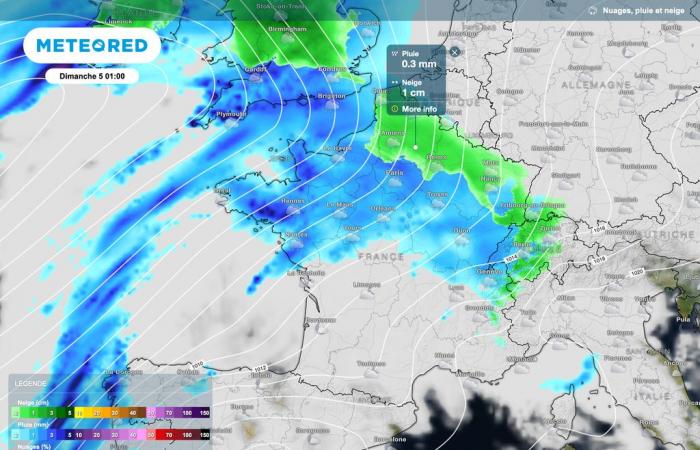
A little snow even appeared behind the front, sometimes as far as the plain between Champagne-Ardenne and Lorraine. But already, after a relatively calm and very cool Friday day.
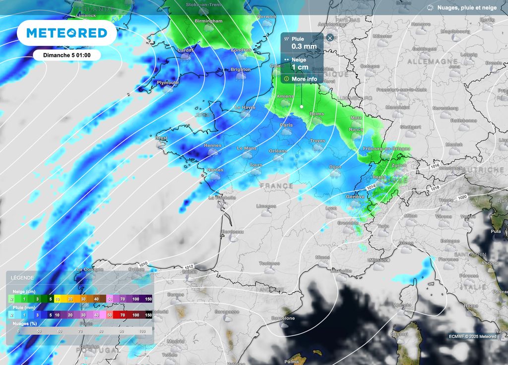
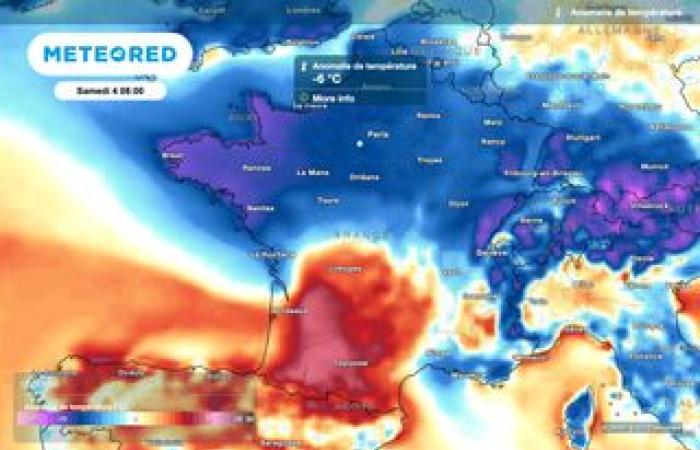
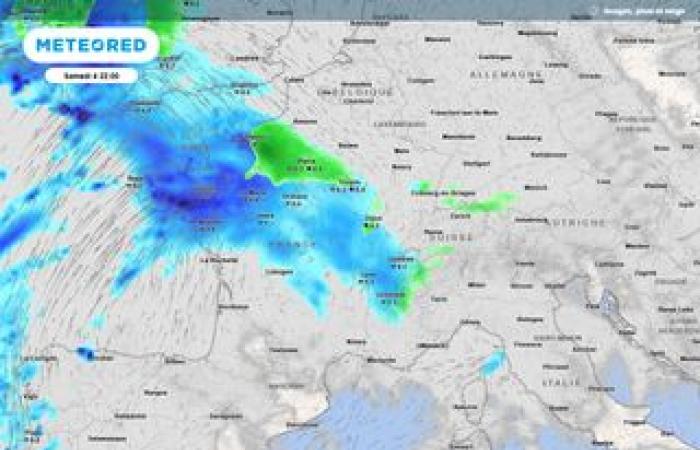
It will bring deterioration from the southwest between now and Saturday. Gradually, it will rise towards the north and east, encountering cold air. Snow alone or even ice may then be observed temporarily. This risk will evacuate outside our borders during the night from Saturday to Sunday.
Thereafter, rains will be frequent until Wednesday or even Thursday. Indeed, high pressures will not prevent rainy disturbances. Note that sometimes, cooler air could favor the temporary presence of flakes at very low altitude over the northern half. This risk will need to be clarified a few hours before the risk begins… although overall it is rain that will dominate.
Heavy accumulations
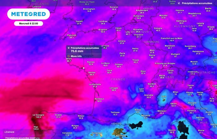
If we look at the atmospheric projections until next Wednesday, well often the accumulations are of the order of 30 to 60mmlocally more. In climatology, this corresponds to the equivalent of 2 weeks or even 4 weeks of rain, even more so if we add Thursday’s rain.
The end of December was rather dry in terms of precipitation thanks to the presence of the anticyclone. However, the year 2024 was very wet with already numerous floods and floods.
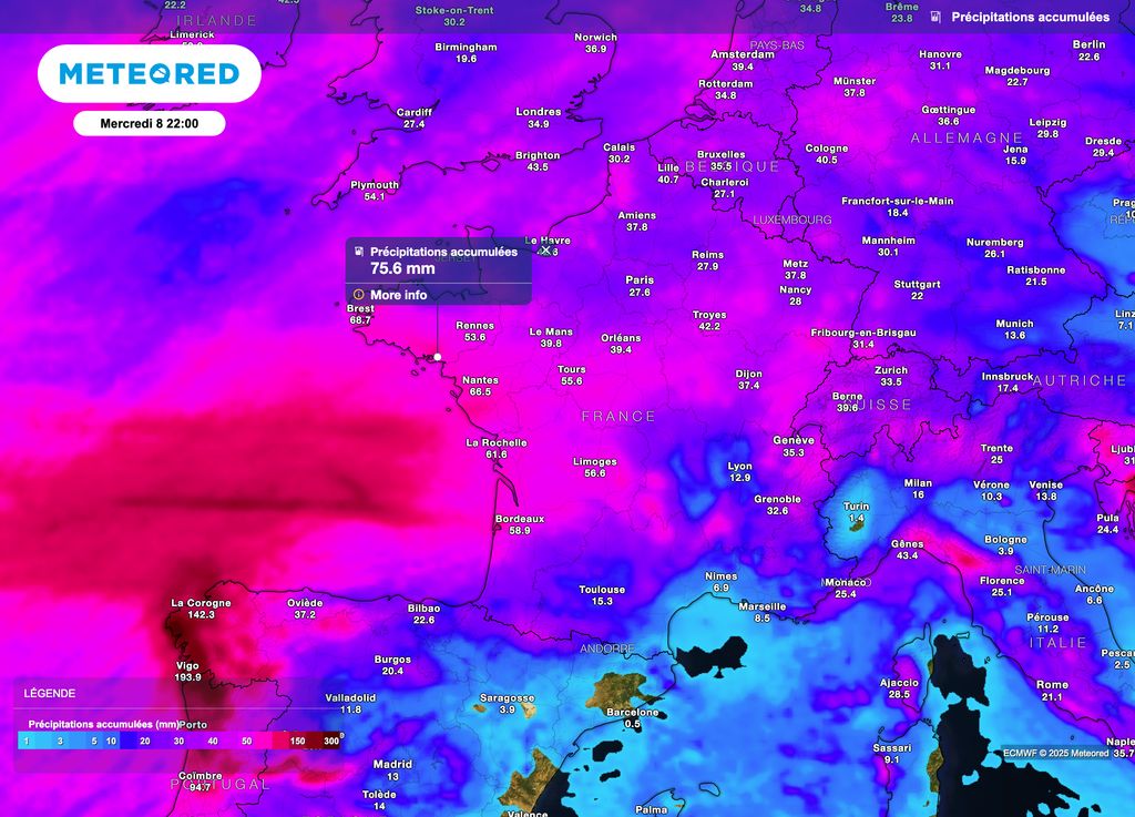
According to weather forecasts, the watercourses should once again react. For the moment, seasonal floods are expected. However, we cannot exclude local overflows and therefore flooding. Note that this bad weather will occur “gradually” and not all at once in the vast majority of cases.
We will therefore monitor the various periods of rain as well as the reaction of the watercourses throughout the coming days. Stay tuned to the weather forecast.
Calmer afterwards
By the second part of the month, more anticyclonic weather over a good part of France should assert itself. Cold could then also be introduced, notably through thermal inversion phenomena.


