France is being swept this Monday by a very active cold front, associated with storm Floriane, a low pressure center which circulates south of the British Isles. Heavy rain is expected in the coming hours. Find our latest forecasts in this article.
This Monday is marked in France by the passage of storm Floriane, which will cause, in many departments, locally violent winds, with gusts that can approach 100 to 110 km/h inland.
This storm Floriane is associated with a very hollow depression which circulates over the British Isles. This depression leads to the passage of an active cold front over France, crossing the country from west to east. This disturbance will bring locally sustained rain and will also generate strong gusts of wind. Due to expected strong winds and waterlogged soils, Increased vigilance will be necessary during the passage of this front.
By the middle of the week, sometimes significant amounts of rain are expected in France. It will be necessary to closely monitor the risk of flooding, which could occur quickly given the saturation of the soil at the start of 2025.
How will the weather forecast change in the coming hours? Find our latest forecasts in this article.
Very choppy weather this Monday
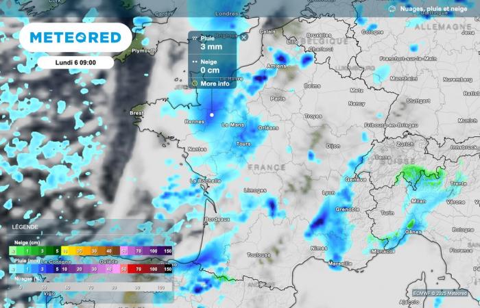
Sustained rain is already present this morning in all regions of western France, from Hauts-de-France to the Loire" rel="tag">Pays de la Loire region, to the Aquitaine coasts.
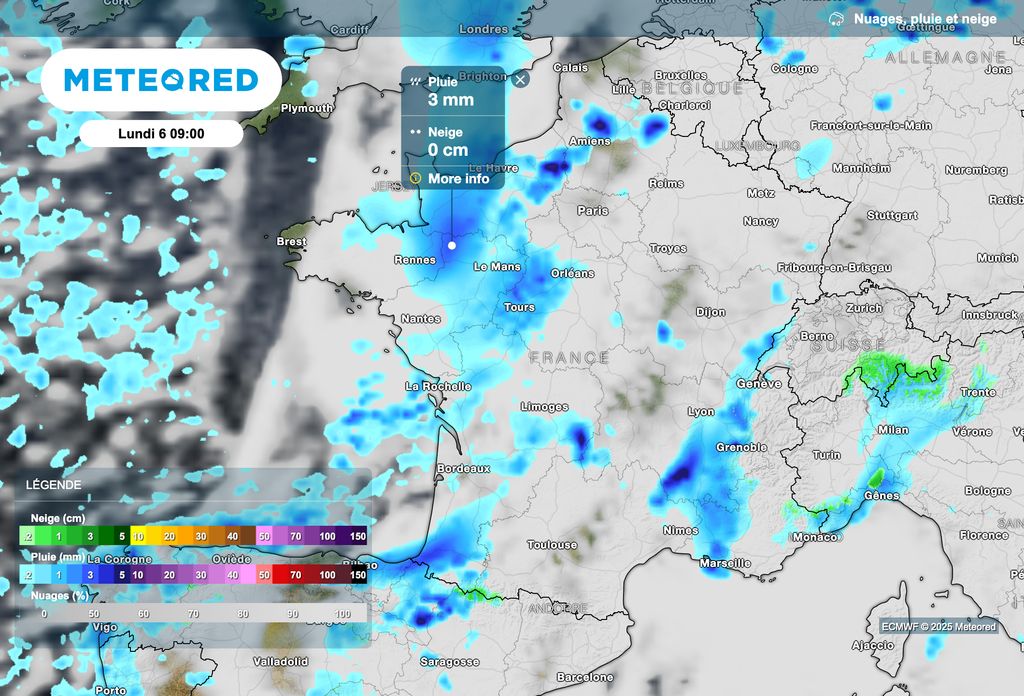
Generally speaking, the weather is unsettled this morning in most regions. A temporary respite, with some clearings, persists between Franche-Comté and Alsace.
The rains cross the country
The rain associated with the cold front will therefore quickly cross all regions over the hours.
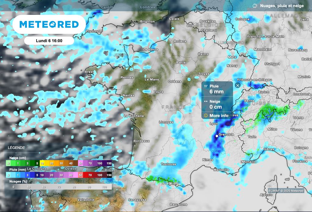
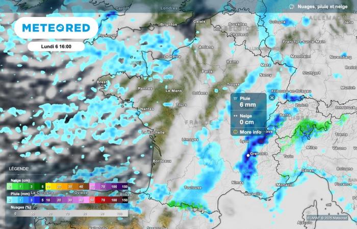
This afternoon, the entire eastern part of France will be affected by the disturbance, with more or less sustained rain. Sometimes stormy showers are also expected in the southeast of the country.
After the disturbance passes, frequent showers may occur in western regions and near the Channel. These showers, sometimes stormy, may be accompanied by sleet.
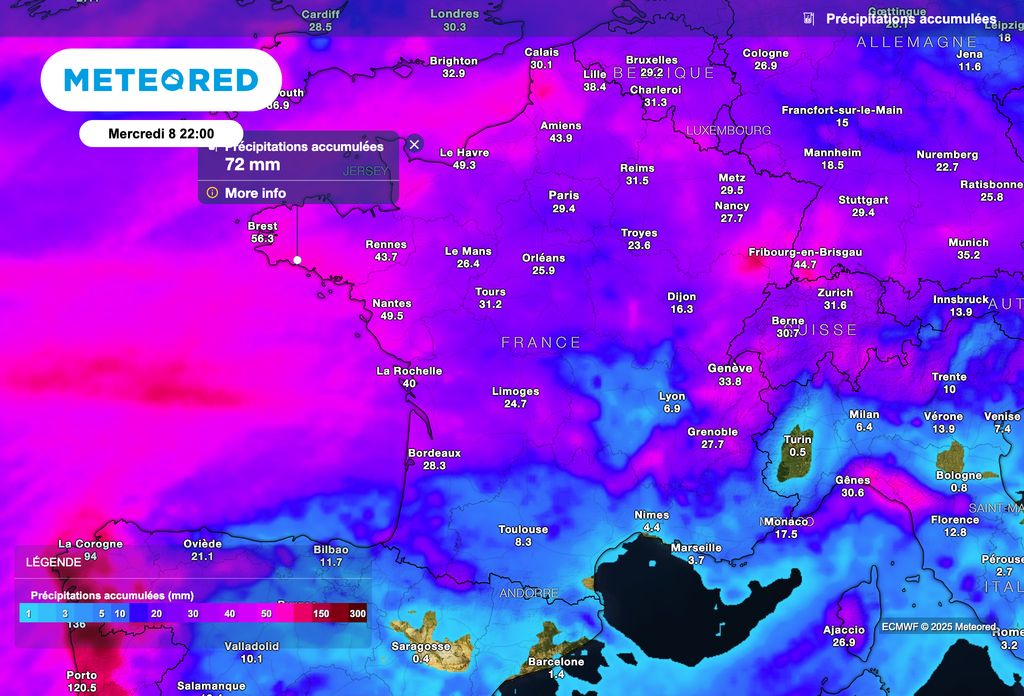
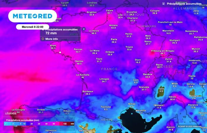
By the middle of the week, and as shown in the map above, precipitation could prove significant over a large northern half of France, with accumulations that can locally exceed 40 to 50 liters of water per square meter.
High wind alert!
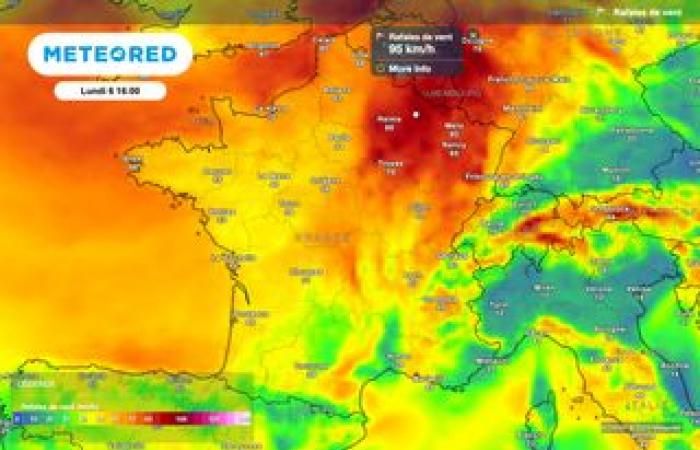
The greatest caution is required until mid-afternoon between the Pays de la Loire, Île-de-France and the Ardennes, with gusts inland that can approach 100 to 110 km/h.
Also pay attention to strong gusts of southerly wind in the Rhône and Loire, where gusts could approach 120 km/h.

