A significant stormy deterioration is taking place this Saturday in France. The southwest to northeast axis is particularly exposed to these sometimes violent storms. Overview of the latest weather forecasts.
After a summer week, The weather conditions are expected to be much more unsettled this weekend. The fault lies with a cold drop that is rising over the country. It will cause a strong conflict of air masses. Severe storms are then to be feared for this day. Let’s look at the weather forecast together.
Already stormy this morning and this afternoon
For this Saturday morning, the most significant storms are expected in the southwest quarter of France. These can already bring significant precipitation in a short time, creating a risk of runoff and even local mudslides depending on the topography.
Electrical activity may also be strong to locally sustained. Concerning the risk of hail, it cannot be excluded even in this area. Note that storms could also occur between the Centre-Val-de-Loire region and the Paris region.
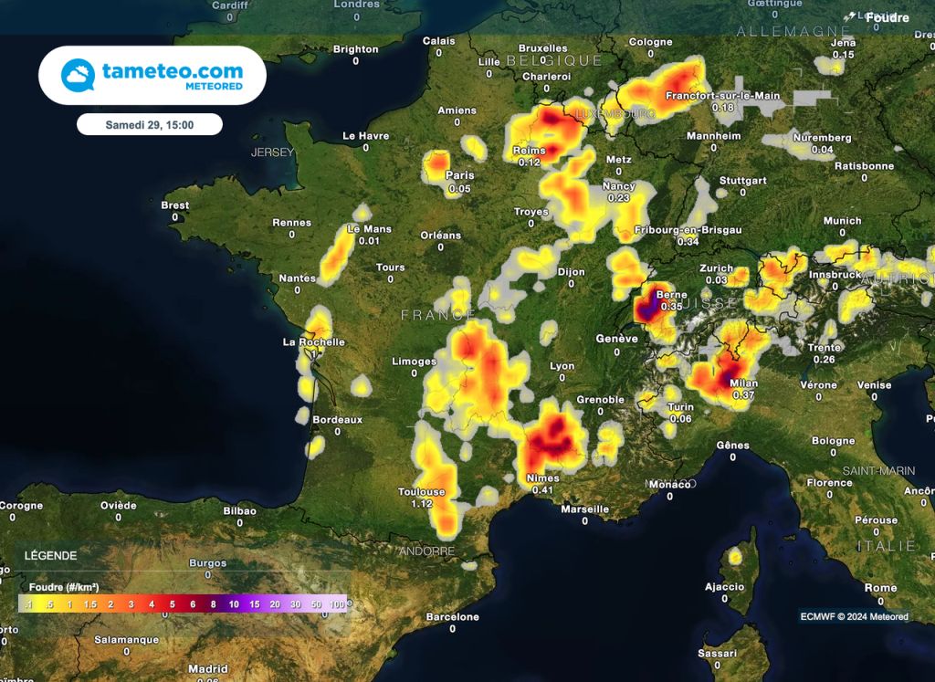
By this afternoon, while the heat sometimes promises to be strong and especially heavyweather conditions will destabilize over a very large north-eastern quarter of France.
Gradually the area arriving from the southwest will in fact head towards the Grand-Est with rains and storms sometimes heavy and carrying hail in its passage.
Be careful because according to several models, hail falls could be heavy if only because of the diameter of the hailstones : they could reach the 4 to 6 cmThis risk will persist throughout the afternoon and will be more marked towards Franche-Comté, Alsace and Lorraine.
Evening and night under high surveillance
That being said, although thunderstorms are possible during the day this Saturday, it is more particularly a stormy area expected during the evening and next night which should be monitored. And for good reason, electrical activity could be intense under the numerous storm centers.
Also, significant accumulations of rain are expected (locally up to 70-80mm) with a greater risk of runoff or even flooding directly caused by this runoff. Wind gusts could also reach 110km/h, occasionally more under a very active storm cell.
In general, wind gusts should reach 80 to 100 km/h as this storm wave passes. The Grand-Est region is the most exposed until the middle of the next night with the Jura and surrounding areas.
So be very careful about France including under an isolated storm. The energy available for the formation of marked thunderstorms will be there. On Sunday, we will again find an unstable area in the same regions but with less intensity.
Stay connected on Tameteo.com and our networks in order to be informed of the weather situation in real time.


