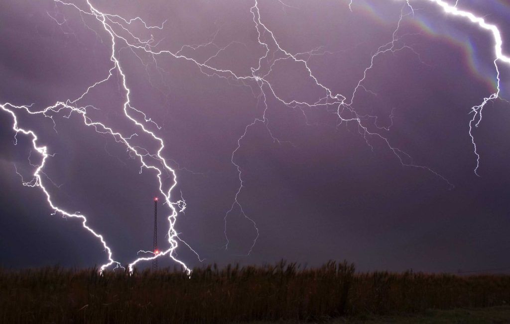
An orange “thunderstorms” alert has been triggered for Saturday in 31 departments while a strong stormy episode will cross most of the country, indicates Météo-France.
Saturday at 6 a.m., the departments of Tarn, Aveyron, Lot, Cantal, Allier and Ain went into orange vigilance for this Saturday afternoon. They thus joined the 25 departments which were already there: Charente, Charente-Maritime, Cher, Gironde, Landes, Deux-Sèvres, Vienne, and all the departments of Grand-Est and Burgundy. Franche-Comté.
Storms “likely to cause significant local damage”
“The high-altitude depression at the origin of the stormy deterioration is currently moving up over Spain towards the Pyrenees,” Météo-France said on Saturday morning.
In Nouvelle-Aquitaine, “frequent storms are present” accompanied by “strong electrical activity, locally high rainfall intensities sometimes of 20 to 30 mm/h” and “hail in places”. The prefect of Gironde, who calls for the greatest vigilance, indicates that these storms “are likely to cause significant damage locally, particularly to light housing and temporary installations. Flooding of cellars and low points can also occur as well as fires starting in the forest following lightning strikes.”
In the morning, these storms will extend to Center-Val-de-Loire, while from Pays-de-la-Loire to Ile-de-France, Champagne-Ardenne and Lorraine, cloudy passages may giving locally stormy but more isolated showers.
Similarly, from Occitanie to Provence-Alpes-Côte d’Azur, the sky will be very overcast and some showers will be possible from the morning. But at the same time, a more marked stormy deterioration will approach the Pyrenees, and will quickly extend towards the Massif Central. In the afternoon, from the east of the Pyrenees to Limousin, then to Auvergne Rhône-Alpes, the storms will become strong and will multiply, giving high intensities of rain, sometimes hail and powerful gusts of wind.
Fourteen departments on orange alert for Sunday
This area of storms will head towards the Centre-Val-de-Loire, the east of the Ile-de-France and Bourgogne-Franche-Comté at the end of the afternoon, to reach the Grand-Est in the evening, with continued heavy rain, violent gusts of wind and hail, particularly in the north-east of the country where these storms will be the most violent.
From the Massif Central to the northeast, the stormy episode has not yet begun. The meteorological services have also placed 14 departments on orange “storm” alert for Sunday in the Grand-Est.


