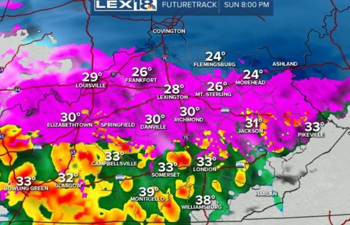
The first significant weather event of 2025 is underway and we have seen a lot of snow falling across the Commonwealth already today. We are moving into the part of the afternoon where we have also started to see the warmer air moving into the mid levels of the atmosphere and that is causing a changeover to sleet/freezing rain in southern KY. Things are still on pace for the area of ice to move north toward Lexington and northern KY keeping everything extremely messy. Southern KY still is looking for some more sleet or just cold rain through the evening.
The entire system will start to wane and work its way out of the state while the colder air starts to filter in. Temperatures, tonight, will be cold enough to freeze all the precipitation making travel even more of a headache into Monday. We still have more snow on the way and ice accumulations are still looking to range between 0.5″ and 0.75″ through this evening and early tonight especially in central KY. Southern and northern KY should see less ice.
Power outages are expected as well as very dangerous travel. If you do not have to travel, don’t. The Winter Storm Warning and Winter Weather Advisory are both in effect and will expire at various times over the next 24 to 36 hours. The Arctic air will then follow the storm and stay put for several days. Stay weather aware!


