“We have acquired a digital terrain model that has allowed us to identify the sites most exposed to flood risks on the national territory. There are twenty-nine (29) sites. These sites have been prioritized and we have selected the seven (07) sites that are most exposed. We have much more precise images, on 50 cm and on 10,000 square meters which covers the entire national territory,” explained Hamidou Konaté.
According to the person responsible for monitoring and evaluation of the Integrated Flood Management Project (Pgiis), these seven (07) pilot sites are made up of the area called Greater Dakar, which goes from Dakar to Thiès, which goes down via Joal. But not only. There is also the Dakar-Diourbel, KaolackKaffrine, Matam-Kédougou-Tamba axis.
“On the choice of these sites, there is work that has been done to somewhat align the typologies of flooding that we can have,” maintained Mr. Konaté. According to him, the different typologies are among others: floods linked to the overflow of watercourses (the sites of Matam and Kédougou), but there are also floods linked to runoff, particularly in Dakar, to rising waters. tablecloth in Dakar and Touba.
The Technical Committee of the Integrated Flood Management Project (Pgiis) held its meeting last Thursday. On this occasion, the progress of the Technical Committee was shared. The Geoportail was also presented to the members of the Technical Committee.
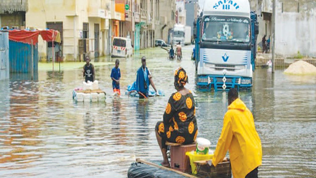
This year, Anacim services are forecasting a rainy season, with enormous risks of flooding. But the authorities took the initiative to avoid any unpleasant surprises.
“From the beginning, a lot of work has been done. First of all, it is a coordination work on the progress of the structural works. Safeguard measures are also envisaged to promote the flow of water. Field visits are made to Dakar, Kaolack, Ziguinchor. But there is also a pre-positioning work of the different devices which is being done by the different structures which intervene in the fight against floods”, informed Hamidou Konaté


 most exposed sites in the national territory)