
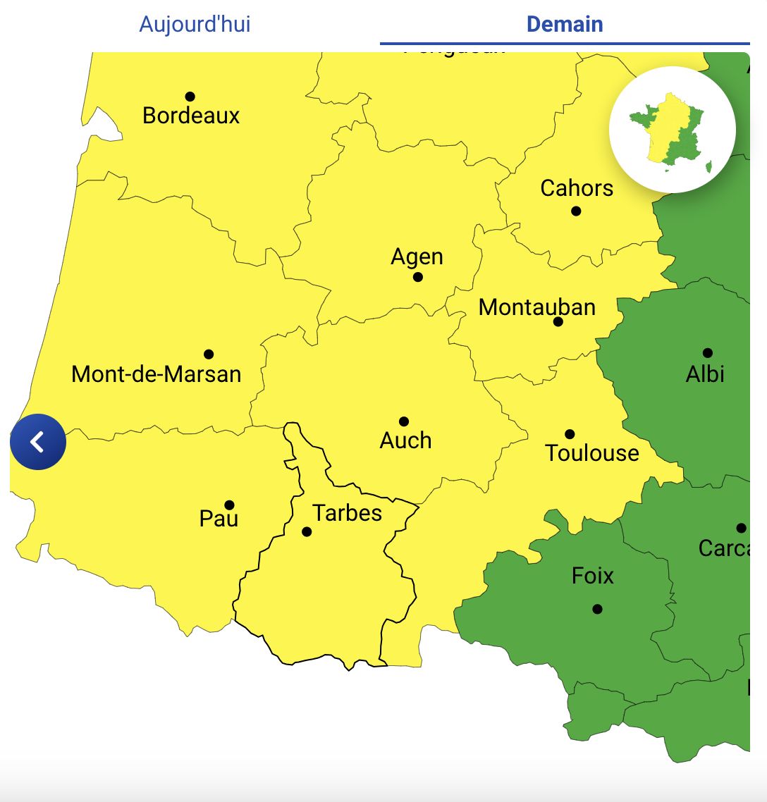
Météo France announces a risk of strong storms over the country in several waves, from the end of the night from Monday to Tuesday, until the evening of Tuesday. Heavy rain and hail are expected. Thus the departments of Hautes-Pyrénées, Gers, Haute-Garonne and Pyrénées-Atlantiques are placed on yellow alert for storms on Tuesday June 18.
Tuesday June 18, the departments of Hautes-Pyrénées, Gers, Haute-Garonne and Pyrénées-Atlantiques are placed on yellow alert due to a risk of strong thunderstorms. Météo France forecasts several stormy waves crossing the country, with potentially dangerous weather conditions, lasting from late Monday night to Tuesday evening.
Thunderstorm alert: yellow vigilance in the South-West
Météo France announces a high risk of powerful thunderstorms, accompanied by intense precipitation and hail. These disruptions are expected to mainly affect the south-west of France, with repercussions expected in several other regions.
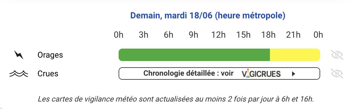
Three distinct stormy waves should be monitored throughout the day on Tuesday:
Second part of the night from Monday to Tuesday and Tuesday morning:
The first storms are expected during the second part of the night from Monday to Tuesday. These disturbances will move quickly from Gironde and Charentes to the Center of France, then Champagne. The storms will be accompanied by heavy rainfall and hail, which could cause local flooding.
Mid-day in the north of the country:
Around noon, a new wave of thunderstorms will cross the north of the country. These storms will be particularly violent, with precipitation reaching 20 to 30 mm per hour, hail and wind gusts of up to 80 km/h. In addition, whirlwind phenomena, such as downpours, could occur.
Late afternoon and evening in the South West:
At the end of the afternoon, a third round of thunderstorms will begin to affect the South West. These disturbances will then extend towards the Massif Central in the evening. Thunderstorms will again be accompanied by heavy rain and significant hail. It is possible that vigilance will be increased to a higher level on the 6 a.m. map depending on how the situation evolves.
Faced with these dangerous weather conditions, it is essential to take precautions:
Stay informed : Follow updates from Météo France and local authorities.
Avoid non-essential travel during periods of high risk of storms.
Protect your assets : Protect objects likely to be damaged by wind or hail.
Be careful near watercourses, as heavy rains can cause flash flooding.
The day of Tuesday June 18 promises to be tumultuous for the inhabitants of the south-west of France. Yellow thunderstorm alert is a call for caution and preparation. By staying informed and taking necessary action, everyone can help reduce the risks associated with these extreme weather conditions.
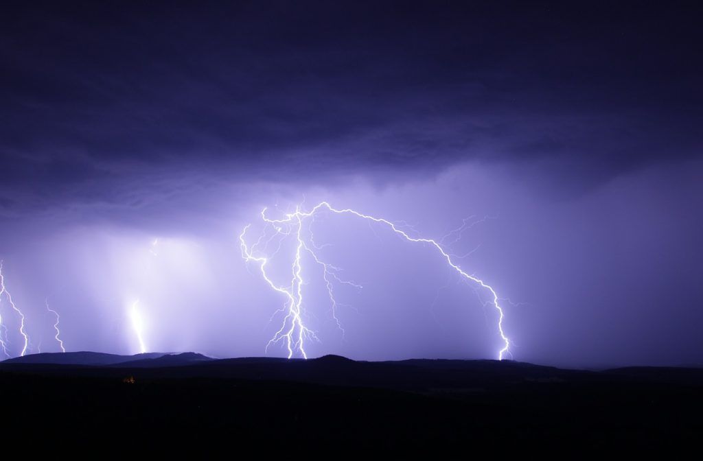
What is a thunderstorm?
A thunderstorm is an atmospheric phenomenon characterized by lightning and thunder. It is always linked to the presence of a cumulonimbus type cloud, also called a thunderstorm cloud, and is often accompanied by a set of violent phenomena: gusts of wind, intense rain, sometimes hail, waterspout and tornado.
The cumulonimbus is a cloud with a diameter of 5 to 10 km, very developed vertically, which can rise up to 16 km in altitude. At its summit, the cumulonimbus spreads out widely, which gives it its general anvil shape.
A storm can always be dangerous at a given point, due to the power of the phenomena it produces.
The storm is generally a short-lived phenomenon, lasting a few tens of minutes to a few hours. It can be isolated (storm near reliefs or caused by warming of the ground in summer) or organized in a line (called “squall line” by meteorologists). Under certain conditions, storms can regenerate, always in the same place, causing heavy precipitation for several hours, leading to catastrophic flooding.
Dangers
Lightning is the name given to a flash of lightning when it hits the ground. This intense electrical discharge can kill a man or an animal, burn a tree or cause fires.
The intense rains that accompany thunderstorms can cause devastating flash floods. A cumulonimbus 1 km wide by 10 km high contains 1 million liters of water.
Hail, precipitation made up of small pieces of ice, can devastate a vineyard or orchard in just a few minutes.
The wind under a cumulonimbus blows in violent gusts up to around 140 km/h and changes direction frequently. More rarely, a very devastating whirlwind, the tornado, is created under the base of the cloud.


