Par
Raphaël Lardeur
Published on
Jan 3, 2025 at 5:36 a.m.
See my news
Follow News
A new gust of wind for the start of the year. After an evening of December 31, 2024 surrounded by gusts of more than 100 km/h, the first weekend of 2025 promises to be disrupted. The risk of icy conditions and the first gales of the year will most affect the northern and eastern areas of France. The south being quite spared.
Here is the weekend forecast.
A very slippery Saturday
“The weekend will be really disrupted,” says Guillaume Séchet at the outset. actu.fr. The Météo-Villes meteorologist expects the arrival of mild air to propel a current of cold air towards the north of France for the day of Saturday January 4, 2025. In finethat this current causes “slippery phenomena” in these areas.
In the morning therefore, temperatures around zero degrees, or even -5°C in Chaumont, in Haute-Marne, a town located in the east of France, will undoubtedly cause icing. “Drivers should be careful,” warns the meteorologist.
In the afternoon, in these regions, “there may be snow in the plains”even if, warns Guillaume Séchet to actu.fr“these flakes may not hold”.
In the evening, “freezing rain” is expected in the north of the city of Paris, up to the Belgian and German borders. “Once again, we must exercise great caution,” he emphasizes, because “the ground, which was previously soaked with the disturbances, will freeze,” further analyzes the founder of Météo-Villes.
A windy Sunday
It is undoubtedly the day of Sunday January 5, 2025 which should hold the most surprises. “A depression is deepening off the coast of the British Isles,” notes Guillaume Séchet for actu.fr.
A depression is an area in which the air pressure is lower. It is measured in hectopascals (hPa). This unit of measurement indicates the weight of the air column from the ground to the upper limit of the atmosphere.
This meteorological phenomenon could cause gusts on the northwest coasts of France during the night from Sunday to Monday January 6, 2025. And, depending on the models, the gusts could reach more than 90 km/h (or even 100 km/h locally) in Normandy and Brittany.
The map (from Météociel) below shows the cumulative gusts between Friday and Sunday, according to the French Arpege model (used by Météo France). The more the color turns red, the stronger the gusts are:
If the map is not displayed, click here.
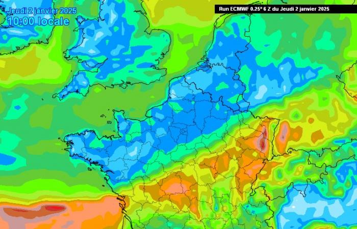
The map (from Météociel) below shows the cumulative gusts between Friday and Monday, according to the European ECMWF model, which anticipates them more in the south of the country:
If the map is not displayed, click here.
For the moment, it is difficult to say whether these gusts will turn into a storm. To do this, the average wind would need to reach or exceed 89 km/h over a period of at least 10 minutes, according to the government site Géorisks.
But be careful, because the deepening of depression is very “dynamic”. That is to say, it is due to atmospheric circulation and not to the heating of air masses, which makes it more unstable.
Follow all the news from your favorite cities and media by subscribing to Mon Actu.


