NASA has shared images of the Dubai floods, seen from space. The least we can say is that the before/after of these images is quite impressive.
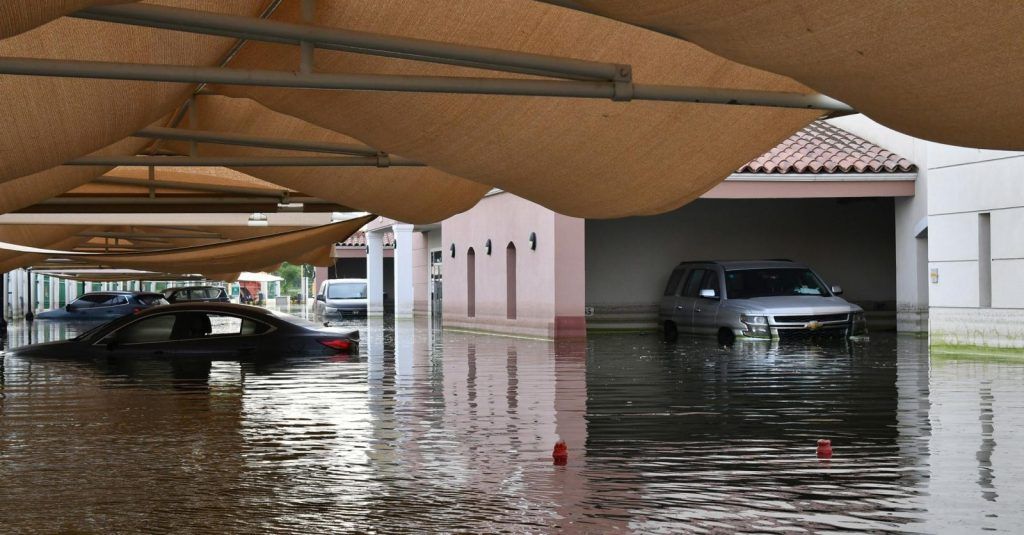
A few days ago, we discovered impressive images of Dubai under torrential rain. Videos showed in particular the flooding that the storm had caused, causing extensive damage. NASA has shared photos of the city, taken from space, and we can say that the consequences are clearly visible.
Also read: It’s official, 2023 is the hottest year on record
What happened?
A slow-moving storm hit the United Arab Emirates last week, and more than a year’s worth of rain fell in some cities, including Dubai. These rains triggered heavy flooding, making roads impassable. On April 19, when Landsat 9, a NASA satellite, passed over the country, part of it was still underwater. The opportunity to take a few photos, and to compare the images taken on April 3, before the storm. The image where we notice the flooding is in false colors (bands 6-5-3), to highlight the presence of water, which appears in blue. We notice that many places are still flooded, notably Shekh Zayed Road, a major artery which crosses Dubai and Abu Dhabi, the capital.
The UAE National Meteorology Center reported that eastern parts of the country recorded up to 250mm of rain in less than 24 hours. A record, when we know that the country with a desert climate generally only receives between 140 and 200mm of precipitation per year. Dubai International Airport also recorded 119 mm, or 1.5 times its normal annual rainfall, which interrupted flights for several hours and caused major disruptions for one of the busiest airports in the world.
Also read:


