After storm Floriane, a new winter offensive is looming for the middle of the week with snowfall expected all the way to the plains. When exactly and where could it snow? Find our latest forecasts in this article.
Do you like snow? It could make its comeback this week in the north of France. While a recent winter episode affected the north of the country last weekend, followed by a spectacular mild spell, a new winter episode is preparing to hit northern France in the coming days.
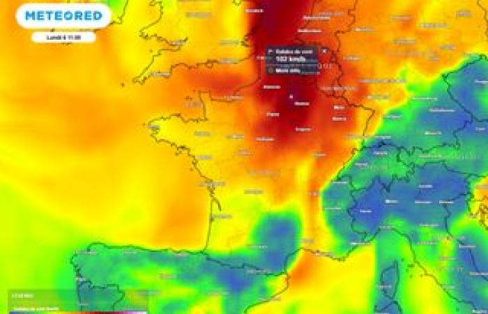
After the storm Floriane this Monday, which generated wind gusts sometimes exceeding 100 km/h inland, Slightly calmer weather will set in for Tuesday. However, the wind will remain sensitive and further rain is expected during the day, mainly in western regions.
The weather situation will need to be monitored again from Wednesday, and particularly from Wednesday afternoon. Indeed, France will find itself at the heart of an air mass conflict: cold air in the far north of the country and milder and humid air further south. The disturbance which will move northwards on Wednesday could cause Snowfall likely to remain on the ground Wednesday evening and Thursday morning in parts of the north.
What areas could be affected by this snowfall? What exactly should we expect in the coming days? Find our latest forecasts in this article.
Be careful in Normandy and Hauts-de-France
In its several-day vigilance bulletin, Météo-France is already mentioning a risk of snow in the plains for Wednesday, mainly along the Channel coasts, notably between Normandy, Picardy and Nord-Pas-de-Calais. If the probability of snow between Brittany, Normandy and Picardy is estimated at 30%, it is significantly higher for Nord-Pas-de-Calais, with 70% probability at this time.
Note that the risk also persists during the night from Wednesday to Thursday as well as Thursday morning, with potential new snowfall likely to affect Upper Normandy, Picardy and Nord-Pas-de-Calais.
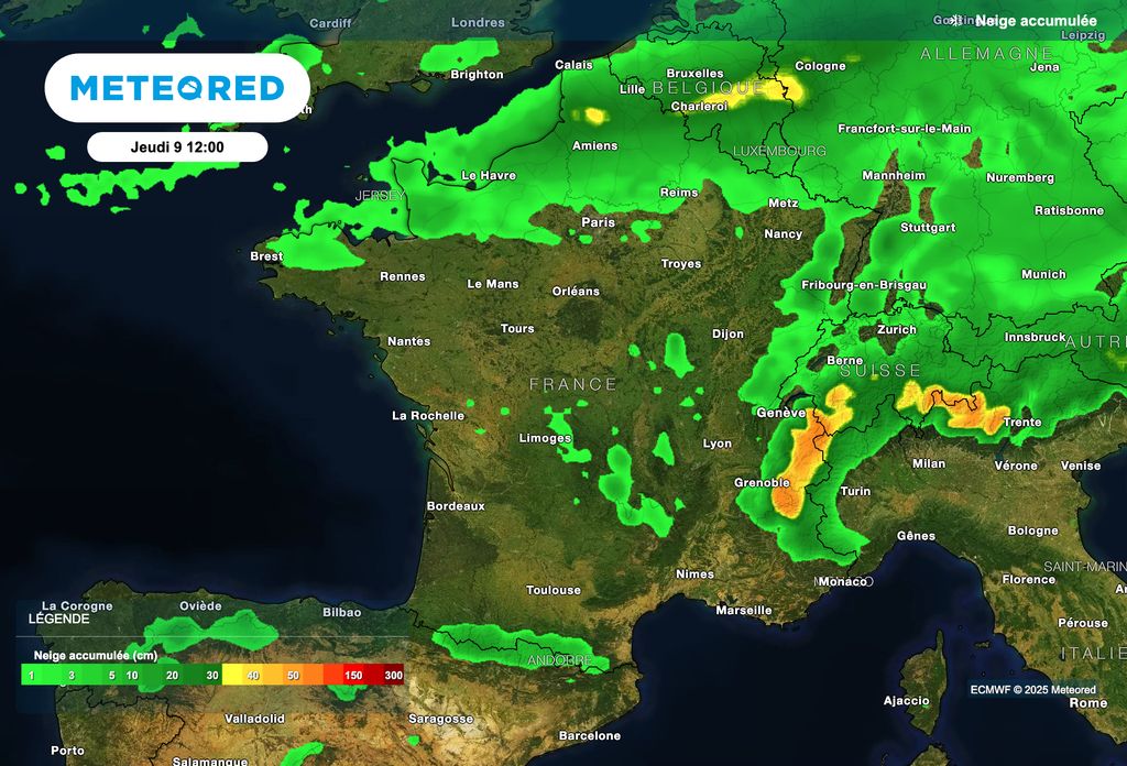
The situation seems more worrying at this time in the Hauts-de-France region, where snowfall could be more lasting and stick to the ground. They could bring 3 to 5 centimeters, or locally up to 10 centimeters. As the deadline is still relatively far away, it will be necessary to refine these forecasts in the coming hours.
When is snow expected?
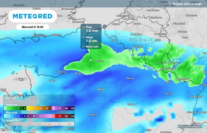
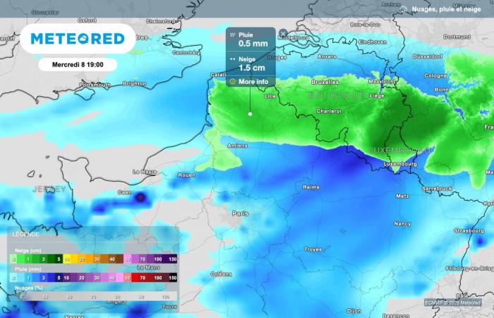
In all likelihood, snowfall is expected Wednesday at the end of the day, going back towards the north of the country. Indeed, in contact with the cold air present in these northern regions, precipitation is expected to occur as snow.
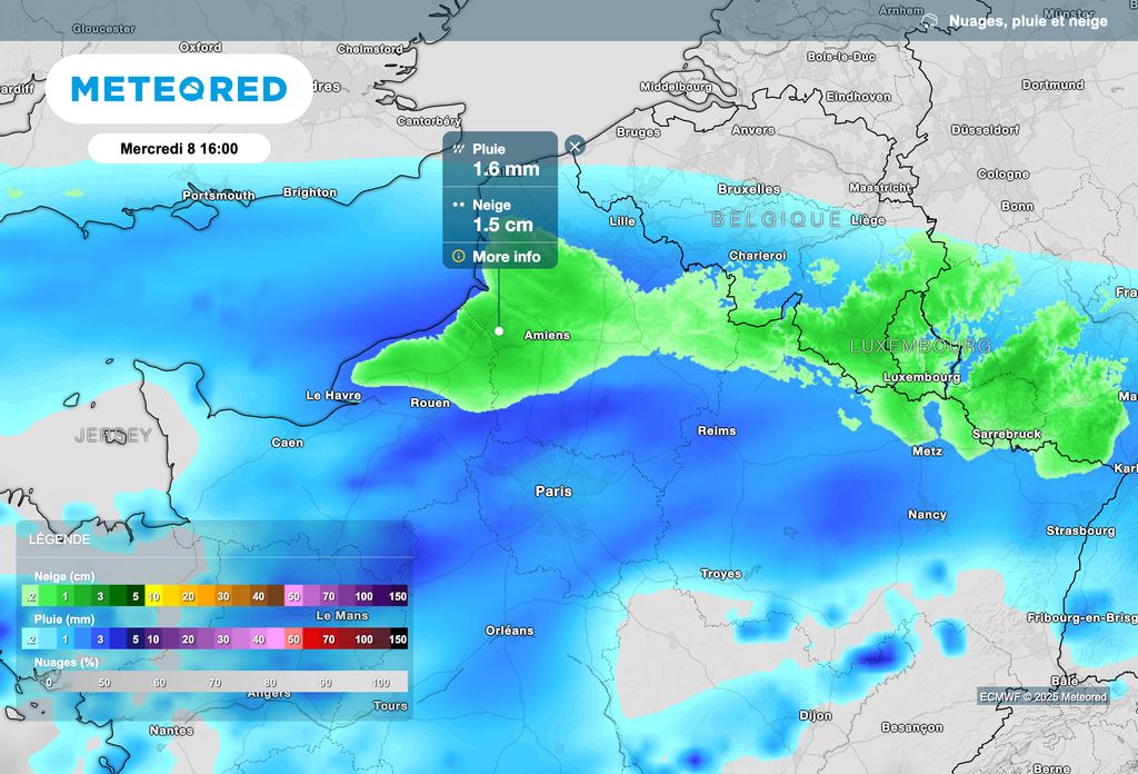
The first snowfalls should affect Upper Normandy and Picardy from late Wednesday afternoon.
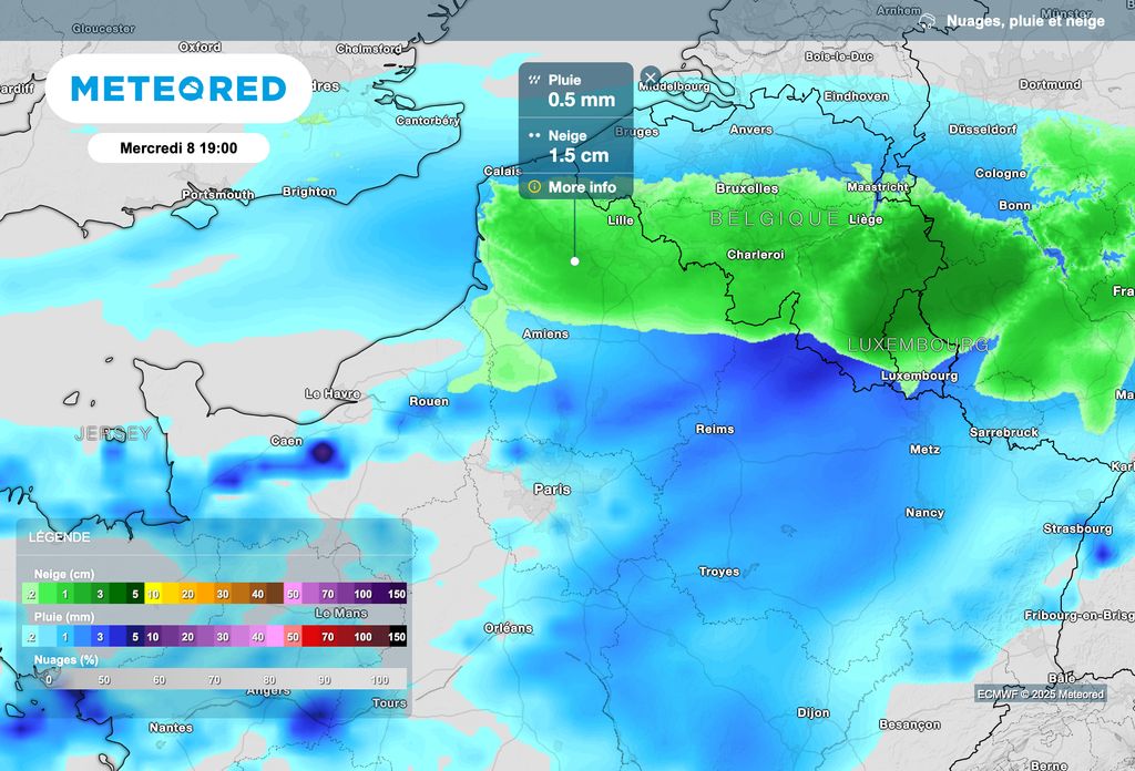
Snowfall should then affect Hauts-de-France on Wednesday evening. With stronger cold air, they could hold on to the ground more easily.
Further snowfall overnight from Wednesday to Thursday
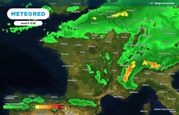
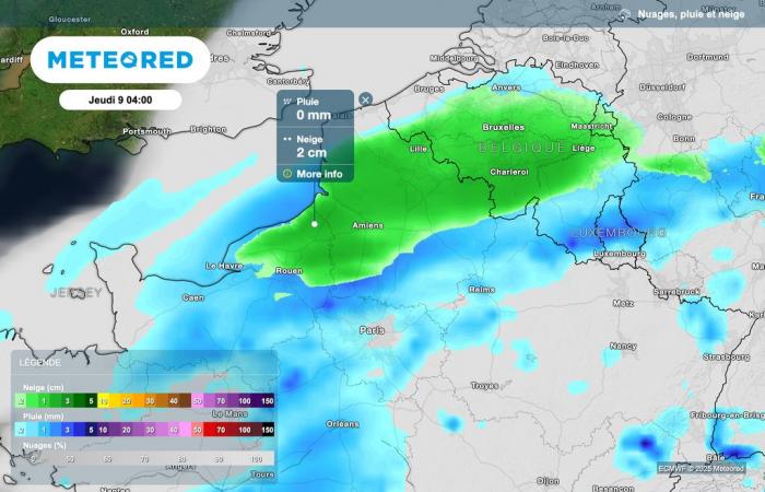
According to the latest forecasts, further snowfall could continue overnight from Wednesday to Thursday, between Upper Normandy, Picardy and Nord-Pas-de-Calais.
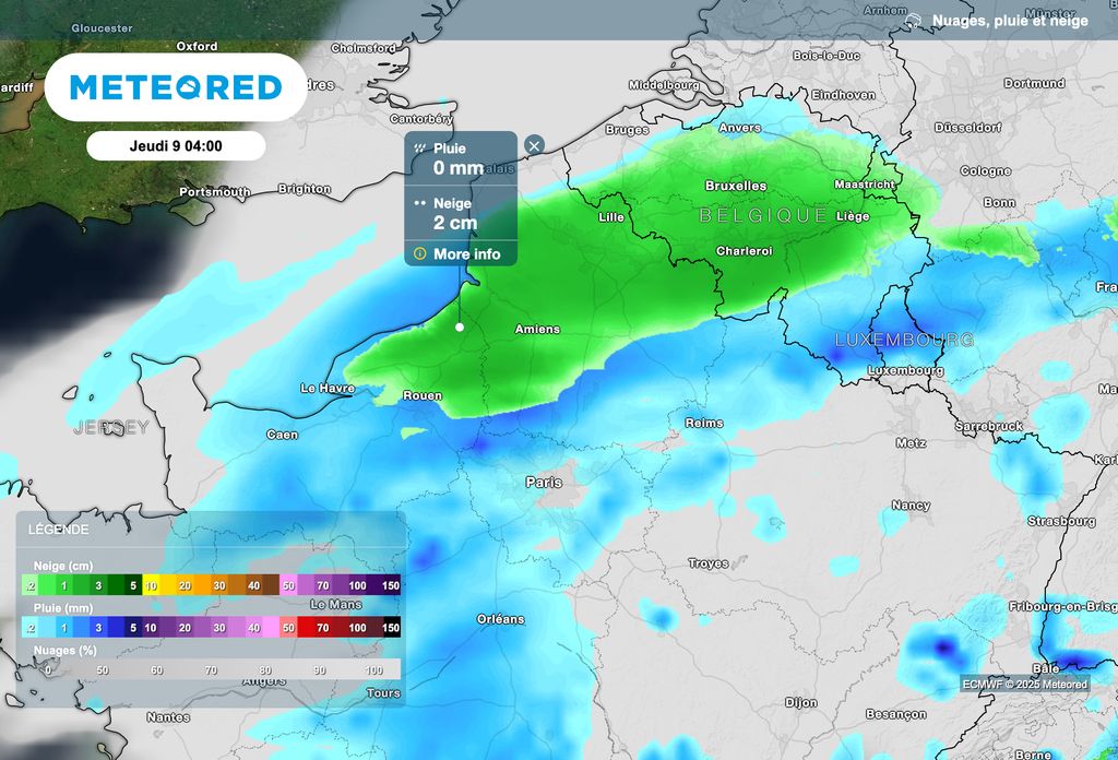
As shown in the map above, snowfall is expected to continue overnight from Wednesday to Thursday in the far north of France. If these occur, they risk seriously complicating traffic conditions on Thursday morning between Normandy and Hauts-de-France.
Further snowfall is expected on Friday with the arrival of a disturbance from the Atlantic which, in contact with cold air, could lead to new winter weather conditions in central regions. A trend that we will refine over the coming days.

