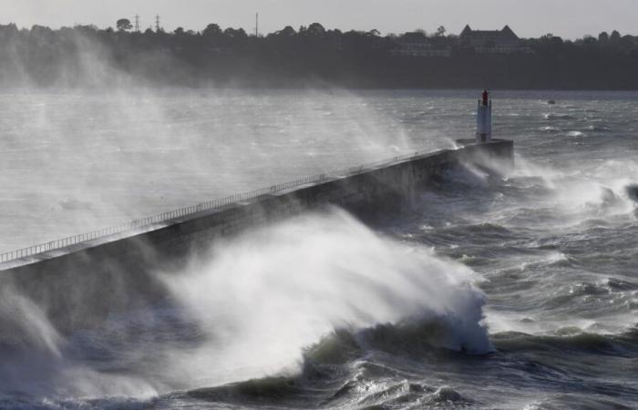
Finistère, Manche, Seine-Maritime… Storm Floriane is already affecting several departments and is expected to shift inland throughout the day, towards Île-de-France and the northeastern departments , where peaks are expected in the early afternoon.
Already impressive readings. Strong gusts of wind have already been noted this Monday, January 6 at dawn with the passage of storm Floriane over a large northern half of France, and while 21 departments are placed on orange vigilance by Météo France.
124 km/h were recorded in Barfleur in Manche, 114 km/h in Villard-de-Lans in Isère, 113 km/h in Fécamp in Seine-Maritime, 107 km/h in Cherbourg in Manche, 101 km/h h on the island of Ouessant in Finistère, 99 km/h on the island of Yeu in Vendée, 94 km/h in Biscarosse in Landes and 93 km/h in Saint-Nazaine, in Loire-Atlantique.
According to Météo France, storm Floriane will circulate on “an axis starting from Vendée to the Ardennes via Île-de-France.” The organization anticipates two peaks of violent wind: the first in the middle of the night from Sunday to Monday and the second Monday at midday.
In the North-West, storm Floriane will enter the territory early Monday morning via the coasts of Vendée, again with gusts of around 90 to 100km/h, locally at 110km/h.
“It shifts towards the Paris region at midday then the north-eastern regions at the start of the afternoon, before quickly evacuating towards Belgium,” adds Météo-France. The orange alert must remain in force until Monday afternoon in the 21 departments concerned.”
In the northern half, there remains uncertainty about the trajectory of the storm” and “the wind could blow equally strongly” in the departments bordering the departments in orange vigilance, underlines Météo-France, which therefore calls for caution.
Trains at a standstill
In Hauts-de-France, the SNCF decided to shut down certain portions of lines for a few hours at midday on Monday, in order to prevent trains from finding themselves blocked by falling trees.
The Paris-Laon lines (between Crépy and Laon), Tergnier-Laon, Creil-Beauvais and Boulogne-Dunkerque are affected. According to Météo-France, “in the vicinity of Aisne, it is not excluded, at this stage, that gusts could even locally reach 110 km/h”.


