Highlights
Thick morning fog: anticipate your departures by car
Showers rise from the Gulf of Lion towards the central massif, without aggravating character
The mildness is widespread in the afternoon
Matin
Frequent fog expected this Tuesday morning © The Weather Channel
The fogs are numerous and thick in the northwest, and, locally, in the Garonne valley and the Val de Saône. If you have to travel, anticipate your departure because you will drive more slowly. Relative coolness is present especially in the northeast, with a few white frosts possible. In the south, the sky is variable, very cloudy in Languedoc-Roussillon with a few drops possible. It's very mild early in the morning.
The minimum temperatures are, like the day before, contrasting: from 3 to 10°C in the northern half and from 10 to 17°C in the south.
Afternoon
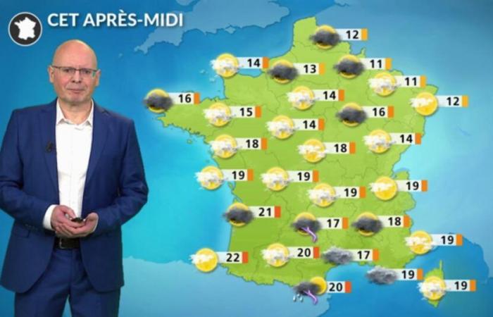
The sky remains very cloudy over the northwest quarter. From the north-eastern Île-de-France, clearings should predominate but uncertainty persists over the dissipation of the clouds. In the center east, the sun is shining and the weather is very beautiful over the Alps. On the other hand, the sky remains cloudy in Occitanie, in the Pyrenees and in the central massif where some showers may occur. The slightly veiled sun resists on the Côte d'Azur and Corsica in a spring atmosphere.
Maximum temperatures vary from 13 to 15°C to the north of the Loire, and from 15 to 20°C to the south, which is very mild for the season.
Soirée
Fog is forming in the northwest while scattered showers are possible in the southwest.
Further trend
The rest of the week will remain calm, with numerous fogs and low morning clouds which allow clearings in the afternoons. If the mornings are a little cooler now in the north-east, temperatures remain around 3°C above normal in the afternoons, especially in the south of the country. Showers will still occur in Languedoc-Roussillon, especially on Friday.


