What will the weather be like this week of October 21? After a historic Cévennes episode, and a record accumulation of precipitation since the start of the year, the weather will be better over the coming week. “With the strengthening of the Azores anticyclone, the disturbed British current will move back towards the British Isles,” details La Chaîne Météo, while warning that this improvement could only be short-lived. The risk of bad weather is low, at least until Thursday.
Monday: clearings on the agenda
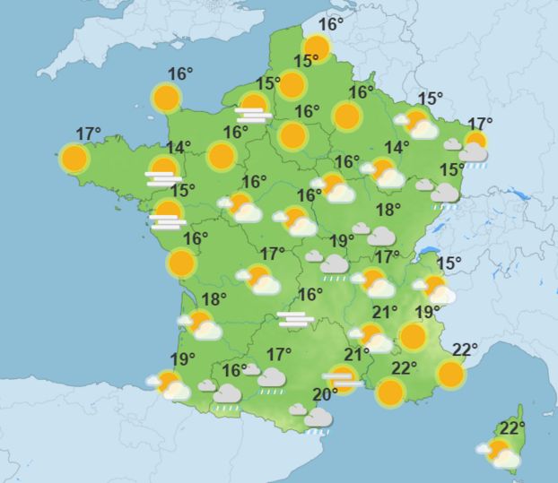
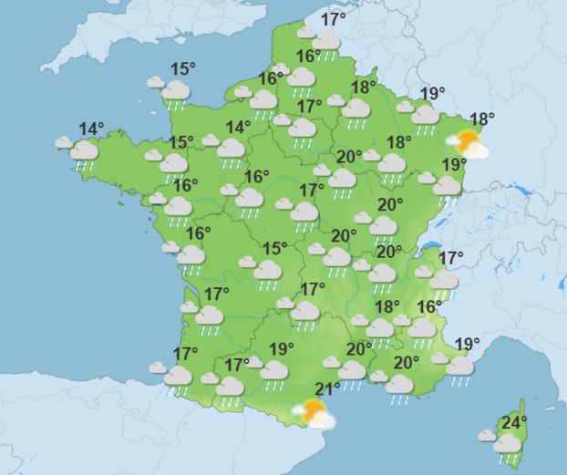
The weather will be very unsettled along the Channel and in the North-West quarter, where rain accompanied by sustained wind is expected. Elsewhere, the weather will be dry and mostly sunny. In the Paris region, the sky will be very cloudy in the morning, with a temperature of 16°C. Clear weather is expected in the afternoon, with the thermometer reading 21°C.
Tuesday: sunny weather
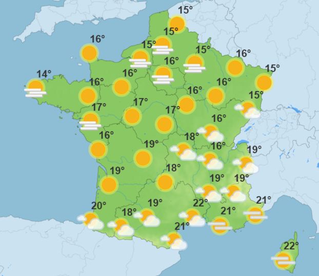
Despite some scattered rain from Tarbes (Hautes-Pyrénées) to Perpignan (Pyrénées-Orientales), Vichy (Allier) and Belfort (Territoire de Belfort), the sun will be there over most of France thanks to the Azores anticyclone.
In Île-de-France, temperatures are falling despite rather clear skies. It will be 12°C in the morning and 16°C in the afternoon.
Wednesday: a beautiful day ahead
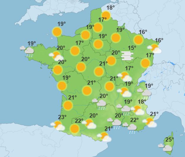
Fog, mists and low clouds will be common in the morning. So be wary on the roads, where visibility will be reduced. The morning freshness will give way to a pleasant mildness in the afternoon and the sun will shine across the entire territory.
In Paris, fog banks are expected in the morning, where the thermometer will show 11°C. Like the day before, it will be 16°C in the afternoon.
Thursday: a warm afternoon
The Azores high pressure is starting to weaken, which will be felt by the weather. The weather is forecast to be overcast and humid near the Mediterranean and a new disturbance is arriving via Brittany.
In the Paris region, the sun will continue to shine from morning until evening. With a confidence index of 4/5, Météo France forecasts 10°C in the morning and 19°C in the afternoon.
Friday: the return of the rain
Unsettled weather is expected for Friday. It should rain everywhere except near Perpignan (Pyrénées-Orientales) and Strasbourg (Bas-Rhin). “In the South-East, a risk of bad weather is not excluded,” warns La Chaîne Météo.
As in the rest of France, the weather will get bad in Paris this Friday. Showers are expected in the morning, with the thermometer hovering around 14°C. The sky will still be cloudy in the afternoon, when 17°C is expected.
Weekend: cooler weather
After a week of mild weather, rain and showers will return across the entire region at one point or another over the weekend. The first trends from Météo France predict rain on Saturday afternoon in the Ile-de-France basin, with a temperature not exceeding 13°C. On Sunday, unstable and cool weather will prevail over a large part of the country. Enough to encourage the French to take advantage of their extra hour of sleep, as we switch to winter time on the night of Saturday October 26 to Sunday October 27.