Updated January 5, 2025 at 9:00 p.m.
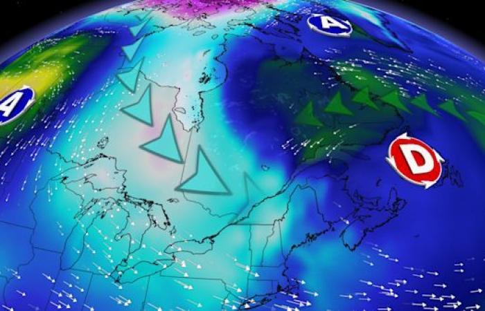
Two polar opposite scenarios are emerging for the coming week. On one hand, this would be the coldest week of the season for the South so far. On the other, the mildest for the northeast. Forecasts.
The cold grips southern Quebec
It’s hard not to notice: an arctic air mass has gripped the southern, central and western regions of the province. In Saguenay, a maximum of -17°C was forecast for Sunday and the mercury could drop to -25°C next night. In southern Quebec, it will be a bitter start to the week: Montrealers should wake up Monday morning with a thermometer reading -16°C, not to mention the feeling of -22.
This cold air mass will be the talk of the town all week since it should keep the southern regions of Quebec below normal until the next weekend. At the time of writing, the mercury is not expected to exceed -5°C. Remember that the average at this time of year is around -4°C.

With a maximum of -11°C, Wednesday would be the coldest, tied with Monday. In short, the average temperature for the coming week would be around -7°C, or 6°C colder than the previous one. It would thus become the coldest of the season so far.

Up to 16°C above normal in the north
A completely different scenario is being prepared for the northern regions of Quebec. A mass of mild air has taken over the Far North as well as the Lower North Shore. Monday morning, it will be 15°C warmer in Sept-Îles than in Montreal. It’s the world turned upside down. This mildness should continue until the next weekend and thus offer the mildest week so far for the Lower North Shore.

In Sept-îles, the average temperature over the next seven days is expected to be around 1°C. Remember that the normal for the city is -8°C. This abnormal sweetness extends to Kuujjuaq. In short, temperatures will be 10°C to 16°C above normal.
SEE ALSO: Quebec on the wrong side of a blockage
Canada


