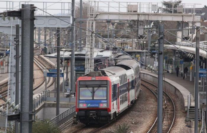
The passage of storm Floriane could well disrupt rail transport, in Île-de-France as in other departments. Météo France placed 21 departments on orange alert for violent winds on Monday, and wind gusts of up to 110 km/h are expected in certain areas. Here is what to expect in Île-de-France, but also on the TER and TGV nationally.
Disturbances in Île-de-France
Faced with these weather conditions, several RER lines have warned their users of possible disruptions for Monday. “Traffic will be interrupted between Brétigny and Saint-Martin d’Étampes, as well as between Brétigny and Dourdan, from 10 a.m. to 3 p.m.,” indicated for example accountex-Twitter) of the RER C Sunday evening.
Slowdowns could also be observed on the lines RER D and E. “Before going to the station, we recommend that you check the timetables of your trains,” we could read on the social networks of the two lines. Accounts RER A and B have not yet communicated about possible delays.
Disruptions are also expected on the majority of Transilien lines. In detail:
On the L linetraffic will for example be interrupted between 9 a.m. and 2 p.m. between Saint-Cloud and Versailles Rive Droite and Saint-Cloud and Saint-Nom.
On line Nit will also be interrupted between Plaisir and Dreux, from 10 a.m. to 1 p.m. and between La Verrière and Rambouillet from 10 a.m. to 2 p.m.
On the J lineit will be interrupted between Pontoise and Gisors from 9:30 a.m. to 2 p.m.
The R line will be interrupted between Melun and Montargis and between Melun and Montereau via Moret between 10 a.m. and 1 p.m.
The K line will be interrupted between Paris and Crépy from 12 p.m. to 2:30 p.m. and between Mitry and Crépy in both directions of traffic also from 12 p.m. to 2:30 p.m.
Finally on line Utraffic will be interrupted between Versailles Chantiers and La Défense from 10 a.m. to 1 p.m.
Furthermore, from Paris-Est, trains to Coulommiers, Provins, Esly, Crécy-la-Chapelle will also be canceled between 11 a.m. and 4:30 p.m.
TERs removed
The SNCF announced a series of measures for the 21 departments on orange alert, ranging from speed reductions on certain lines, to the absence of service to certain stations, including “traffic stops” (preventive stops to prevent trains are blocked in the middle of the track, particularly due to falling trees).
In Hauts-de-France, the SNCF will shut down certain portions of lines for a few hours at midday on Monday. The Paris-Laon lines (between Crépy and Laon), Tergnier-Laon, Creil-Beauvais and Boulogne-Dunkerque (from 11 a.m. to 1 p.m.) are affected.
The preventive “traffic stops” will also concern the Limoges-Angoulême lines until 1 p.m., Limoges-Vierzon until 5 p.m., Poitiers-La Rochelle, Étampes-Orléans, and Tours-Poitiers, at least part of the day. , as well as Nancy-Bar-le-Duc from 11 a.m. to 4 p.m.
TGVs also affected
TGV lines will also be affected by traffic interruptions. “There will be no direct Paris-Limoges-Toulouse trains before 4 p.m., four direct Nantes-Bordeaux trains will be canceled and there will be no TGV from Tours and Saint-Pierre-des-Corps until 'at 4 p.m. and no TGV service until 2 p.m. from Poitiers and Châtellerault stations,' details a press release from SNCF Réseau.
Sunday evening, the departments affected by Météo France's orange vigilance were: Vendée, Maine-et-Loire, Sarthe, Indre-et-Loire, Loir-et-Cher, Eure, Loiret, the eight departments of Île-de-France, Aisne, Marne, Ardennes, Meuse, Rhône and Loire.
The trajectory of the storm being still uncertain, Météo France also recommended that residents of neighboring departments, placed on yellow alert, remain cautious throughout the day on Monday. Rail traffic could also be disrupted in these areas.


