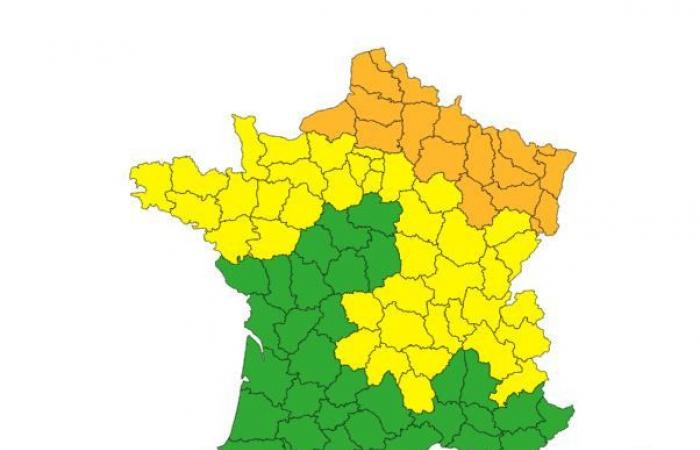
Due to a new disturbance, Météo France is placing 16 departments on orange “snow-ice” alert this Saturday, January 4, 2025. Around thirty others are placed on yellow alert for a risk of snow and ice, including Paris and the the whole of Île-de-France. So, what should we expect this Saturday in the Ile-de-France region? Find out the forecast.
Lately, Mercury has been playing yo-yo. While temperatures should return above seasonal norms this Sunday, the cold settles over a large part of the country this Saturday, January 4 with a risk of snow announced in several departments of France.
So, this January 4, 2025, Weather France places 16 departments in vigilance orange « snow-ice »mainly in the north and northeast of the country. “A disturbance associated with a lot of mild air will sweep across the entire country in a southwest/northeast direction this Saturday and overnight from Saturday to Sunday“announces the meteorological service.”This disturbance will encounter a mass of cold air, causing snowfall and especially freezing rain for a few hours, while the mild air definitively gains“, specifies Météo France.
Seine-Maritime, Somme, Pas-de-Calais, Nord, Aisne, Oise, Ardennes, Marne, Meuse, Haute-Marne, Moselle, Meurthe-et-Moselle, the Bas-Rhin, the Haut-Rhin, the Territoire de Belfort and the Vosges are thus placed in vigilance orange “snow-ice” this Saturday, January 4.
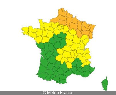
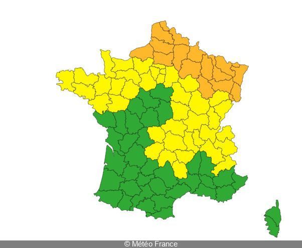
What about the situation at Paris and Île-de-France ? Météo France places Paris and the 7 other Ile-de-France departments (Seine-et-Marne, Yvelines, Essonne, Hauts-de-Seine, Seine-Saint-Denis, Val-de-Marne and Val-d 'Oise) in yellow vigilance « snow-ice » this January 4, 2025. This yellow alert is valid from 5 p.m.
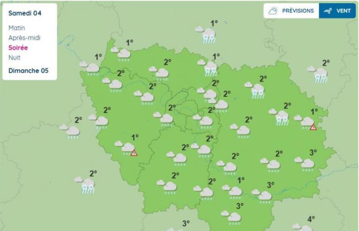
According to Weather Francethis disturbance will return to Île-de-France this Saturday evening and will cross the Ile-de-France region from the southwest to the northeast. “It is associated with a powerful mild spell but, before this sets in during the night, the previous cold air could persist.” explains the meteorological service, while specifying that “the first precipitation will be in the form of light snowfall, which may slightly whiten the ground in places, followed by temporary freezing rain before the arrival of “normal” rain for the second part of next night“.

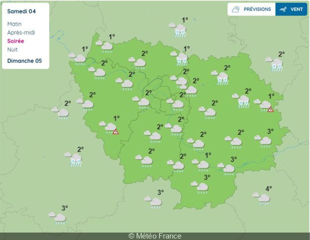

A few flakes could therefore fall in the evening in the northeast of Val-d'Oise and in the north of the Seine-et-Marne. Of the freezing rain are also announced in the Yvelines and in Seine-et-Marne.
For now, these are only forecasts. It is advisable to keep informed of changes to these forecasts and future updates of the vigilance map. Also be extremely careful when traveling and, if possible, avoid driving in certain departments where icy patches are forecast. “If the scenario worsens, an increase in the level of vigilance would be possible” adds Météo France.
France

