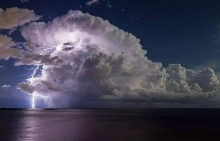
An orange “thunderstorms” alert has been triggered for the day of Saturday June 29 in 34 French departments, while a strong stormy episode will cross most of the country, indicates Météo France. The weather services have also placed 14 departments on orange alert for Sunday in the Grand-Est.
Saturday at 10 a.m. Puy de Domel’Ain and the Loire have gone into orange “thunderstorms” alert. A little earlier in the morning, at 6 a.m., the departments of Tarnof the’Aveyronof Lotof Cantalof the’Ally and of theAin had suffered the same fate. They thus joined the 25 departments which already were: the Charentethe Charente Maritimethe Cherthe GirondeTHE LandesTHE Two Sevresthe Viennaet all departments of Grand Est and Bourgogne-Franche-Comté.
“The high-altitude depression at the origin of the stormy deterioration is currently moving up over Spain towards the Pyrenees”said Météo France on Saturday morning.
In Aquitaine, “frequent thunderstorms are present” accompanied by a “strong electrical activity, locally high rainfall intensities sometimes of 20 to 30 mm/h” and of “hail in places”.
High temperatures across the country
From the Massif Central to the northeast, the stormy episode has not yet begun. In the morningthese storms will extend to the Centre-Val de Loire, while from the Pays de Loire to the Ile-de-France, Champagne-Ardenne and Lorraine, the cloudy passages could give locally stormy but more isolated showers.
Likewise, from Occitanie to Provence-Alpes-Côte d’Azur, the sky will be very cloudy and a few showers will be possible from the morning. But at the same time, a more marked stormy degradation will approach the Pyrenees, and will quickly extend towards the Massif Central.
The afternoonfrom the east of the Pyrenees to Limousin, then to Auvergne Rhône-Alpes, storms will become strong and multiply, giving high intensities of rain, sometimes hail and powerful gusts of wind.
This area of storms will head towards the Centre-Val de Loire, the east of the Ile-de-France and Bourgogne Franche-Comté at the end of the afternoon, to reach the Grand-Est in the evening, with continued heavy rain, violent gusts of wind and hail, particularly in the north-east of the country where these storms will be the most violent.
Only the regions from Brittany to Nord-Pas-de-Calais, as well as Corsica, will remain safe from this bad weather, and will keep a calmer but cloudy weather. The south-easterly wind will blow quite strongly until the beginning of the afternoon from Provence-Alpes-Côte d’Azur to the Massif Central.
Morning temperatures will be between 8 and 13 degrees from Brittany to Belgium, from 15 to 20°C elsewhere, up to 21 to 22°C in Corsica. The afternoonit will be 18 to 23°C near the Channel and the Atlantic, 23 to 28°C elsewhere, but up to 27 to 32°C from the Grand-Est to Berry, Rhône-Alpes and Provence-Alpes-Côte d’Azur, and in Corsica, locally 34°C in the Alsace plain and on the Isle of Beauty.
What about the Alpes-Maritimes and Var this Saturday?
In the Alpes-Maritimes, everything is “green” this Saturday, June 29, according to Météo-France. No particular vigilance, after days in yellow for the risk of storms, some of which caused damage.
In terms of temperatures, it will be between 17 and 26°C this morningThen between 24°C and 31°C this afternoonwith no precipitation announced by weather forecast services.
In the Var, vigilance (yellow) this Saturday concerns only the wind. Météo-France therefore recommends being attentive. Mercury will display, between 21 and 27°C in the morningThen between 26°C and 29°C in the afternoon.


