
The violent storms which will affect France in the coming hours have pushed this Friday, June 28, Météo France has placed 25 departments on orange alert for the day of Saturday, June 29.
The departments concerned are: Landes, Gironde, Charente-Maritime, Charente, Deux-Sèvres, Vienne, Cher, Nièvre, Yonne, Côte-d’Or, Saône-et-Loire, Jura, Doubs, Haute-Saône, Haute-Marne, Aube, Marne, Meuse, Ardennes, Moselle, Meurthe-et-Moselle, Bas-Rhin, Vosges, Haut-Rhin and the Territoire de Belfort.
The storms legitimizing this increase in the level of vigilance will first hit the south-west of France, late in the night from Friday to Saturday. They will then slide towards the Centre-Val de Loire and the Paris region. Then, during the day on Saturday, potentially very violent storms will break out in a large north-eastern quarter of the country, from the Ardennes to the Lyon region, via Alsace.
Storms linked to a cold drop
These storms are due to the arrival in France of a cold drop (pocket of cold air at altitude) which, by hitting the mass of hot air which is currently flooding France, will cause instability there.
“We will have all the ingredients: very strong electrical activity, hail, possible tornadoes and sometimes wind gusts of more than 100 km/h,” explains Yann Amice, meteorologist at Weather & Co.
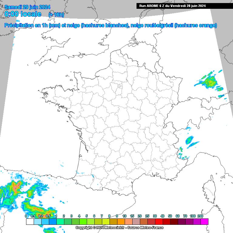
Heavy rainfall is also expected as these storms pass through. This is what the animation below shows. Created with forecasts from the French Arome model (the most accurate of the French models), it shows the intensity of the hourly accumulations to be expected in France during the day on Saturday.
Ultimately, over the entire episode, accumulations of more than 40 mm are expected locally, particularly in New Aquitaine, in central France or in Alsace. Météo France even mentions accumulations which could locally reach 80 mm in the Grand-Est.
Spectacular but not surprising accumulations, given the climatic context. “In a warmer climate, the water contents of air masses in these stormy situations tend to increase, leading to more intense and rainier phenomena”thus recalls Météo France.
Towards a calmer and fresher start to the week
This intense rain-storm degradation should gradually evacuate towards Germany, even if thunderstorms may continue to break out in certain areas of the northeast on Sunday morning.
“On Monday, the weather should return to calmer conditions,” continues Météo France in its forecast bulletin for dangerous phenomena. The weather at the start of next week will also be marked by a certain cooling.


