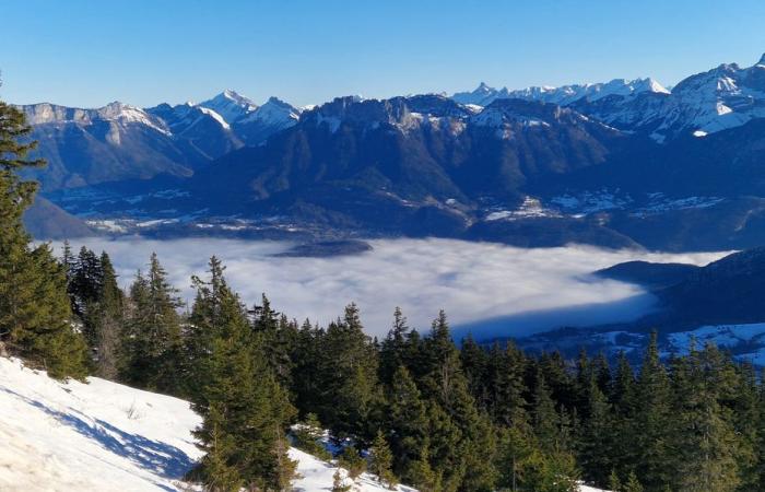
This last week of the year 2024 is marked by a sea of clouds, which covers part of the plains of the Northern Alps. A “usual” weather phenomenon for the season due to a temperature inversion, which inspires many amateur photographers.
The essentials of the day: our exclusive selection
Every day, our editorial team reserves the best regional news for you. A selection just for you, to stay in touch with your regions.
France Télévisions uses your email address to send you the newsletter “The essentials of the day: our exclusive selection”. You can unsubscribe at any time via the link at the bottom of this newsletter. Our privacy policy
For those lucky enough to climb to a higher altitude, a breathtaking unobstructed view. For those remaining in the valley, it is difficult to see further than the end of the street.
For several days, a thick white fog has invaded the towns and villages of the Alps. In Annecy, even the lake has disappeared behind the mist. Enough to give a mysterious atmosphere to the city at the end of the year, and to inspire photography enthusiasts.
Annecy-le-Vieux in the fog this December 31.
•
© F3 Alpes
With his hat screwed on his head, this Annecian went out to capture this very special luminosity. “I've been taking photos in Annecy for 40 years, I sometimes feel like I've been there, but atmospheres like this allow me to do interesting things.“, he says.
The mist that covers Lake Annecy inspires photography enthusiasts.
•
© F3 Alpes
Others decided to ride through the fog in pursuit of the sun. At Semnoz, at an altitude of 1700 meters, skiers and hikers discover a sea of clouds and almost dazzling light. “A spectacular view“for some,”a real sunbath” for others.
Above the clouds, skiers enjoy the sunny slopes.
•
© F3 Alpes
On social networks, many Internet users have shared photos of this impressive layer of clouds, like Flore, who immortalized the landscape during her climb to the Col de Porte, near Grenoble.
The sea of clouds captured from the heights of Corenc, in Isère.
•
© Flore B.
“It's quite classic for this time of year, explains Thomas Blanchard, independent meteorologist. We have what we call temperature inversions. That is to say, it is colder in the valley than in the mountains. And the temperature difference between these two air masses forms condensation, and gives this sea of clouds effect..
Very low on the horizon at this time of year, the sun fails to warm the bottom of the valley and dissipate this layer of mist. The absence of wind also explains the longevity of the phenomenon.
“A disturbance will arrive Thursday afternoon, with the wind which will rise on Wednesday to dissipate the fog and the gray weather. We expect precipitation to return on Thursday afternoon, with fresh snow expected to fall from 700 meters above sea level. All massifs will be affected by these new falls between Thursday and Friday“, concludes the meteorologist.


