This Saturday, the cold is very present in France. But already, the mild air will arrive from the southwest with a risk of icy conditions ahead. Find out the weather forecast.
A deterioration is progressing this Saturday in France. It collides with cold air present in the north/north-east of the country, creating a risk of snowfall. But it is the risk of freezing rain which is being monitored even more closely. Update on the weather forecast for the next few hours through these new lines that we are offering you.
Air mass conflict
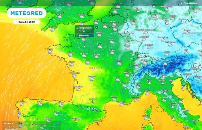
The rise of this disturbance from the southwest will bring much milder air. Thus, temperatures of around 10°C or a little more are possible by the evening of this Saturday between the Breton coasts and the Basque Country. The Nouvelle-Aquitaine region should also find very mild air.
Ahead, cold air will persist with temperatures near the ground near 0°C. It is in this area, at the start of the disturbance, that snowfall may be observed.
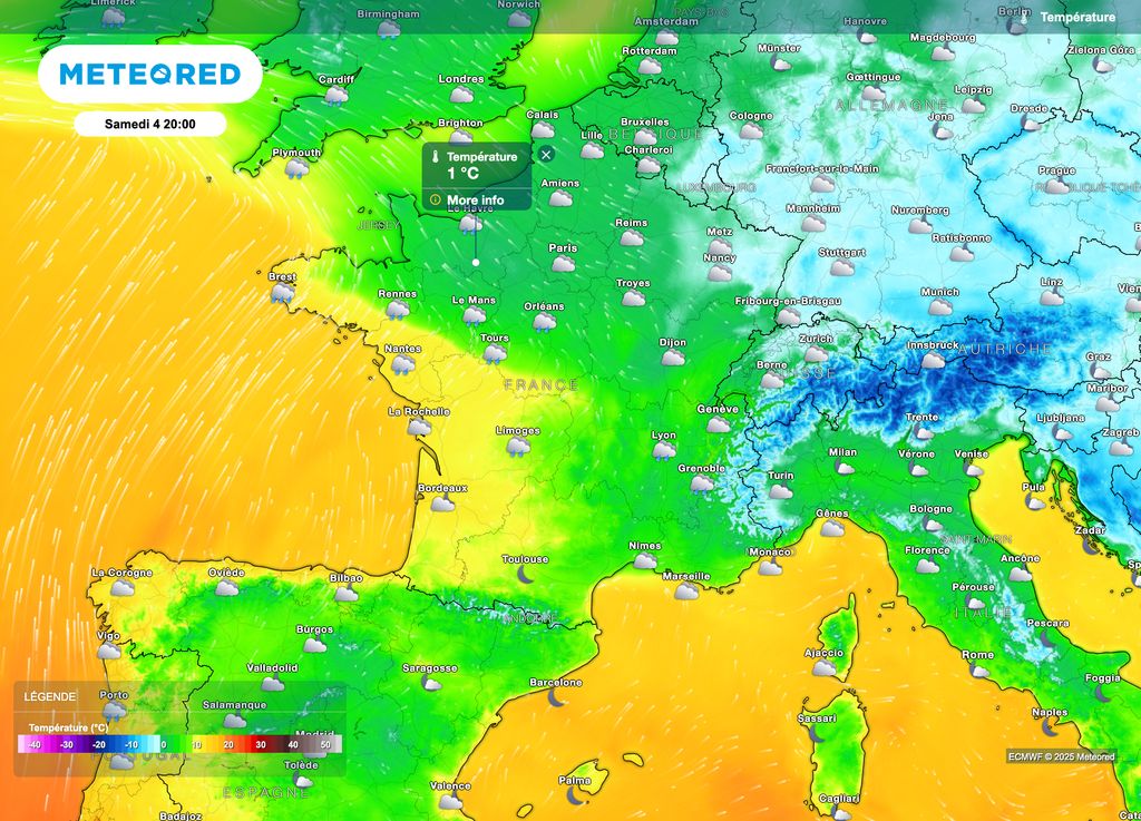
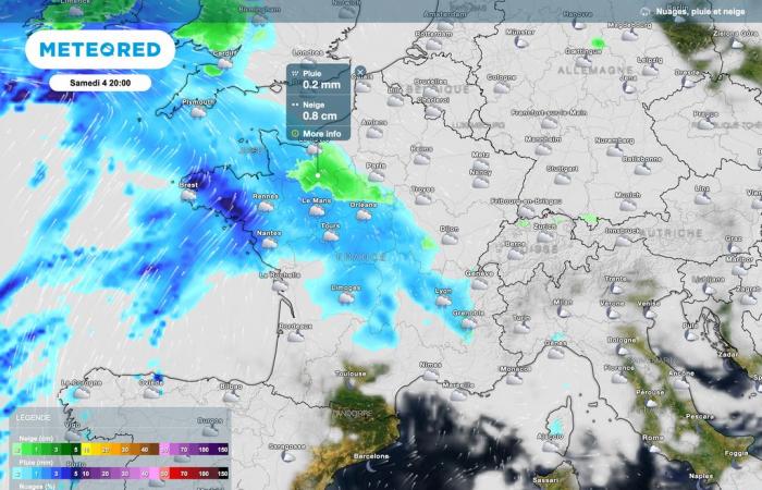
However, the arrival of mild air at altitude and the persistence of cold temperatures on the ground (sometimes still frozen) raises fears of a risk of freezing rain.
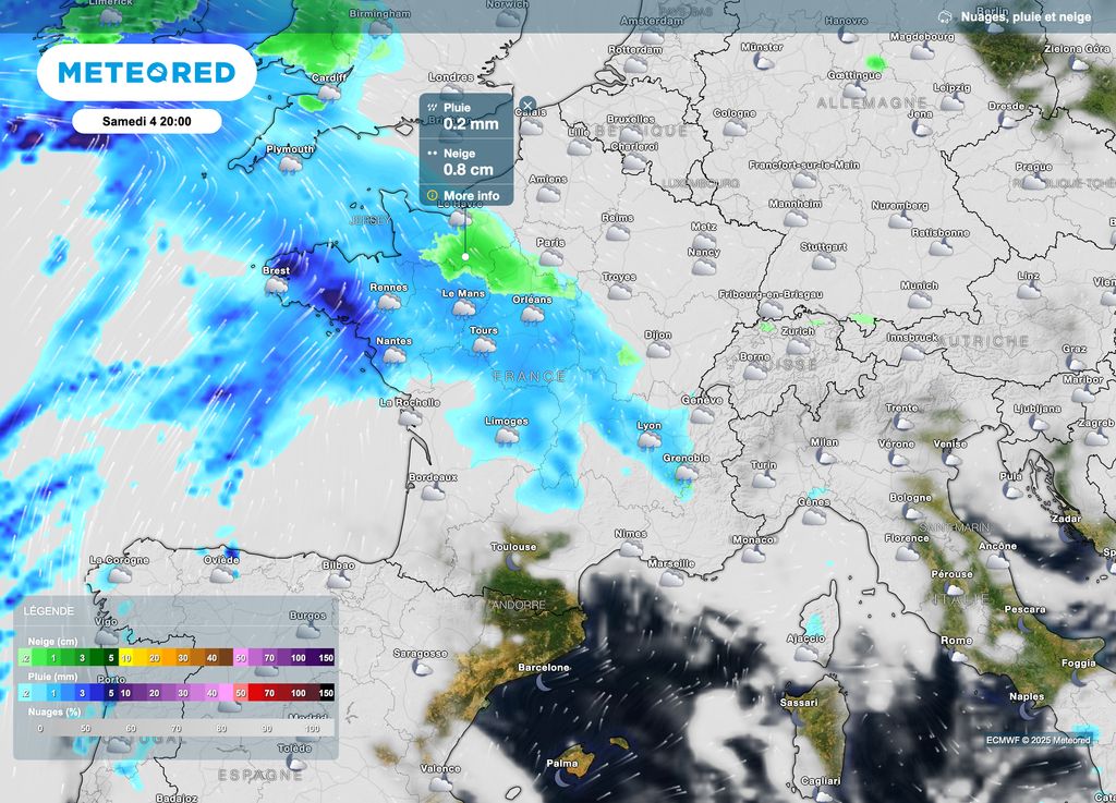
On the map above, it is in Normandy that the risk of snow and freezing rain will be present early Saturday evening. Be careful, the Paris region will also be affected after a cold but generally calm day.
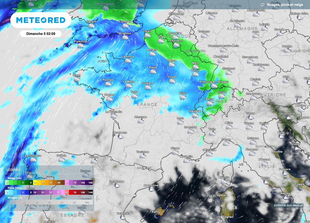
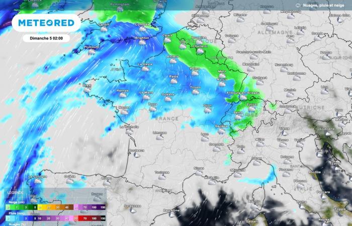
Going up towards the northern and northeastern regions (between Hauts-de-France and the Grand-Est), the cold air will be more persistent. In fact, the risk of an episode of freezing rain is expected to be more pronounced. These sectors will be affected until the middle of the night at the latest.
The risk of icy conditions will pass beyond our borders by the end of Saturday night into Sunday morning with cold air which will be pushed into Germany.
Flood risk
After this rather brief icy episode over time (please be very careful, icy is not necessarily visible on the roads), the rain will continue to fall. Moderate accumulations of precipitation will be added to those that have already fallen.
Also, a risk of flooding will be present in snowy areas in the east, for example in the Vosges and Jura massifs: this mild spell will encourage at least partial melting of the snowpack at medium altitude. Locally, areas could see a risk of flooding (overflowing of watercourses).
This risk will also be present in the following days since further rainy weather is expected across almost the whole of France. A weather situation to follow on Tameteo.com.

