At the same time, the strong winds will mostly remain and will bring precipitation a lot of the time, mostly falling as rain and sleet, meaning a white Christmas is off the cards for Tallinn and most of the coastal areas of Estonia.
Thursday morning’s road conditions are still hazardous however, so take care while driving and out and about.
At the time of writing a low-pressure system has arrived in the Norwegian Sea, traveling from the Atlantic via the Azores and bringing warmer air with it from the 40s.
On reaching the British and Irish archipelago, it clashed with a colder air mass there and brought strong winds to that region within a few hours until it moved on to the coast of Norway by this morning.
The southernmost edge of this system will bring warmer and moister air masses far enough to impact on Estonia too, though the wind and rain remains.
Rain moving eastward will turn to snow and sleet, intensifying with strong winds and blizzard-like conditions, while by Friday, the low-pressure system will move on to Finland, bringing rain mixed with wet snow to Estonia, along with persistent strong winds and above-freezing temperatures.
The cold front brought falling temperatures, turning rain into sleet and snow, creating icy roads and hazardous conditions, especially in Central and Eastern Estonia.
Strong winds up to 20 meters per second accompanied freezing rain, with temperatures ranging around 10 degrees: From -5 degrees Celsius inland, to highs of +5 degrees over the islands.
The slippery conditions caused the Transport Administration (Transpordiamet) to issue a warning for Wednesday night which should still be heeded early Thursday as the slippery conditions on the roads will persist, particularly in central and eastern Estonia, even as the mercury rapidly rises.
For updated road condition information, travelers are encouraged to check the Tark Tee portal here, before setting out on non-crucial road trips.
The strong southerlies continue too this morning, in gusts up to 16 meters per second on the coasts. This will also drive sheets of rain in eastern and southern Estonia, as far west as the Tallinn-Pärnu axis at times.
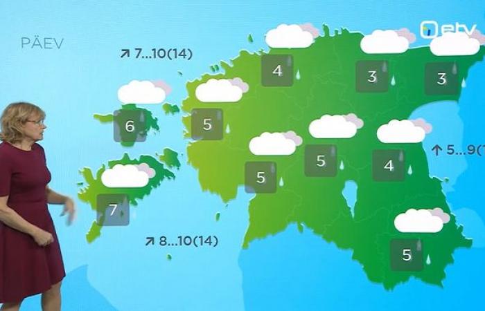
Meanwhile, the temperatures will climb above zero, up to +8 degrees over the islands and no lower than around zero this morning in the northeast.
The rain will become even more predominant after lunch, reaching the far west and islands and blanketing the country, by which time temperatures will be mild, +3 to +8 degrees, though the winds, now chiefly from the southwest, will blow at speeds of 8-11 meters per second and in gusts up to 14 meters per second, keeping things a bit chillier than otherwise.

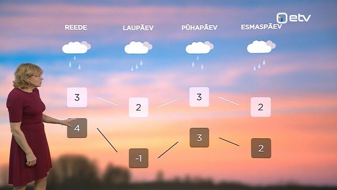
These conditions will prevail into the weekend and into the Christmas break, from Tuesday, December 24, the main holiday in Estonia and Northern Europe.
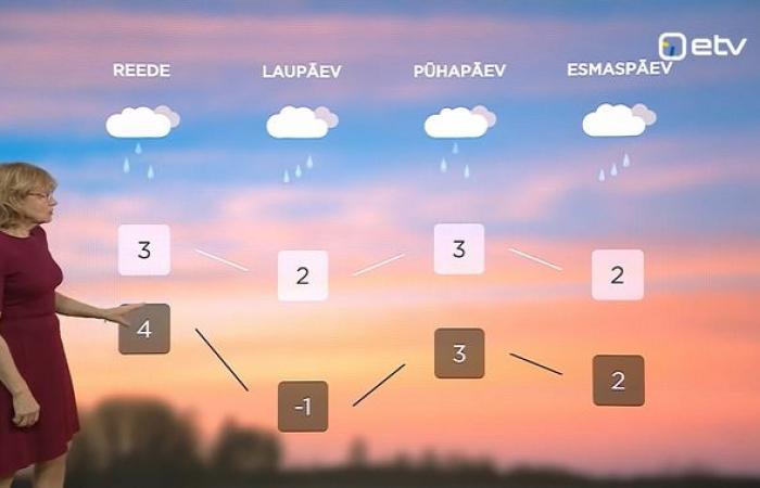
The strong winds will come and go and come back again, while the mean ambient temperatures are set to stay mild at least until Tuesday (+2-3 degrees during the day, yet, curiously higher sometimes at night at -1 to +4 degrees).
The showers will remain every day, falling as sleet and occasionally snow at the coldest times and in the coldest inland and eastern regions.
The shortest days of the year are here too, meaning there will be no appreciable difference in sunrise and sunset times over the next few days.
In Tallinn, sunrise is at a bit before 9.20 a.m. through to year-end; sunset today is just before 3.20 p.m., to just after 3.20 p.m. during the Christmas break and after the solstice on Saturday, and at 3.30 p.m. by New Year’s eve.
—
Follow ERR News on Facebook and Twitter and never miss an update!
Source:
“Actual camera,” weather forecaster Taimi Paljak.


