Storm Caetano is a very deep depression which arrived on Thursday November 21, 2024 on the island of Ouessant. It presented an atypical trajectory through France, traveling towards Lake Geneva then Switzerland in the evening.
This trajectory caused a major air mass conflict between the cold air present to the north of the Loire and a powerful warm spell rising from the southwest.
The effects of this depression were a remarkable snowfall for the month of November, early on, and stormy gusts between the Atlantic coast and Auvergne-Rhône-Alpes.
A notable snow episode
Snowfall mainly occurred from Normandy to the Paris basin and the center-east, along the occluded front of the depression. The presence of cold air in the north of the country and the mild temperatures linked to the depression were particularly conducive to a notable event. It fell 5 to 10 cm on this axis, with exceptional thicknesses for a month of November reaching 20 to 30 cm on the Normandy hills (Orne, Eure and on the plateaus of western Paris).
Snowy days in the Paris region are not frequent in November. We have to go back to the end of November 2010 to find significant snowfall in the south of Île-de-France and especially in Orléanais, where 30 cm fell. In the past, 23 cm of snow fell in Paris on November 14…1887, just like in 1919! Also in November, in 1968, there was 6 cm of snow in Paris
Some remarkable thicknesses:
16 cm in Roissy (95)
4 cm in Paris-Montsouris, which had not been seen since 1968 for the month of November.
8 cm in Rouen-Boos, record for the month of November
6 cm in Evreux (27)
and up to 20 to 30 cm in the hills of Orne and locally on the heights of Eure and Val d'Oise (20 cm in Omerville and 28 cm on the heights of Triel sur Seine)
Snow depths recorded on 11/21/24 © The Weather Channel
A13 motorway near Saint-Cloud © Cyril Bonnefoy
Record wind gusts
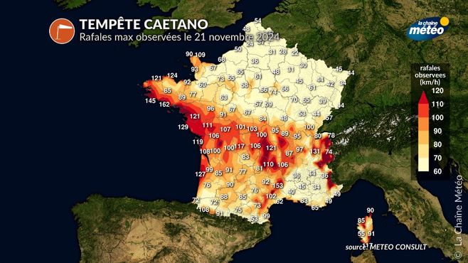
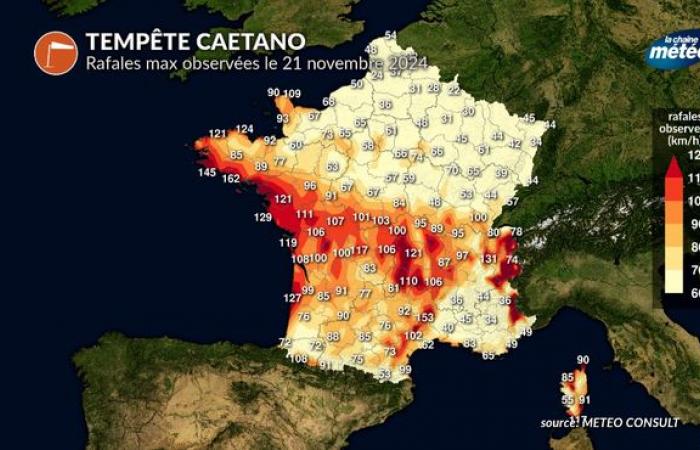
From the start of the morning, the arrival of the low pressure minimum on the Breton tip caused stormy winds from Finistère to Gironde, with peaks reaching 147 km/h at the Pointe du Raz (29). The maximum intensity is noted at midday when the southwest winds shift to the western sector, on the coast but also inland. The violent winds headed towards the central massif then the Northern Alps. Gusts reached 110 to 140 km/h with monthly records.
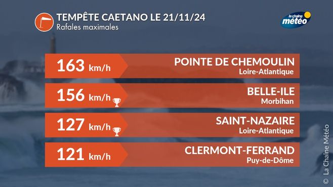
For example, we recorded 121 km/h in Nantes, 127 km/h in Saint-Nazaire (44), 156 km/h in Belle-Ile, 139 km/h in Vernine (63), 136 km/h in Super Besse (63), 121 km/h in Clermont-Fd (63), 120 km/h in Roanne (42). In the Alps, the winds were very violent in the high mountains (170 km/h at the Galibier nivose), and also reached 131 km/h in Aix-les-Bains.

Gusts of wind during the Caetano depression © The Weather Channel

Some maximum gusts during storm Caetano © The Weather Channel


