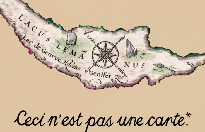
Represented as a small drop of water in the 2nd century or accompanied by a sea monster, Lake Geneva has always been mapped. Until August 31, 2025, the Léman Museum in Nyon (VD) unveils around a hundred geographical maps in its exhibition “Ceci n’est pas une carte”.
A card doesn’t seem as moving as a painting or photo. However, it is these geographical representations that are in the spotlight at the Musée du Léman, as part of the exhibition “Ceci n’est pas une carte”.
“A map is truly a window on history, on anecdotes, on dreams. We look at maps and imagine ourselves going to encounter unknown lands. And what’s more, a map, for a space that we know , presents us with a territory, but also an era”, underlines in the 12:30 p.m. of November 14 Lionel Gauthier, director of the Musée du Léman.
What was the lake like at that time? What were the towns called? Where were the borders? Who owned the banks? And what were the concerns of the people of the time? So many questions that can be answered through a history of cartography.
A history of cartography
There are as many maps as there are eras and the lake takes a different shape from one map to another. “It talks about the evolution of cartographic techniques, the skills and technical abilities that people who made maps have had over the centuries. It also talks about conventions, because we decide that the mountains are going to be represented like this , the roads will be represented like this. For example, in the 17th century, the maps were oriented towards the East, which is why the lake seems to be upside down,” indicates Lionel Gauthier.
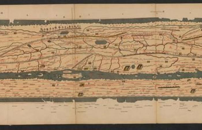
From the first representation on a map of the road network at the time of Emperor Augustus to more recent representations, including parchments showing the lake as a band, the Léman Museum exhibits years of cartographic collections. “The museum has existed for seventy years and for all this time, there have been people collecting maps. And then there are books and enthusiasts,” explains Lionel Gauthier.
Some more recent maps, dating from the 20th century, represent the winds to help navigators. “There are a lot of winds on Lake Geneva, this is one of the particularities of this lake. This is also why it is so difficult to navigate there. These winds are very sudden, very fast and very numerous” , specifies the director of the museum.
The Lake Geneva Monster
The exhibition also tells the mythology and legends surrounding Lake Geneva. “There are several maps on which monsters are depicted. It’s an era in cartography where we decorate maps with elements – boats, fish, monsters – because, simply, we don’t know at all what is under the water”, explains Lionel Gauthier.
At certain times, fishermen claimed to have encountered a monster twelve meters long in the lake. Like the Loch Ness monster, research has never proven anything. “I think they were somewhat drunken fishermen. But in any case, they were taken seriously. A very precise drawing by a scientist even shows a gigantic shoulder blade found in the lake. It was a hoax,” says smiling, the museum director.
The exhibition has been on display since October 10 at the Musée du Léman. “It’s called ‘This is not a map’, because in fact, it’s much more than a map. It is a lake, a representation, stories, a territory, imaginations, traditions. Obviously, a little nod to Magritte, but it makes sense,” concludes Lionel Gauthier.
Comments collected by Blandine Levite
Web adaptation: Lara Donnet
“This is not a map”, Musée du Léman, Nyon (VD), from October 10, 2024 to August 31, 2025.


