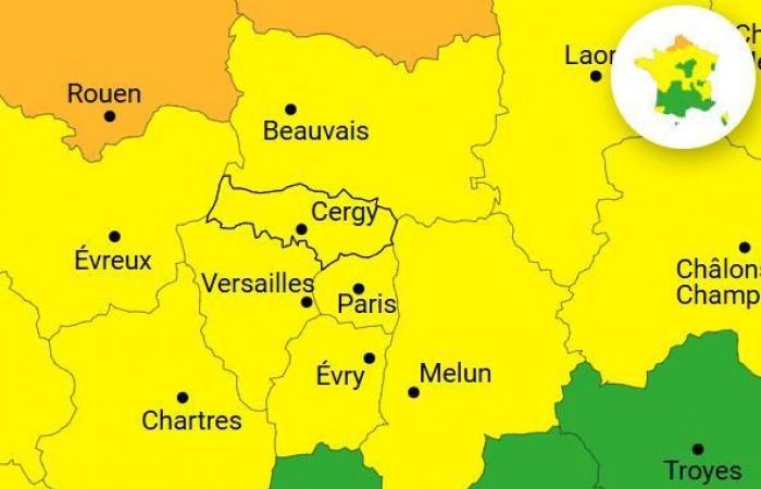
Snow could return to Paris and Île-de-France from this Wednesday, January 8, 2025. Two Ile-de-France departments, Val-d'Oise and Yvelines, are placed on yellow alert for a risk of snow and ice, according to Météo France. Showers mixing rain and snow are expected, with a potential of 1 to 2 cm on the ground locally, before rapid melting late in the afternoon.
After the passage of the Caetano storm, which caused beautiful snowflakes to fall in Île-de-France last November, the question arises: snow will she return to the Ile-de-France region in the coming days? Especially since Météo France announces snow and ice vigilance in two departments of Ile-de-France.
This week's weather forecast predicts a conflict between polar cold air et hot, humid air coming from the south of Europe, favoring the formation of snow in the north of the country. This Wednesday, snowfall is expected to begin in Normandie in the middle of the afternoon before gradually spreading to Hauts-de-France and touch part of Île-de-Franceparticularly the west of Val-d'Oise and Yvelines.


In these areas, precipitation will initially be light in the morning, before intensifying and temporarily changing to snow from midday. Although temperatures will remain slightly positive, snow could still hold on to the ground in parts of the region. In Paris, although snow is possible, precipitation will mainly take the form of heavy rain. The capital and the entire region are on yellow alert for a risk of rain-flood until midnight.
Beyond Île-de-Francefour departments – North, Pas-de-Calais, Somme and Seine-Maritime – are placed in vigilance orange for heavier snowfall, with accumulations reaching 5 to 10 cm. Twelve other departments, mainly north of the Seine, are on yellow alert. Caution is therefore recommended when traveling, particularly due to the risks of black ice and difficult traffic conditions.
Uncertainties remain about the evolution of this disturbance. If snow is confirmed, it could continue overnight from Wednesday to Thursday. Some scenarios even suggest a passage of the disturbance towards the south, which could include a large part of Île-de-France and bring about more significant accumulations. For the moment, forecasts suggest a return of rain in the evening, quickly putting an end to possible snow accumulations in the region.
We recommend that you stay informed of upcoming updates to the vigilance map and limit your travel, particularly by car, to avoid the most affected areas. Please note that these are only forecasts at the moment. To find out if the snow will make its return to several departments of Île-de-France this Wednesday and at the end of the week, we will therefore have to keep an eye on the evolution of the weather.
France


