Par
Timothée L'Angevin
Published on
Dec 28 2024 at 2:56 p.m.
See my news
Follow News
After Enol, Dioniso and Darragh, a new storm will it hit France at the start of 2025? In any case, this is what the weather models suggest.
Four days before the deadline, it is still a little early to say, but a fairly significant gust of wind should hit the northwest and north of the country between January 1 and 2.
A depression off the coast of Ireland
In question, a vast depression (cloud disturbance linked to a confrontation between a cold air mass and a warm air mass, which favors wind, rain, thunderstorms) which should form off the Atlantic around December 31.
Elle would gain in intensity in the north of Ireland and in Great Britain, January 1 and 2. Which would cause sustained winds on the British Isles, but also here further south.
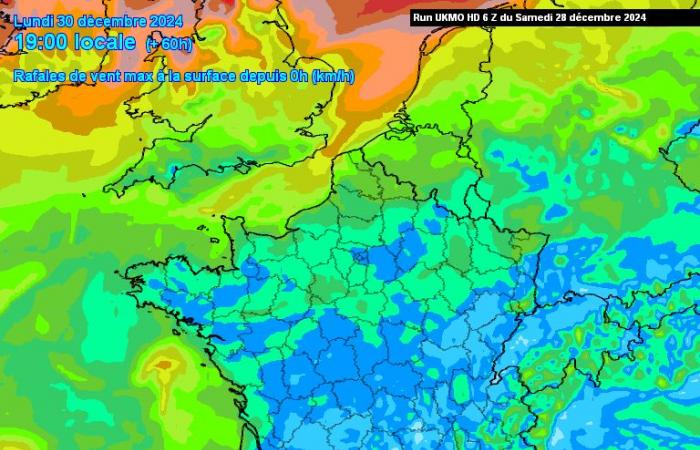
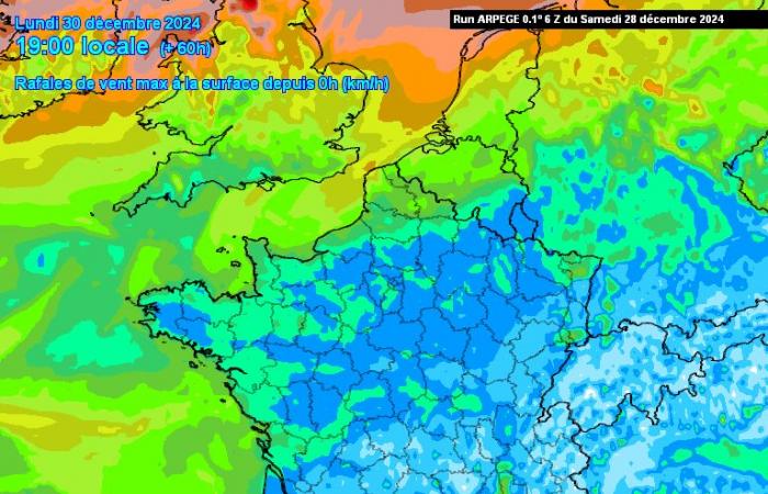
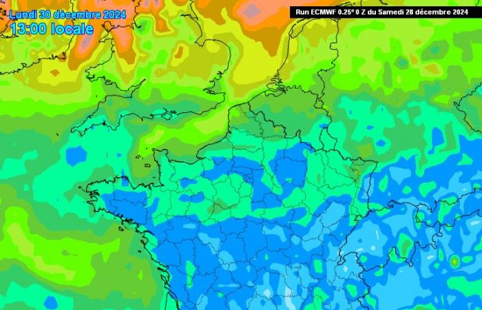
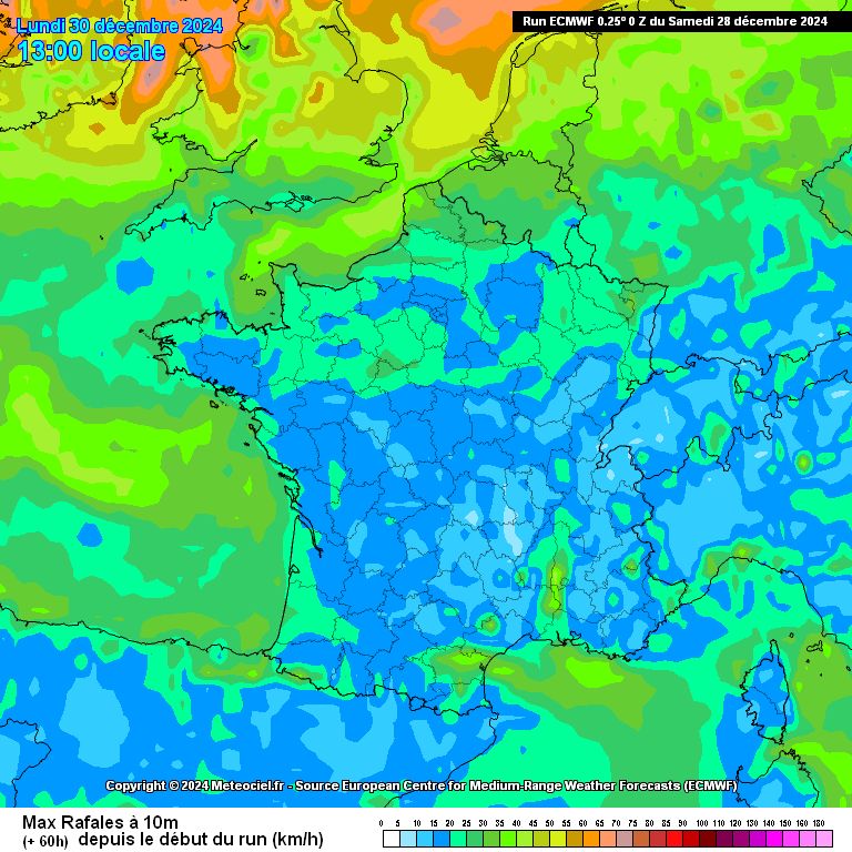
Depending on the different models, gusts of around 100 km/h, even up to 110, 120 or 130 km/h could hit the Channel coasts in Brittany, Normandy and Hauts-de-France. At a lower intensity, the wind could rush inland in a large northern third, from Pays-de-la-Loire, to Alsace.
Up to 130 km/h on the coasts
According to the German Icon model, which projects the most pessimistic scenario, the wind could reach 130 km/h in the Pas-de-Calaisand up to 120 km/h along the coasts of Seine-Maritime and the Somme, Thursday January 2.
This pattern is also shared by the British model UKMO, which foresees gusts of more than 120-130 km/h in the Strait of Pas-de-Calais.
The French Arpege model (used by Météo France) is a little more measured. It envisages maximum gusts of 100 km/h in the far north of the country.

A more or less similar scenario from the European ECMWF model, according to which the storm stage (wind greater than 100 km/h inland) will not be reached.
Lots of rain in the forecast?
Beyond the gusts of wind, this depression could bring ussignificant accumulations of rain throughout the northwest of the countrydepending on different weather models. We could reach several tens of millimeters in Normandy and Hauts-de-France.
Here again, given the deadline, it is a little early to make a decision and provide details in detail.
Her name would probably be Éowyn
As the British Isles will be the first to be affected, it will fall to the Irish (Met Éireann) or English (Met Office) weather services. to name the storm.
If, however, this phenomenon were to occur, it would then be called Éowyn (according to the list of storm names), a first name of Irish origin, which is reminiscent of the niece of King Théoden, characters from The Lord of the rings.
Follow all the news from your favorite cities and media by subscribing to Mon Actu.

