
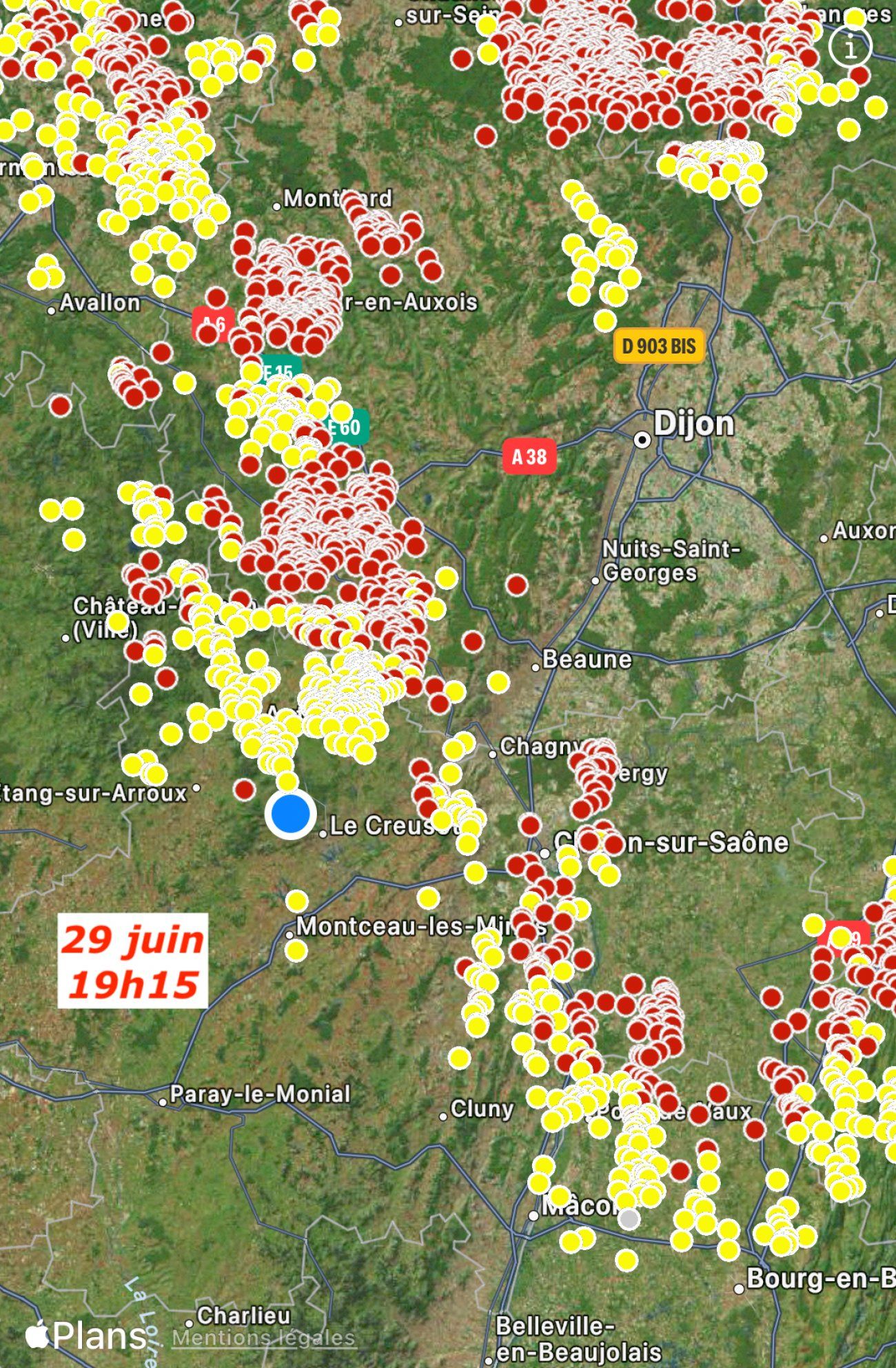
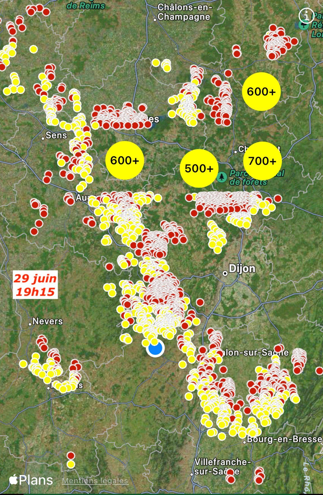


UPDATED: They arrived via the Nièvre and the Saône et Loire. Wind gusts of up to 120 km/h are feared, with up to 80 liters of water per m2, with the risk of large hailstones… UPDATE: The storms have moved towards the Côte-d’Or and the Champagne.
At 5 p.m., a large cloud mass had begun its passage through Burgundy, arriving via the Nièvre and the Saône and Loire.
The latest bulletin from Météo France (4 p.m.):
Observations notables :
The heat that precedes thunderstorms is very present in the region this Saturday afternoon. We note in particular 30.4°C in Dijon (21), 31.4°C in Mâcon (71), 32.0°C in Remiremont (88), 32.2°C in Dole (39) and Colmar-Meyenheim (68).
Qualification
A severe summer storm situation that requires special vigilance given the geographical extent and intensity of the expected phenomena. In addition to intense electrical activity, these storms can cause violent gusts of wind, hail and heavy accumulations of rain in a short period of time.
Expected development
A structured and well-organized stormy degradation approaches the south of Burgundy at the end of the afternoon. It then spreads rapidly towards Franche-Comté and the Grand-Est from 7-8 p.m.
This remarkable stormy episode is accompanied by locally violent phenomena, particularly in the event of the formation of storm supercells or organized line structures:
– wind gusts sometimes exceeding 100 km/h, up to 120 km/h possible very occasionally;
– significant accumulations of precipitation in a very short time (locally 40 to 50 mm in less than an hour and up to 80 mm in a few hours);
– risk of large hail with locally hailstones with a diameter greater than 5 cm;
– intense electrical activity;
This marked stormy area then gradually evacuates through the north-east of Lorraine and Alsace after midnight. Behind, less virulent storms may still occur until Sunday 4 a.m. For the rest, stormy rains remain in the news until mid-Sunday morning.
The press release from the Prefecture
The Côte d’Or department is placed on orange alert for violent thunderstorms from 4 p.m. and until midnight today Saturday June 29.
According to forecasts, the storms will be accompanied by wind gusts of 80 to 100 km/h and up to 120 km/h locally, heavy rainfall accumulations of around 70 to 80 mm are expected as well as Hail falls with possibly 5 cm hailstones.
The Côte-d’Or prefecture invites mayors and event organizers to cancel any event scheduled to take place outdoors.
She also calls on them to remain vigilant and to take all necessary measures to protect populations and property.
The prefect of Côte-d’Or decided to activate a departmental operational center at the prefecture at 4 p.m. in order to monitor developments in the situation and make operational decisions with all the relevant services.
The prefecture invites everyone to remain vigilant and to adapt their outdoor activities to the risks induced by this possibility of locally violent storms.
Communiqué


