Heavy rainfall, lightning, gusts of wind and hail are expected in the strong summer storms announced by Météo-France for this Saturday, June 29. 28 departments are on orange alert.
The orange “thunderstorms” vigilance, which at one time concerns up to 34 departments, is now only required in 28 departments for the day of this Saturday, June 29, while a strong stormy episode will cross most of the country , indicates Météo France.
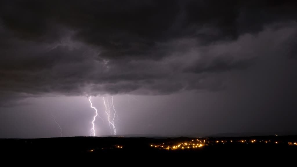
Since the end of the night, strong storms will occur from Landes to Poitou. They will mainly be accompanied by heavy rain, and locally by hail.
List of departments concerned: Cher, Nièvre, Yonne, Côte-d’Or, Jura, Saône-et-Loire, Doubs, Territory of Belfort, Haute-Marne, Aube, Haute-Saône, Ardennes, Marne, Meuse, Bas-Rhin, Haut-Rhin, Moselle, Vosges, Meurthe-et-Moselle, Allier, Ain, Cantal, Lot, Aveyron, Tarn, Puy-de-Dôme, Loire and Rhône.
A “strong rainstorm episode” will cross “most of the country” on Saturday, Météo-France underlines in its latest forecast bulletin. “Only the regions from Brittany to Nord-Pas-de-Calais, as well as Corsica, remain safe from this bad weather, and will have calmer but cloudy weather,” the organization specifies.
In the afternoon and evening of Saturday, “a burst of thunderstorms will move from the southwest to the northeast of the country”, warns Météo-France on its website in its orange “storms” alert sheet.
For the departments concerned by this vigilance, the meteorological service warns of a “strong summer stormy situation which requires particular vigilance given the geographical extent and intensity of the predicted phenomena”.
“In addition to intense electrical activity, these storms can cause violent gusts of wind, hail and heavy accumulations of rain in a short time,” warns Météo-France.
Some preserved regions
Only the regions from Brittany to Nord-Pas-de-Calais, as well as Corsica, will remain away from this bad weather, and will keep a calmer but cloudy weather. The south-easterly wind will blow quite strongly until the beginning of the afternoon from the Provence-Alpes-Côte d’Azur region to the Massif Central.
Morning temperatures will be between 8 and 13 degrees from Brittany to Belgium, from 15 to 20 degrees elsewhere, up to 21 to 22 degrees in Corsica. In the afternoon, it will be 18 to 23 degrees near the Channel and the Atlantic, 23 to 28 degrees elsewhere, but up to 27 to 32 degrees from the Grand-Est to Berry, Rhône-Alpes and the Provence region. -Alpes-Côte d’Azur, and in Corsica, locally 34 in the Alsace plain and on the Isle of Beauty.
Sunday will see the “return of calmer weather, but cool for the season”, with “stormy residues” in the morning “from the Grand-Est to Limousin and Auvergne-Rhône-Alpes”, as well as a “persistent risk of storms in Rhône-Alpes” in the afternoon, Météo-France specifies in its latest forecast bulletin.


