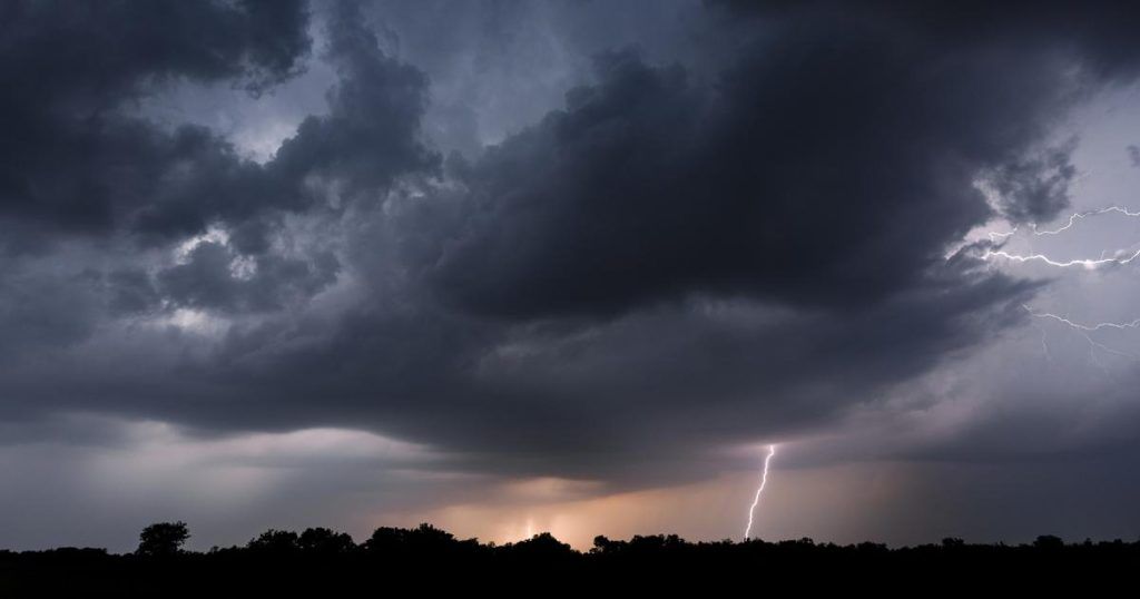
This weekend, France is being hit by a stormy episode, probably the strongest since the start of this year 2024. The meteorological services have also placed 14 departments on orange “thunderstorms” alert for Sunday.
This weekend is marked by a powerful conflict of air masses over France. Some regions are exposed to dangerous phenomena: hail, gusts of wind and torrential rains. This powerful stormy wave is coming up from the southwest this Saturday morning and will head towards Germany. Thus, the main axis exposed to storms will stretch from the Pyrénées-Atlantiques to Lorraine. More than half of the territory will be affected, but the storms will not have the same violence everywhere.
On Saturday at 6am, the departments of Tarn, Aveyron, Lot, Cantal, Allier and Ain were placed on orange alert. “thunderstorms” for this afternoon. They thus joined the 25 departments which were already there: Charente, Charente-Maritime, Cher, Gironde, Landes, Deux-Sèvres, Vienne, and all the departments of Grand Est and Burgundy-Franche -County. In total, 31 departments are affected by orange vigilance “thunderstorms”.
In this configuration, we cannot exclude a move to maximum alert level red in certain departments (in the north-east) depending on the evolution of the latest forecasts (this evolution would rather concern certain departments in the north-east for Saturday evening). Alerts issued by the flood monitoring organization Vigicrue are also possible depending on the reaction of the watercourses, announces La Chaîne Météo.*
Progression of thunderstorms
The first storms have burst during the night from this Friday to Saturday in the Pyrenees, the Basque Country and Béarn. They can occasionally be strong. Saturday morning, these storms are present from Landes to Charente. Accumulated rain could already be abundant in this area (20 to 30 mm in 3 hours). They will weaken as they progress towards Centre-Val-de-Loire during the morning. The wind will be strong on the Atlantic coast as well as in the area of the Autan wind and the sea wind (Occitanie), from 70 to 80 km/h.
Saturday at midday: heavy rain in Aquitaine
With the slow progression of the depression over the southwest, stormy rains will persist all morning. Accumulations are likely to be abundant in the south of Gironde and in Landes (locally 50 to 80 mm). Diffuse storm activity also propagates towards the axis of the Loire, but with low intensity.
Saturday afternoon until 5 p.m.: increasing number of storms in Occitanie and the Massif Central
The evolution on Saturday afternoon will be very rapid. In a heavy atmosphere, storms will increase over two thirds of the country, from Occitanie to Auvergne, Center region, Cévennes, then over Franche-Comté and the Alps. The wind will be strong, particularly in the mountains (Massif Central) then, late in the afternoon, in the Rhône valley (80 km/h) and the Val de Saône. The Tarn and Aveyron seem to be subject to the strongest storms in this area.
At the same time, storms will cease in Aquitaine but showers will continue. In this area, the episode will cease, but rivers may be in flood.
Saturday 5 p.m. to 8 p.m.: start of the high-risk period
At the end of this afternoon, powerful storms will break out in the Center then quickly from the Northern Alps to Franche-Comté to Burgundy and towards Lorraine. These regions will experience hailstorms, strong gusts of wind (more than 100 km/h with possible peaks of 150 km/h) and torrential rain falling suddenly in a short time. Accumulations of 50 to 100 mm are possible locally, likely to cause flooding and mudslides in these regions.
Saturday evening: 8 p.m. / 11 p.m.: very violent storms in Lorraine
The evening will be very stormy, both in the Center and in Lorraine, where supercells (the most powerful storms) are expected. These storms will move back towards Luxembourg. Others, less powerful, will still break out in the Alps and the central massif and then subside. The real danger mainly concerns the North-Eastern quarter of the country. These storms will also pass over Alsace, particularly in the west, with the Rhine valley seeming less exposed.
Night from Saturday to Sunday: the most violent storms will move away in Germany
The supercells will pass through Germany around 2am after sweeping across the north-east of our country, as well as part of Alsace. During the night, electrical activity will weaken but the rains could continue from the Centre to Champagne-Ardenne, with still abundant rainfall accumulations.
This situation therefore presents a real danger given the expected violence of the storms, particularly in the northeastern third. Abundant rains are expected across the board, which is significant, falling on soils that are sometimes still weakened following recent stormy episodes (notably last weekend in the Center East). Locally, accumulations of 100 mm could be reached, particularly in the South-West and North-East), likely to cause flooding and mudslides.
The wind will often be strong throughout this day. The strongest gusts are feared at the end of the afternoon while the storms will spread across the Central East and North-East regions (100 to 150 km/h locally). In this context of very high instability, tornadoes are possible in the regions of the Grand Est. Hail is a parameter to take into account for the northeast third at the end of the afternoon. Hailstones of 5 to 8 cm are possible when the strongest storms pass (from Isère to Jura), and 3 to 5 cm in the Grand Est.
Sunday
Météo-France meteorological services have placed 14 departments on orange vigilance “thunderstorms” for Sunday in the Grand-Est.
On Sunday, the storms from the previous day will clear out on the eastern side, but the weather there will remain disturbed while the clear spells will return from the west, with generally falling temperatures and a noticeable, very cool wind. We do not expect more than 20°C in the Paris or Toulouse basin, and still 25°C in the Rhone Valley. The North-East quarter will experience gloomy and almost autumnal weather, with wind, showers and threatening skies. Temperatures will have dropped by 15°C in these eastern regions after the storms have passed.
*The Weather Channel is a property of the Figaro group.


