

By
Briac Trébert
Published on
June 16, 2024 at 10:05 a.m.
See my news
Follow News
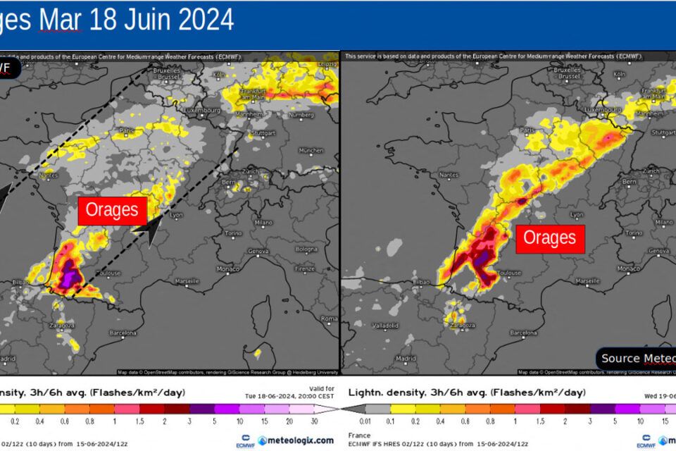
“A particularly chaotic sequence”, summarizes, on actu.fr, meteorologist Yann Amice. From the night of Monday June 17 to Tuesday June 18, 2024, a large part of France will once again find itself in an air mass conflict, and, thus, under thunderstorms, sometimes violent.
If the southwest should be particularly concerned, few regions will escape it, as the days go by.
A new “even more marked” deterioration will then take over
During the night from Monday to Tuesday, these storms should first break out in Aquitaine and then spread to the Center, Île-de-France and as far as Hauts-de-France in the morning of Tuesday 18 June.
And a new stormy deterioration – even “more marked”, warns Météo France in its forecasts of dangerous phenomena – will take over on Tuesday at the end of the afternoon over Aquitaine (again) and will shift (again) towards the Center in the night of Tuesday to Wednesday June 19, 2024.
A context favoring violent storms, with heavy rain and hail
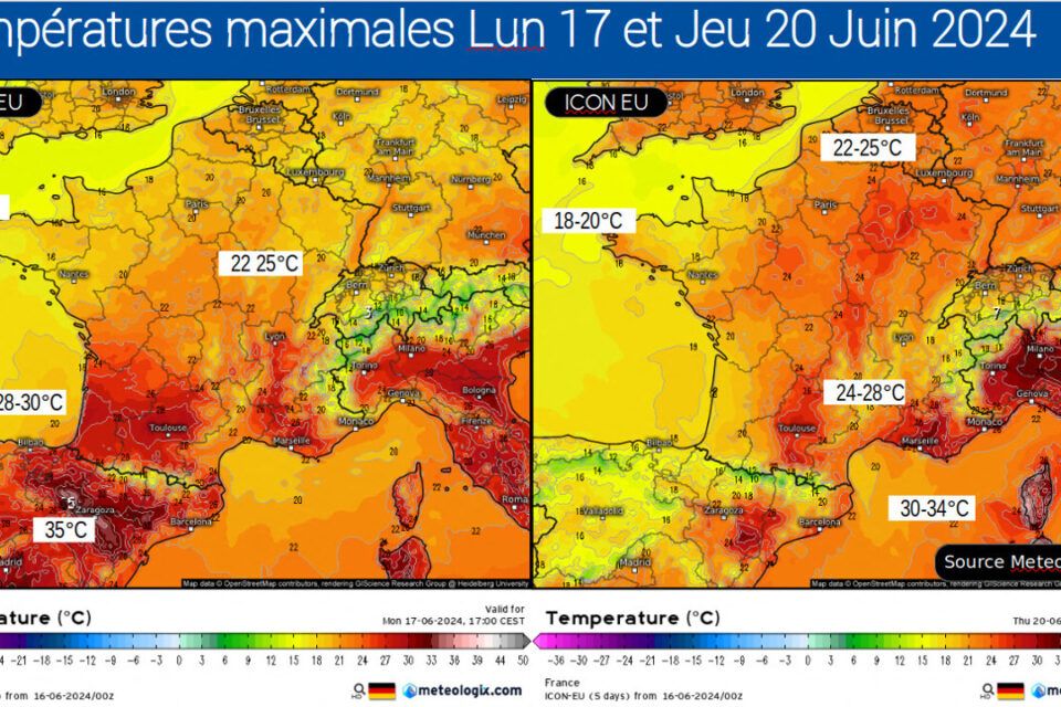
“Very warm air will circulate from North Africa and rise in the South, but, at the same time, cool air will create resistance over the British Isles with a nice altitude anomaly pivoting on Spain”, summarizes Yann Amice.
A context favoring violent storms, with heavy rain and hail, is feared Keraunosthe French observatory for tornadoes and violent storms.
France will find itself in a very significant air mass conflict this week between cool air from the British Isles which will plunge over Portugal and very warm air in the Mediterranean. And, in this context, a geopotential low – a little cold drop – will be positioned in Spain. A strong thermal contrast which will be conducive to this very strong instability in France.
The arrival (finally) of very good weather next?
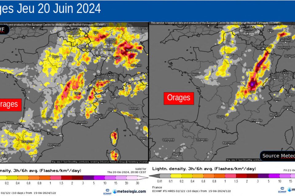
This marked stormy sequence will therefore land Monday evening from the southwest before moving towards the northeast. But given the little change in altitude configuration, this will happen again Tuesday, Wednesday and probably also Thursday. “The high temperatures at night this week will favor this instability of the air mass, thus acting as a trigger,” explains the meteorologist.
An improvement should take shape “from the west” from Friday June 21, 2024. And several weather models foresee the prospect of the arrival of real good weather, dry, anticyclonic in character, from the weekend of Saturday June 22 and Sunday June 23 in France.
Follow all the news from your favorite cities and media by subscribing to Mon Actu.


