
Our weather is currently managed by an anticyclone centered on the eastern North Sea and which will move towards the southern Baltic Sea at the start of the weekend.
It will still send us dry but cool continental air from Germany, Sweden and the Baltics. Conditions will therefore still remain dry for a few days, although this Friday morning there will still be fog over the center and east of the country, giving way to fairly sunny weather except in the provinces of Limburg and Liège where cumuliform clouds will be more numerous. .
It will therefore still be cool with temperatures between 10 and 16° depending on the altitude of the regions. The northeast to east wind will not be too noticeable with peaks of 10-30 km/h. The following night will be very clear except in the provinces of Liège, Namur and Luxembourg where low stratus and fog will reform in many places. The minimums will drop between 2 and 6° on the plain and between 4 and -2° on the Ardennes relief.
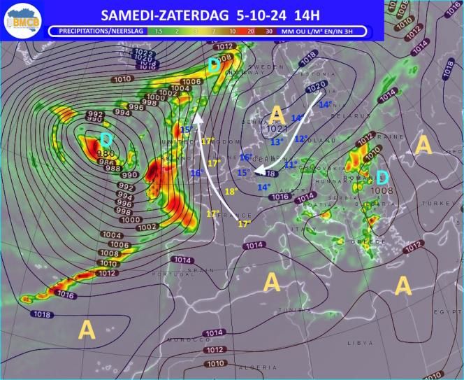
SATURDAY
It will be a beautiful autumn day with plenty of sunshine before midday and the appearance of new fair weather cumulus clouds in the afternoon. Despite the presence of the sun and a slight south-east wind, temperatures will remain low all day with approximately the same maximums as those of the day before. The night will initially be very starry, but the high-altitude clouds will arrive in the second part of the night, as will many low stratus clouds over the Ardennes and Gaume. The minimums will be lower with values between 5 and 10° but more between 0 and 5° in the east of the Ardennes.
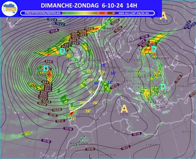
Sunday
It is the south to southeast wind that will be noticed, blowing with peaks between 30 and 50 km/h. The sky will be cloudier but with still a little sunshine before midday; it will then become more and more cloudy with local even light rain from the French border. It will be a little cooler with highs falling between 16 and 18° in the plains and at the sea.
A larger band of rain will cross the country during the night which will also be milder than the day before with minimums not falling below 11° in Hautes Fagnes and 14 to 15° in the western half of the country.
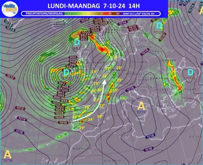
Monday
In the morning it will still rain quite well in Gaume and the Ardenne and this rain will return more and more to the other regions during the afternoon.
A deep depression will move slowly towards the north-east towards Ireland sending us, with a south-west wind blowing with peaks of 40-50 km/h, southern air coming from the Pyrenees and the north of Spain. This explains the very mild weather with temperatures which can locally reach 19 to 20° in the plains.
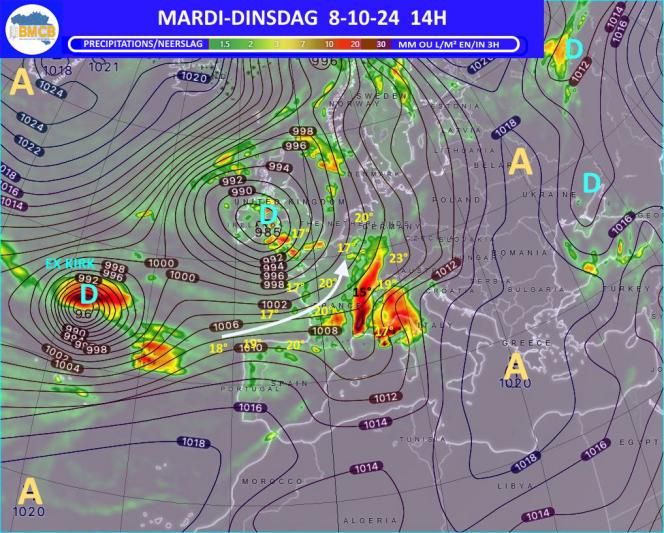
Mardi
The said depression will have arrived on the Irish Sea and will continue to determine very unstable weather with alternation of clearings and showers sometimes copious and stormy in an air still relatively mild for the season with maximums between 13 and 18°. Note also the southwest wind which will also have gained strength with peaks of 55-75 km/h.
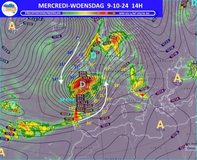
Wednesday
Most forecast models envisage the arrival in the near ocean of another deep storm depression which is none other than the remains of Hurricane “Kirk” which evolved for several days in the Atlantic. This system is expected to move northeast over the British Isles and bring new very windy, humid but mild conditions…
Evolution for the rest of the week
It should still rain every day with a lot of wind but also with initially still mild temperatures which will display 12 to 16° in the Ardennes and 16 to 19° in the plains. It is not impossible that the wind will blow next Thursday or Friday with gusts close to or exceeding 100 km/h but this will depend on the exact trajectory of the low pressure center over England and the North Sea…


