The threat is becoming more and more felt… The south of the Lesser Antilles should be crossed by tropical storm Beryl during the day of Monday or next Tuesday and could transform into a hurricane.
Tropical Storm Beryl was officially named by the National Hurricane Center (NHC) last night, Friday, June 28. Its winds were already at 65 km/h. Since then, storm Beryl has continued to strengthen and could well turn into a hurricane during the day.
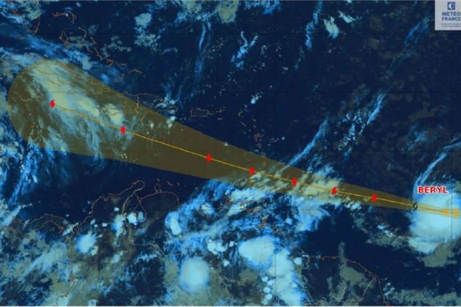
At 5:30 this morning, Beryl was located 1,570 km east-southeast of Barbados and was moving west at 33 km/h. It is expected to maintain this trajectory or curve slightly towards the west-northwest during the next few days. Its sustained winds are now reaching 85 km/h with gusts of 100 km/h. The storm appears to be in a phase of rapid intensification, to the point that the NHC acknowledges that it may have been a little conservative with this speed. Beryl is expected to become a hurricane by this evening, but it could be faster before transiting the Lesser Antilles, said Bruno Benjamin, forecaster and president of the association Ouragans.com.
According to Météo France, numerical weather forecast models predict Beryl’s passage over the Lesser Antilles with the following characteristics:
● a passage as close as possible to the center during the day of Monday July 1st or even at the beginning of the night of
Monday July 1st to Tuesday July 2nd.
● a passage from the center to the Lesser Antilles, between Tobago for the southernmost island and the South of the
Martinique for the northernmost island.
● a transition of the system to hurricane stage from category 1 to 2.
● rapid movement of the system
The Barbados meteorological services have already placed the island on hurricane pre-alert since the phenomenon is expected to reach them on Sunday evening.
Beryl is expected to cross the Antilles arc on Monday near Saint Vincent and Saint Lucia, but at the rate it is developing, Martinique could have peripheral effects.
The prefect of Martinique chaired a meeting on Friday afternoon with the State emergency services and network management operators in order to take stock, with Météo France.
This phenomenon could affect the Lesser Antilles during the day on Monday. Given the deadline and the uncertainties about the exact trajectory of the phenomenon, it is not yet possible to precisely predict its impact on Martinique. It is already very likely that the sea state will be very rough from Sunday evening, and particularly during the day on Monday, with average waves of around 5 meters in the Saint Lucie channel. .
Prefecture of Martinique


