An intense cold snap is set to hit the United States, including normally mild regions like Florida.
A powerful flow of Arctic air from Canada is heading straight for the southern United States, bringing dangerously cold temperatures that will even reach the Gulf of Mexico as early as early next week.

DON’T MISS: A polar vortex prepares to invade Canada and the United States with dangerous cold
A bitter cold sets in in the south
We are witnessing the start of one of the most significant cold spells of the last ten years. A lobe of the polar vortex extending from the Arctic will allow icy air to surge toward southern latitudes, even reaching the tropics in the coming days.
January 20 could be one of the coldest days the United States has seen in years. So much so that the presidential inauguration in Washington, D.C., will be held indoors for the first time in 40 years.


Most areas east of the Rockies will remain below freezing during the day. The worst of the cold will head to the east coast mid-week.
Sub-zero temperatures will reach as far as the Gulf of Mexico at the heart of the cold snap Monday and Tuesday.
In Atlanta, Georgia, maximum temperatures will remain below 0°C on January 20, with values struggling to rise above freezing on Tuesday and Wednesday. The normal maximum temperature for this period of January in Atlanta is around 12°C.


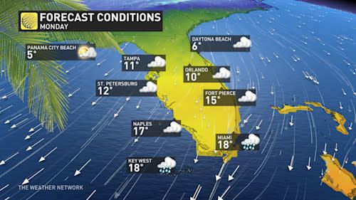
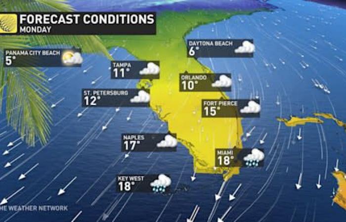
Relatively cool temperatures are also expected to reach Florida.
Freezing nights are expected in parts of North Florida Monday and Tuesday. The maximum temperature in Orlando on Monday will not exceed 10°C, far from seasonal norms of around 22°C for this time of year.
-Winter storm risks increase with colder weather
Forecasters are also watching for the possibility of a winter storm in the Deep South concurrent with the cold snap.
An active storm track along the Gulf of Mexico could generate a disturbance in Texas late Monday, moving along the Gulf Coast during the day Tuesday.


Forecast models suggest the possibility of snow, freezing rain and ice pellets, extending from central Texas to the northern Gulf Coast, even impacting northern Florida.
Although conditions appear favorable for snow and ice, it is very rare for winter precipitation to occur in this region.
Houston, Texas, has not recorded measurable snow since a historic cold snap in February 2021. Mobile, Alabama, and Tallahassee, Florida, experienced a light dusting of snow in January 2018.


Mobile suffered a disruptive ice storm in January 2014. Tallahassee hasn’t recorded 2 cm of snow since December 1989, a cold snap during which it was colder in Miami than in Calgary.
A small amount of winter precipitation near the Gulf Coast would be considered a high-significance event. Most municipalities in this region are poorly equipped to handle snow removal or road treatment.
WATCH: Know the signs of frostbite and hypothermia
Click here to watch the video
These weather events remind us of the importance of preparing for extreme weather conditions. While the articulation of climatic phenomena may seem surprising, it leaves room for many reflections on the long-term consequences of climate change in different regions of the globe.
- --


