Météo France places seventeen departments, mainly in the North-East, on snow-ice yellow vigilance. Snowfall is also forecast in Aubrac, between Aveyron and Lozère.
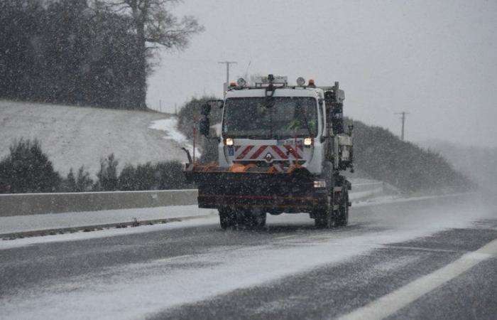
Even though the sun is out, the drop in temperatures continues to progress and the winter cold sets in. Also, for this Thursday, January 2, 2025, Météo France places 17 departments on yellow snow and ice vigilance. Thirteen departments are placed on wind yellow vigilance.
u2744ufe0fu2744ufe0f In the NE the #snow should be a little more generalized than initially expected.
We can therefore expect 0 to 2 cm local below 200m
2 to 4 cm around 3-400m-> The largest accumulations are expected in the late afternoon and early evening. pic.twitter.com/lJfA8xj7Bw
— PREVI NEIGE (@previneige) https://twitter.com/previneige/status/1874768375639060511?ref_src=twsrc%5Etfw
Departments on snow-ice yellow vigilance
- Nord
- Material
- Ardennes
- Marne
- Dawn
- Meuse
- Meurthe-et-Moselle
- Côte-d’Or
- Haute-Marne
- Moselle
- Vosges
- Haute-Savoie
- Doubs
- Bas-Rhin
- Haut-Rhin
- Territory of Belfort
- Alpes-de-Haute-Provence
Document – Météo France
Departments on yellow wind vigilance
- Meurthe-et-Moselle
- Haute-Marne
- Vosges
- Haut-Rhin
- Territory of Belfort
- Haute-Savoie
- Côte-d’Or
- Doubs
- Jura
- Haute-Savoie
- Allier
- Puy-de-Dôme
- Loire
- Isère
Rain-snow limit at low altitude
According to Météo France forecasts, “this afternoon and this evening, the bad weather continues its progress towards the South and stretches from the North of New Aquitaine and the Center-Val de Loire to the Vosges, to Burgundy Franche -Comté and Auvergne Rhône-Alpes, with still wind and snow at low altitude in the north-east. A layer of a few centimeters forms on the heights of Champagne-Ardenne. Lorraine around 300/400 m and later in the evening in Burgundy Franche-Comté A thicker layer is expected on the Vosges relief, with 7 to 15 cm around 800/1,000 m altitude and more than 20 to 30 cm. on the ridges.
And continues: “In the north of the Massif Central and the Alps, it snows first above 1,200 to 1,500 m then lower and lower the next night up to 400/600 m.”
Snow expected in Aveyron and Lozère
Snow should return this Thursday evening in Occitanie, particularly in Aveyron and Lozère.
As detailed by InfOccitanie, “in the evening, a disturbance arrives from the North of France. It will produce snowfall in Lozère and Aveyron. The rain-snow limit will lower from 1,500 to 1,000 meters above sea level on the Aubrac and Margeride side, it will also snow on Mont-Lozère. Lévézou could also be impacted.
“On the heights of Aubrac, it will be snow with a rain-snow limit which should be around 1,200 m. A layer of snow of more than 5 cm is possible,” announces Météo Sud-Aveyron.
On the thermometer side, still according to Météo Sud-Aveyron, the coolest temperatures recorded this January 2 morning are:
- – 4.5°C in Sainte-Geneviève-sur-Argence
- – 4°C in Saint-Christophe-Vallon
- – 3.5°C in Vitrac-en-Viadène
- – 3°C in Montlaur, Vibal and Espalion
- – 2.8°C at Rodez airport
- – 2.5°C in Monteils, Rignac and Murat-sur-Vèbre
- – 2°C in Villefranche-de-Rouergue, Saint-Affrique, Laguiole and Saint-Geniez-d’Olt
- – 1.8°C in Pont-de-Salars
France


