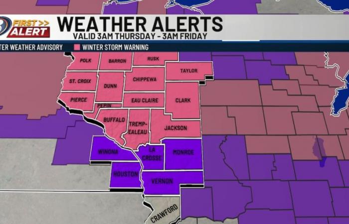
Our first widespread snow of the season is moving in as a clipper-type low pressure system tracks from the northwest. This will bring accumulating snow to the area Thursday, leading to slick and potentially hazardous travel at times. The heaviest snow is expected to occur during the morning, which means you’ll want to exercise extreme caution and take it slow for the commute. Snow will still be around through the afternoon and evening, though lighter in nature. Breezy east-southeast winds will also cause some blowing snow, leading to low visibility at times. Because of the accumulations and impacts to travel, Thursday is a 13 FIRST ALERT WEATHER DAY. In addition, the National Weather Service has issued a Winter Storm Warning for most of Western Wisconsin to highlight the threats.
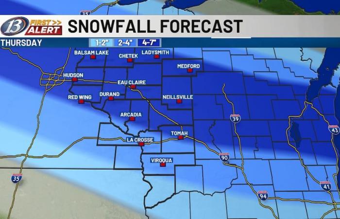
By sometime Thursday afternoon, the snow will begin to turn scattered and eventually taper off in the evening as the low continues to push out of the area. With a tightening pressure gradient behind the low, as high pressure moves into the area, winds will take on more of a northerly flow and lead to frigid wind chills nearing the zero degree mark later Thursday evening and into Friday morning. By the time the snow is all said and done, most areas will see around 4-7″ of snow. However, given the possibility of heavier bands of snow developing, some locally higher amounts are not out of the question.
As always, be prepared for impacts to your commute both in the morning and evening. Be sure to bring a blanket or an extra layer in your vehicle in the event of a slide off, or any other emergency. Give yourself some extra time and be sure to stay up to date with the latest forecast either on-air, online, or on our 13 First Alert Weather app!
Copyright 2024 WEAU. All rights reserved.


