It’s still very early and the forecast could certainly change, but the timing is looking like late Thanksgiving night through much of Friday could get messy.
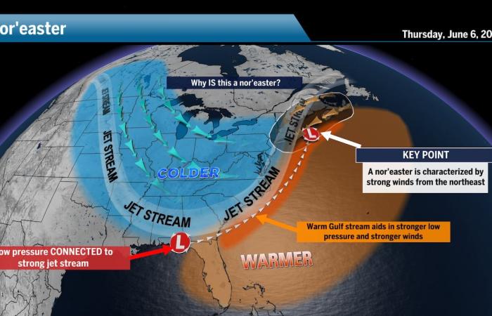
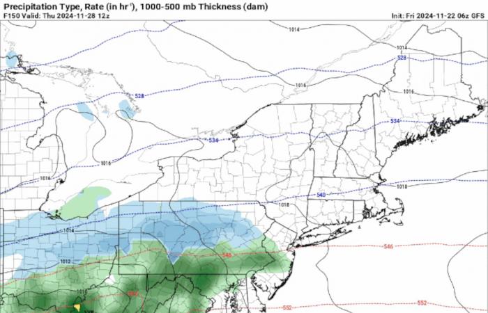
The latest models point to this storm possibly arriving later than originally thought, becoming more of a Black Friday storm than a Thanksgiving storm. Still another possible track is showing with good confidence that the jet stream will be bowed and try to parallel the coast, which could send the core of this low offshore as it nears New England to set up a more impactful storm.
In other words, this has the potential makings of a nor’easter.
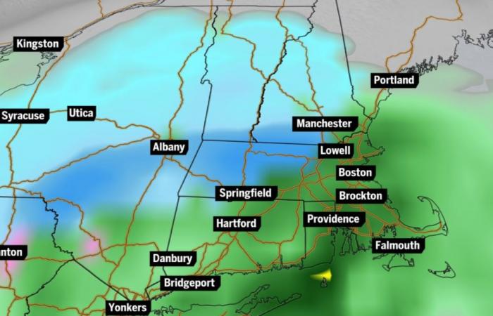
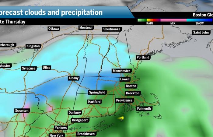
A strong low-pressure system, a nor’easter is simply a storm setup with winds coming in from the northeast — it doesn’t necessarily mean we’re getting loads of heavy snow or rain. Right now, it’s looking like mostly rain in Boston and the rest of Southern New England and snow up north. Remember, it’s still very early and this forecast could absolutely change.
The amount of precipitation will depend on how much moisture is available over the Northern Atlantic versus how cold the air is over land. This contrast creates instability — or rather, energy — in the atmosphere, with the relatively moist air rising rapidly and condensing into rain or snow.
Regardless, it will be worth watching how things come together over the next several days.
Thanksgiving-Black Friday storm
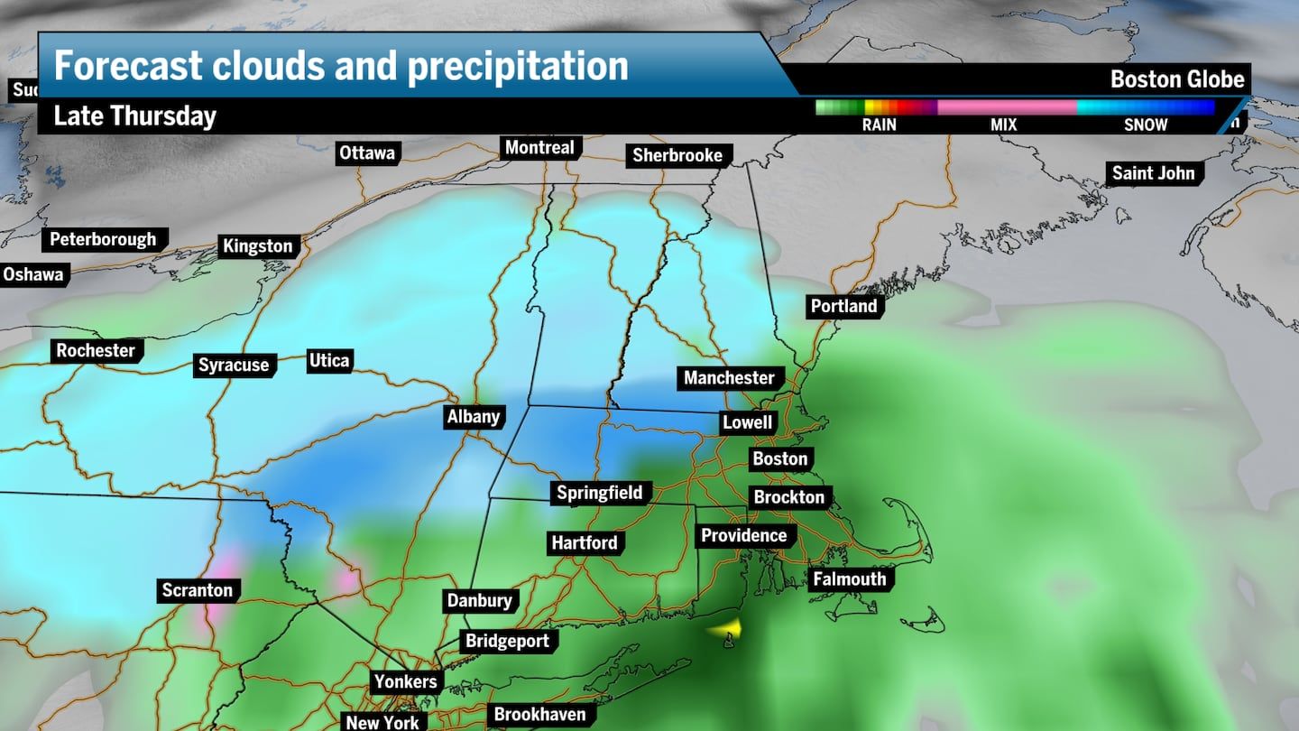
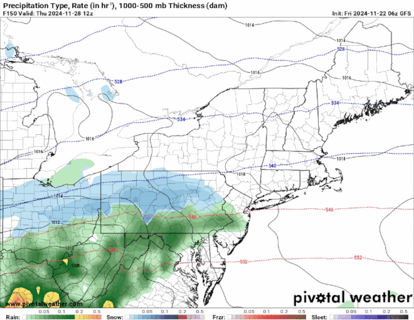
As of right now, most models have the core of this low skirting just off the Southern New England coast Thanksgiving night, which will make it interesting. It looks unlikely that this storm will be a large-scale snowstorm, but guidance does agree that there will be some messy weather spoiling travel plans, with rain, snow and gusty winds involved.
Southern New England forecast
This system should be mainly a rain event across Rhode Island, Eastern Massachusetts and Connecticut at the very least Thanksgiving night and most of Friday. It’s really too early to get into rain and snow totals but there should be enough cold air present, especially on the backside of the system to bring some sleet, ice, or snow at times into the picture across the hill towns of Central and Western Mass. We’ll see what track this storm takes, which will obviously dictate where the rain-snow line sets up.
If I had to commit to rain and snow totals, given all the variables at play here, I’d expect between 1 and 1½ inches of rain across Southern New England, with possibly 2 to 4 inches across the western four counties of Massachusetts.
Windy conditions are likely, with gusts up to 25 to 30 miles per hour, especially along the coast.
Northern New England forecast
As of now, it does look like Northern New England may be in for a shot of snow Thursday night and much of the day Friday, but the trends for now show that snow may be concentrated to central and southern portions of Vermont, New Hampshire and Maine. Uncertainty in the exact storm track may bring rain or a wintry mix to the area beginning overnight Thursday, with a switch over to all snow on Friday.
Again, if I had to throw out a snowfall range, I would say between 3 and 6 inches, but this is really just a guess with how many variables there are to consider with a storm that is still four days away.
The weather will shape up more clearly as we inch closer to the holiday, but make sure that you’re taking extra time on the roads and not rushing to your destination.
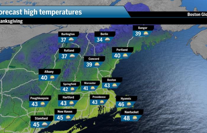
Temperatures will certainly plunge by the holiday. There should be an Arctic chill in place across the region on Thanksgiving with likely daily highs only reaching the low 40s and overnight lows near or below freezing.

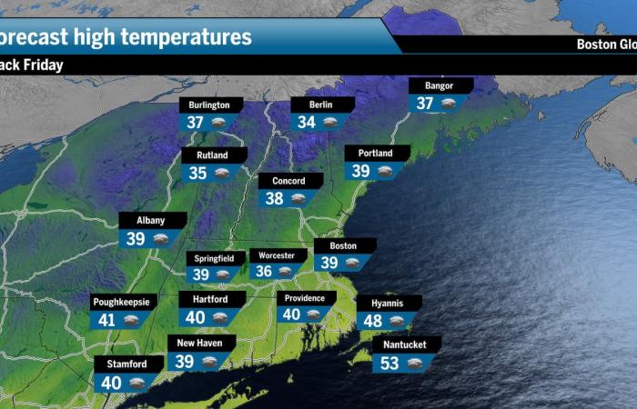
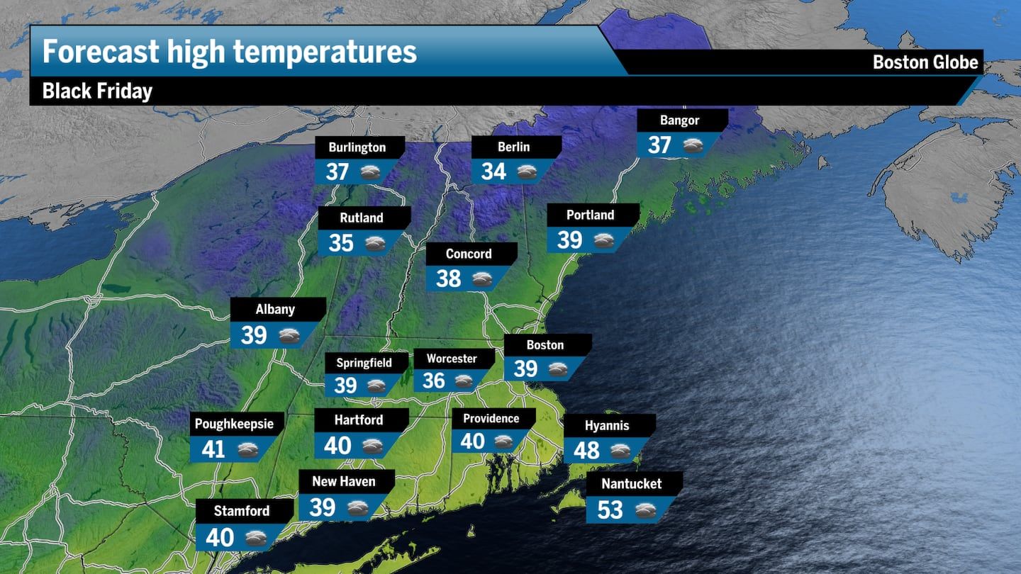
The cold air should stick around through the weekend with Black Friday likely seeing temperatures barely reaching a high of 40 degrees. The morning will be much cooler as shoppers head out before sunrise to grab some early holiday bargains.
The upcoming storms, combined with the recent precipitation from Thursday-Friday, are expected to help ease the severe drought conditions after an exceptionally dry fall. Months of high pressure dominated the region, leading to extremely dry conditions throughout New England and an unprecedented number of wildfires in Massachusetts.
Want more forecast details? Sign up here for our daily Globe Weather Forecast that will arrive straight into your inbox bright and early each weekday morning.
Ken Mahan can be reached at [email protected]. Follow him on Instagram @kenmahantheweatherman.

