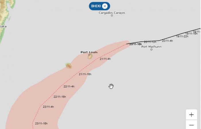
Now at the stage of “filling depression”, the ex-cyclone Bheki will circulate tomorrow to the south of the island with “a very moderate influence” from this Wednesday evening.
Positioned this Wednesday, November 20 at 4 p.m. at 19.2 South /.0 East, ex-cyclone Bheki continues its route towards Reunion. Now at the “filling depression” stage, the system was then 585 km from the coast, progressing towards the West at a speed of 19 km/h.
“The weakening trend will continue for the next few days. It is a rather weakened system which should circulate near the Mascarene archipelago”reassures Météo France which forecasts “a very moderate influence on Reunion Island” starting this Wednesday evening and until Friday.
Be careful, however: a yellow Waves-submersion alert has been issued as of this Thursday, November 21 at 9 a.m., for an area going from Cap Chevron to Champ-Borne, via Pointe de la Table (three-meter swell), as well as as a yellow alert Strong winds at the same time for the West and East zones.
A few gusts around 60 km/h are expected tonight on the South-West and North-East seaside as well as on the volcano massif.
However, Météo France forecasts “a very mild, cloudy and temporarily rainy night, mainly in the South-East quarter.” However, the total precipitation should remain “reasonable.”
The weather will remain poor this Thursday, November 21, still gloomy on Friday with a few gusts of wind in the West, but the weekend should gradually see conditions improve, Météo France still forecasts.
France


