Play
- Some significant changes are in store in the nation’s weather this week.
- Colder air will steadily march across the country, particularly into the South.
- Two windy storms appear set to sweep through the Midwest and Great Lakes.
- The second storm could bring some season’s first snowfalls to parts of the Midwest.
A weather pattern change this week will usher in conditions more typical of November to the central and eastern U.S., including colder air, a pair of windy storms and even season’s first snowfalls for some.
Colder, finally: It hasn’t felt like winter is around the corner in the South recently. Instead, it’s been the warmest first two weeks of any November on record for dozens of cities from Texas to Florida to the southern Appalachians, according to the Southeast Regional Climate Center.
And that’s where the coming reality check might be felt most.
This colder air should arrive in the Plains around Wednesday, then quickly spill over the rest of the South, lower Midwest and East Thursday. It will likely hang in through the weekend.
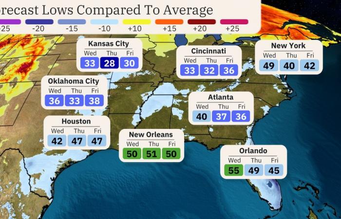
We have some sample forecast low temperatures in the map below. Lows in the 30s and 40s will be common in the South. Even Florida may have some chilly mornings in the 40s and 50s. Meanwhile, highs in the 40s and a few 30s will be the rule in the Midwest and interior Northeast.
(MAPS: 10-Day US Forecast Highs and Lows)
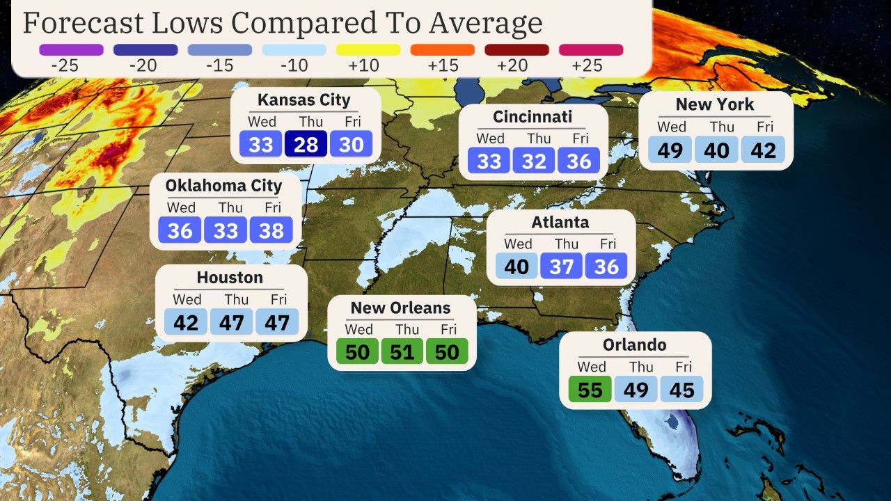

(The contours on the map show how far above or below average the day’s low temperatures are forecast for this time of year. )
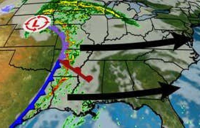
Two storms: A pair of low-pressure systems will affect the central and eastern U.S. during the week.
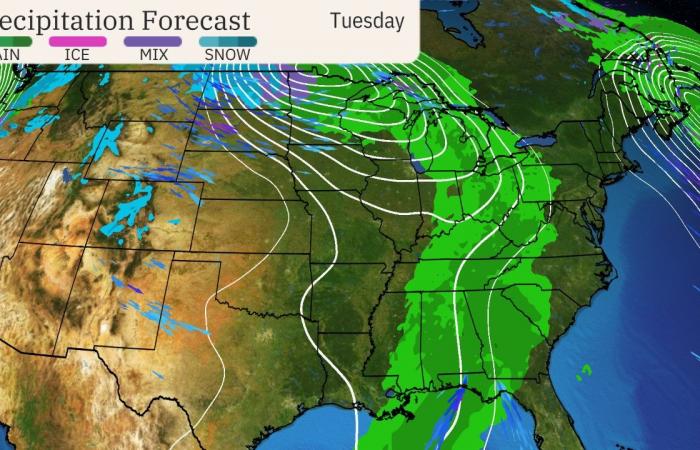
The first of those will intensify in the Northern Plains and upper Midwest on Tuesday.
But most of this first storm probably won’t have enough cold air for snow, even over much of the upper Midwest and Great Lakes. Instead, rainfall and windy conditions will affect these areas early this week.
(For even more granular weather data tracking in your area, view your 15-minute details forecast in our Premium Pro experience.)
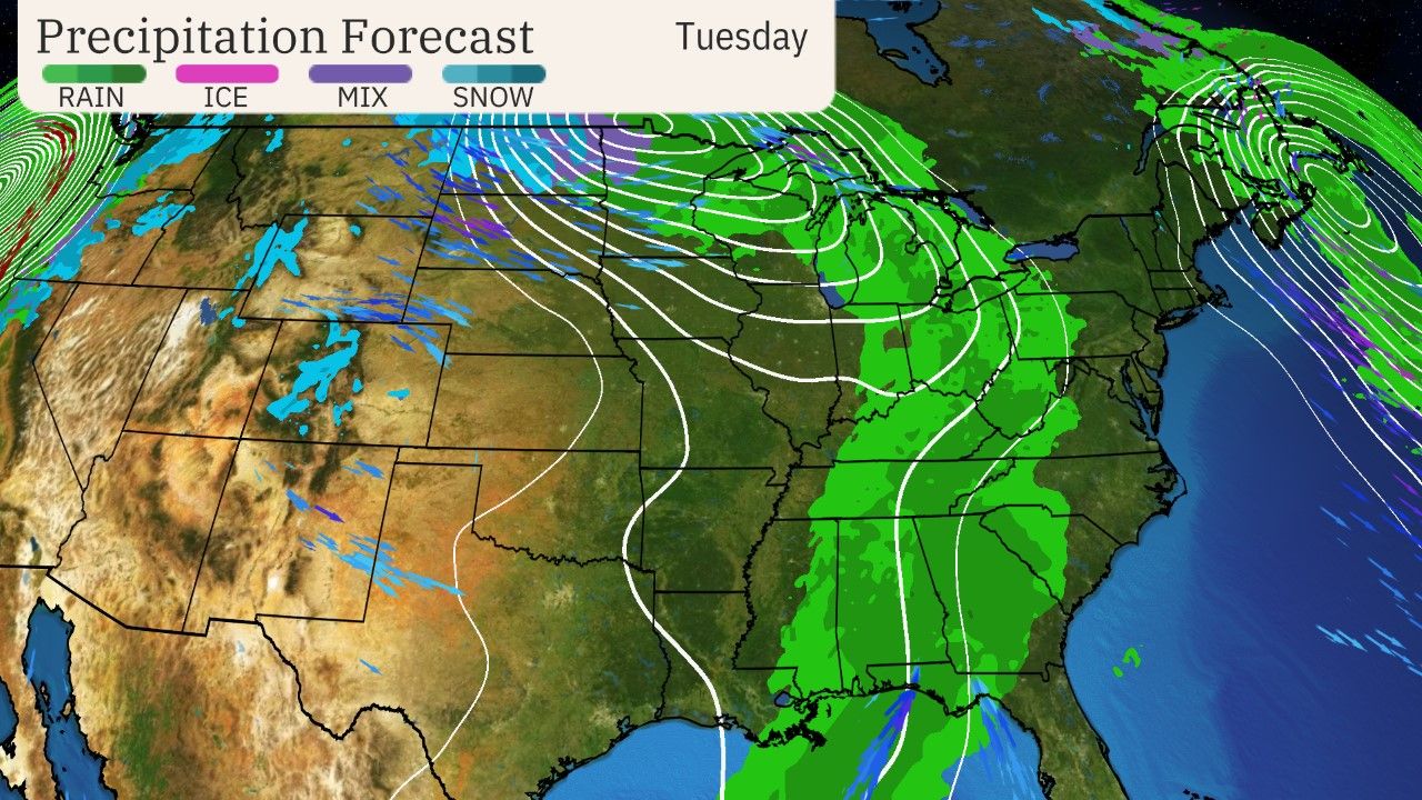

Tuesday’s Forecast (Storm 1)
(The white lines are called isobars, lines of equal pressure. The closed isobars over the upper Midwest indicate where forecast models suggest the center of the storm may be. Any arrows on the map above show forecast winds, as well. )
Soon after that first system winds down, another storm is expected to develop near the Great Lakes and Northeast beginning late Wednesday.
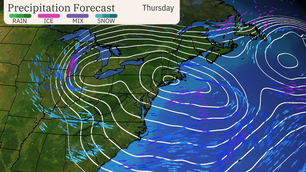

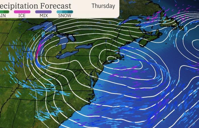
Thursday’s Forecast (Storm 2)
(Same as the earlier map, but for the second storm on Thursday. )
Northeast rain outlook: Given recent wildfires and the flash drought during one of the driest autumns on record, the Northeast’s Interstate 95 corridor is in desperate need of a soaking.
Unfortunately, the first storm will likely fizzle before producing any significant rain in the Northeast.
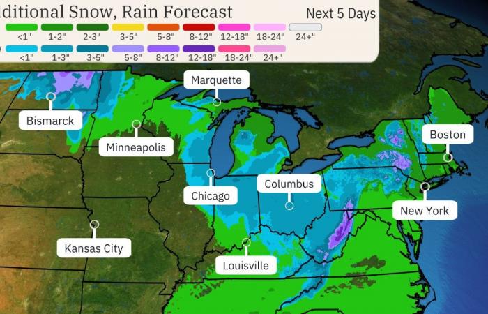
The second storm could bring at least a period of soaking rain from Maine to Maryland late in the week, possibly the most rain they’ve seen in a couple of months.
In the snow? As we mentioned earlier, the first storm won’t have much cold air to work with.
However, the second, stronger storm may be just cold enough to generate some accumulating wet snow showers in parts of the Great Lakes, Ohio Valley and interior Northeast later in the week, particularly in the Adirondacks, Appalachians and Catskills.
For some, it could be their first slushy accumulations of the season.
And as this second stronger storm sits for a while, it could eventually turn on the lake-effect snow and rain machine in parts of the Great Lakes Friday into the weekend.
(MORE: Is A Snowless East Unusual This Time Of Year?)
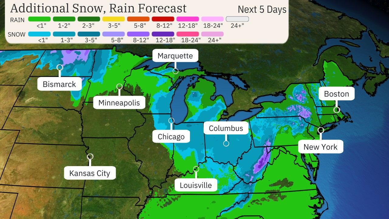

Snow, Rain Outlook
(While it is too far out in time to specify exact forecast rain and snow totals, areas in the heavier contours have the highest chance at heavier precipitation.)
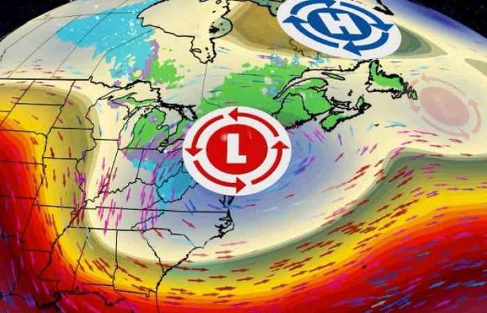
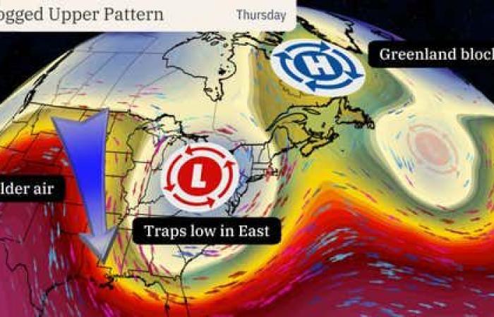
Why the pattern change: The short answer is the wind flow in the atmosphere will become temporarily clogged.
A bubble of high pressure aloft known as the Greenland block will act as a temporary roadblock, forcing a deep low-pressure system to become stuck in place over the East.
That’s the reason the second storm system and the cold air may last several days in the East.


Jonathan Erdman is a senior meteorologist at weather.com and has been covering national and international weather since 1996. Extreme and bizarre weather are his favorite topics. Reach out to him on X (formerly Twitter), Threads, Facebook and Bluesky.

