Stéphane AILI / Getty Images/500px
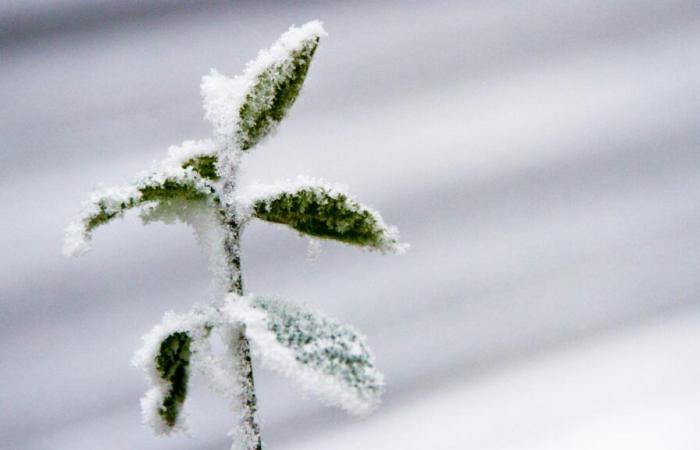
With the arrival of snow and cold, the weather for the week of November 18 promises to be wintery.
WEATHER – It's a good time to bring out gloves and scarves. The weather for the week of November 18 promises to be particularly wintry, with cool temperatures in the morning and during the day, as well as possible snowfall in the plains. “From Monday, a change in weather is looming”already warns Météo France.
“Much more unsettled weather is expected next week”describes the forecaster in his latest bulletin. Météo France announces “ more frequent and more marked precipitation. Indeed, from Monday, you should expect to have to take out your umbrella in the north west of France, particularly in Hauts-de-France and Normandy.
But this is only the beginning: this rainy disturbance will gradually reach the entire northern half in the evening, then the rest of France during the day on Tuesday. These showers will be accompanied by a windier atmosphere, with gusts between 30 and 80 km/h in the northern half on Tuesday. We will have to wait until the weekend to see sunnier skies and milder weather.
Reading this content may result in cookies being placed by the third party operator who hosts it. Taking into account the choices you have expressed regarding the deposit of cookies, we have blocked the display of this content. If you wish to access it, you must accept the “Third Party Content” category of cookies by clicking on the button below.
Play Video
A cold snap and the return of snow
In terms of temperatures, a significant cold snap is expected from Wednesday, which will give the mercury “a more wintery character”. In the morning, it will be 2°C in Tours or Reims, 5°C in Paris and Lille, or even 10°C in Bordeaux. And those temperatures will only rise by a degree or two in the afternoon. Milder temperatures are, however, expected for the following week.
Before that, snow will return to the mountains at low altitude this week, and why not to the plains. “The risks (or chances) of snow for Thursday seem to be becoming clearer (even if the scenarios remain very fluctuating due to an extremely turbulent weather situation)”, observes meteorologist Guillaume Séchet on X, sharing a forecast map for Thursday indicating possible falls in the eastern plains.
Reading this content may result in cookies being placed by the third party operator who hosts it. Taking into account the choices you have expressed regarding the deposit of cookies, we have blocked the display of this content. If you wish to access it, you must accept the “Third Party Content” category of cookies by clicking on the button below.
Play Video
“The Lorraine plateaus, the Alsace plain, as well as the valleys and plains of Auvergne-Rhône-Alpes will be the most exposed,” also indicates La Chaine Météo which specifies however that these flakes will not last “ necessarily on the ground » in these regions. On the other hand, more abundant snowfall is expected in the Alps, the Vosges and the Jura.
Also see on The HuffPost:
Reading this content may result in cookies being placed by the third party operator who hosts it. Taking into account the choices you have expressed regarding the deposit of cookies, we have blocked the display of this content. If you wish to access it, you must accept the “Third Party Content” category of cookies by clicking on the button below.
Play Video


