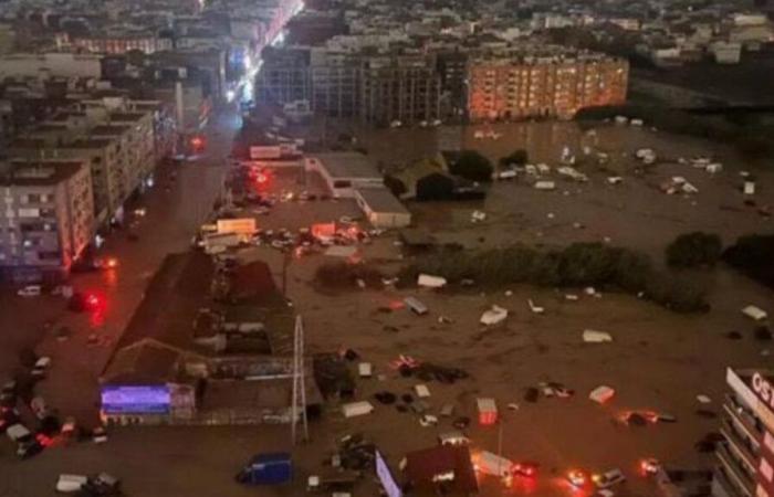
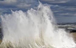
But why are we seeing increasingly violent DANAs in Spain and what do we expect in the coming years?
The DANAS, ancient cold drops, increasingly extreme
Las DANAs, formerly known as “cold drops”,» are meteorological phenomena typical of the Mediterranean basin and other areas where cold air is isolated at high levels of the atmosphere. In recent years, these isolated depressions at high levels have gained in intensity and frequency, becoming more extreme and destructive episodes of torrential rains.
The cause of this increase in severity of DANAs this directly related to climate change. And here we have no doubts because as the temperature of the planet increases, the air is capable of retaining more water vapor, which makes the rains more intense, associated with phenomena like these.
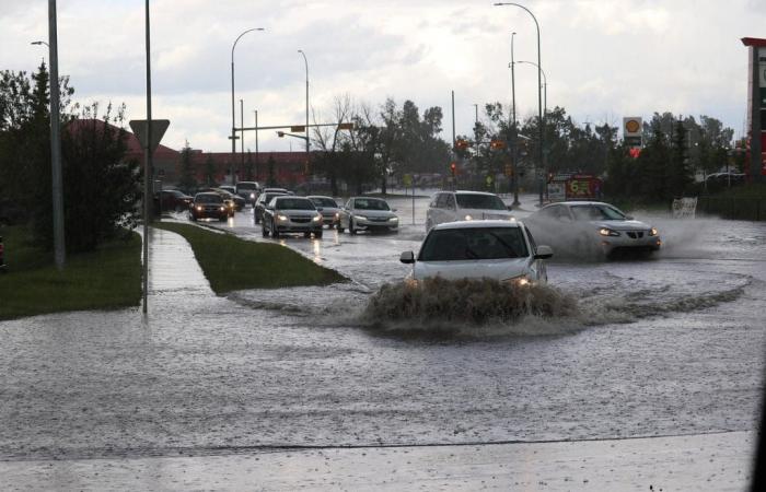
The result is intense rains in short periods, which cause flash floods, damage to infrastructure and put both people and ecosystems at risk.
Furthermore the Mediterranean Sea, warmer than normal (already getting warmer due to global warming) at the end of summer is an extra ingredient when it comes to providing humidity in the Levant.
Mediterranean water temperatures have been increasing year after year, and when they reach higher than normal levels, they contribute a large amount of humidity to the atmosphere in the Spanish Levant and other coastal areas.
This Warm water acts as “fuel” for storms. As the air over the Mediterranean absorbs this extra moisture and then encounters cold air masses aloft, perfect conditions are created for the formation of heavy rain and torrential storms.
This phenomenon not only aggravates the intensity of DANAs, but also increases the frequency and magnitude of rain which can result in severe flooding and rapid river overflows.
A future with a more torrential character
Looking ahead, the continued increase in temperatures in the Mediterranean poses a worrying scenario regarding the intensity of extreme weather phenomena, especially DANAs. As This sea warms, it becomes a reservoir of energy and humidity which favors the formation of more intense storms with greater destructive capacity.
The higher the sea temperature, the greater the probability of torrential rains, as water vapor in the air increases.
The Mediterranean It is a unique enclave where several factors converge that facilitate these processes. The combination of warm waters, high-level air masses and complex orography on the surrounding coasts creates a «cultivation broth» ideal for weather phenomena to amplify.
With increasingly high temperatures, the Mediterranean contributes more humidity and energy to the atmosphere, which, in the presence of cold air masses, can trigger torrential rains and extreme storms.
According to climate models, it is expected that lMediterranean temperatures will continue to rise in the coming decades, which could enhance the frequency and severity of these phenomena.
The Mediterranean, in the spotlight for these events: a boiling cauldron
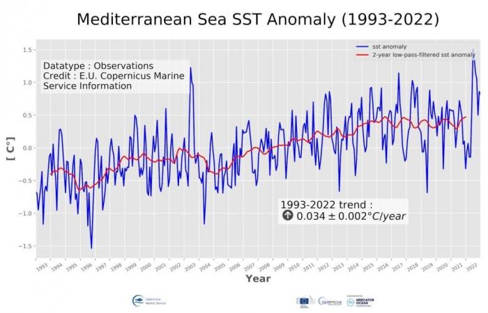
The Mediterranean is in the spotlight of global warming and it is no wonder since it heats up a bit 20% faster than the world average. To give us an idea, the water temperature in this area has risen 1.6ºC in the last 40 years.
This accelerated warming of the Mediterranean not only impacts marine ecosystems, but also contributes to intensifying extreme weather events in coastal areas.
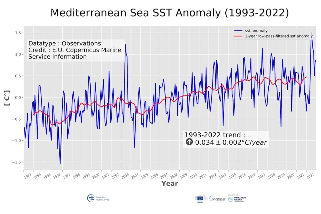
Time series of monthly mean (blue line) and 24-month filtered (red line) sea surface temperature anomalies in the Mediterranean Sea during the period 1993-2022. The anomalies are relative to the climatological period 1993-2014 and were constructed from the CMEMS satellite product SST_MED_SST_L4_REP_OBSERVATIONS_010_021. Source: Copernicus.
How much The hotter the Mediterranean, the greater the air vapor that circulates over the region, something that creates a necessary fuel for the rains to be more intense.
The Mediterranean is warming 20% faster than the world average. The warmer the Mediterranean, the greater the air vapor that circulates over the sea.
This warm sea not only modifies the patterns of marine life, but by raising the amount of humidity in the air, it becomes a trigger for severe storms. Warm, humid air masses accumulating over the Mediterranean enhance events such as DANAs, increasing the risk of torrential rains and flooding in the Levant regions and other areas of southern Europe.
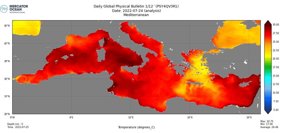
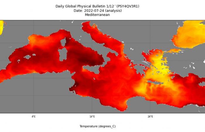
From the Balearic Sea to Sardinia, as well as east of Corsica and throughout the Tyrrhenian Sea, exceptional surface temperatures of between 28 and 30°C were recorded this summer. Fuente: Mercator Ocean/Copernicus.

