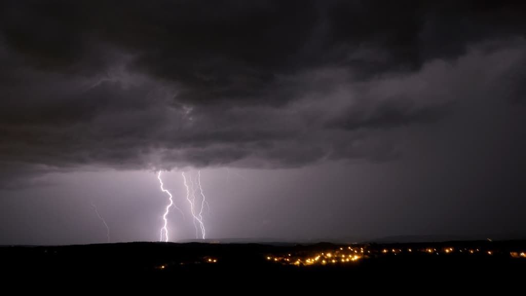
“The most violent storms are now organized around a line going from the Jura to Luxembourg,” indicates Météo-France.
The orange “thunderstorms” vigilance, which has affected the weather in up to 34 departments, is now only required in 16 departments for this Saturday, June 29, while a strong stormy episode will cross most of the country, indicates Météo France .
“The storms are gradually shifting towards the north and east,” writes the meteorological institute in its bulletin updated at 10 p.m.
List of departments concerned: Yonne, Côte-d’Or, Jura, Doubs, Territoire de Belfort, Haute-Marne, Aube, Haute-Saône, Ardennes, Marne, Meuse, Bas-Rhin, Haut-Rhin, Moselle, Vosges and Meurthe-et-Moselle.
France is crossed by an “extensive stormy wave”. “The most virulent storms are now organized around a line going from Jura to Luxembourg,” explains Météo-France.
“Special vigilance”
In the afternoon this Saturday, “torlenuous storms impacted the Tarn department where we recorded 61 mm in 1 hour in Dourgne (81), 56 mm in 1 hour in Montredon (81) and 66.6 mm in 3 hours in same place”.
“In addition, we observed storms in the Lot department with rain intensities of around 20 to 30 mm/h at the beginning of the afternoon,” explains Météo-France.
“Only the regions from Brittany to Nord-Pas-de-Calais, as well as Corsica, remain spared from this bad weather, and retain calmer but cloudy weather,” the organization specifies.
High intensity
For the departments concerned by this vigilance, the meteorological service warns of a “strong summer stormy situation which requires particular vigilance given the geographical extent and intensity of the predicted phenomena”.
Towards the Center-East, “violent phenomena could be observed” with “notably high rainfall intensities”, while “some small to medium-sized hail falls are also probable, as well as wind gusts which could locally exceed 80km/ h”.
In the Grand-Est, “the storms will be particularly violent”, warns Météo-France, with gusts “between 100 and 120 km/h occasionally”, large hail and “intense electrical activity”.


