An explosive weather situation expected in France on Saturday
The weather configuration this weekend will be marked by a powerful conflict of air masses over our country. Cool air coming from the Atlantic will collide with the warm air currently present. This type of situation, rather classic in summer, will be reinforced by the rise of a depression coming from Portugal, which will circulate towards the Benelux. France will be crossed by this depression and by the conflict of air masses on Saturday: suffice to say that the weather ingredients will be combined for this storm offensive to be violent, probably the strongest since the beginning of this year 2024, which could be quite remarkable.
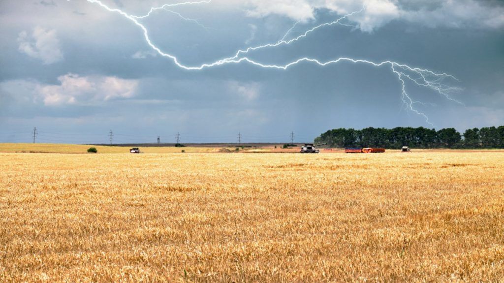
A stormy wave will cross France on Saturday © The Weather Channel
Chronology of this degradation
This powerful storm wave will rise from the southwest and head towards Germany. Thus, the main axis exposed to storms will stretch from the Pyrénées-Atlantiques to Lorraine. More than half of the territory will be affected, but the storms will not have the same violence everywhere.
Saturday morning: extension of storms over New Aquitaine
The first storms will already break out in Friday night to Saturday night on the Pyrenees, the Basque country and Béarn. They can occasionally be strong.
On Saturday morning, these storms will be present from Landes to Charente. Rainfall accumulations could already be abundant in this area (20 to 30 mm in 3 hours). They will weaken as they progress towards the Centre-Val-de-Loire during the morning. The wind will be strong on the Atlantic coast as well as in the Autan and sea wind domains (Occitanie), from 70 to 80 km/h.
Saturday midday: heavy rain in Aquitaine
With the slow progression of the depression over the southwest, stormy rains will persist all morning. Accumulations are likely to be abundant south of the Gironde (locally 50 to 60 mm). Diffuse storm activity also propagates towards the axis of the Loire, but with low intensity.
Saturday afternoon until 5 p.m.: increase in storms over Occitanie and the Massif Central
The evolution on Saturday afternoon could be very rapid. In a heavy atmosphere, storms will increase over two thirds of the country, from Occitanie to Auvergne, Center region, Cévennes, then over Franche-Comté and the Alps. The wind will be strong, particularly in the mountains (Massif Central) then, late in the afternoon, in the Rhône valley (80 km/h) and the Val de Saône.
At the same time, storms will stop in Aquitaine but showers will continue. In this area, the episode will stop.
Saturday 5 p.m. to 8 p.m.: start of the high-risk period
At the end of this afternoon, powerful storms will break out in the Center then quickly from Franche-Comté to Burgundy and towards Lorraine. These regions will experience hailstorms, strong wind gusts (more than 100 km/h) and torrential rain falling suddenly in a short time. Accumulations of 50 to 100 mm are possible locally, likely to cause flooding and mudslides in these regions.
Saturday evening: 8 p.m. / 11 p.m.: very violent storms in Lorraine
The evening will be very stormy, both in the Center and in Lorraine, where we expect supercellules (the most powerful storms). These storms will move back towards Luxembourg. Others, less powerful, will still break out in the Alps and the central massif and then subside. The real danger mainly concerns the north-eastern quarter of the country.
Night from Saturday to Sunday: the most violent storms will move away in Germany
The stormy supercells will pass into Germany around 2 a.m. after sweeping the northeast of our country, as well as part of Alsace. During the night, electrical activity will weaken but the rains may continue from the Center to Champagne-Ardenne, with accumulations of rain still abundant.
Parameters to fear: hail, stormy wind, flooding
Extension of the risk of thunderstorms on Saturday © The Weather Channel
This situation therefore presents a real danger given the expected violence of the storms, particularly in the northeastern third.
– Heavy rain: accumulations of 30 to 50 mm are expected across the board, which is significant, falling on soils that are sometimes still weakened following recent stormy episodes (notably last weekend in the center east). Locally, accumulations of 100 mm could be reached (southwest and north-east in particular), likely to cause flooding and mudslides.
— Gusts: the wind will often be strong throughout this day. The strongest gusts are feared at the end of the afternoon while the storms will spread over the central east and north-eastern regions (100 km/h). In this context of very high instability, tornadoes are possible in the regions of the Grand Est.
– The hail is a parameter to take into account for the northeastern third at the end of the afternoon. Hailstones of 5 to 7 cm are possible during the strongest storms.


