After last week's snowfall and the spectacular warm weather over the weekend, temperatures are starting to drop again. Are further snowfalls possible this week in the plains? Find our latest forecasts.
While some regions of France were paralyzed by very early snowfall last week, followed by a spectacular warm spell over the weekend, the start of the week is marked by violent gusts of southerly wind, accompanied by still high temperatures in the eastern regions, ahead of a rainy front crossing the country.
Behind this disturbance, temperatures are starting to drop again and are once again more in line with the season. Just yesterday, values were sometimes 8 to 10 degrees above seasonal norms.
How will temperatures evolve in the coming hours and days? If a new cooling seems to be looming, could snowfall once again reach the plains? Find our latest forecasts in this article.
Incredibly high temperatures!
Over the past few hours, the powerful southerly wind linked to Storm Bert has caused temperatures to soar in places. Thanks to a Foehn effect, they even exceeded the 25 degree mark in places last night, notably at the foot of the Pyrenees. At 6 a.m. this morning, the town of Pau, in the Pyrénées-Atlantiques, showed an incredible temperature of 26.3°C!
This afternoon, temperatures remain very mild ahead of the front, where the southerly wind is still blowing. Peaks of nearly 20 degrees are even recorded locally. It's even up to 21/22 degrees in Roussillon.
Another drop in temperatures tomorrow!
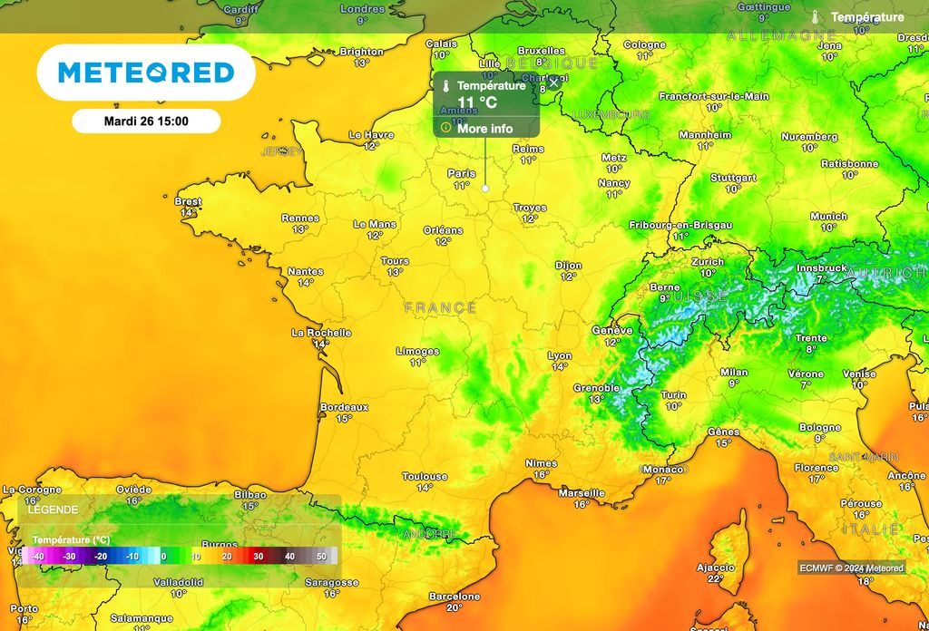
A drop in temperatures began today after the passage of the front which crosses the country from west to east. This decline will continue tomorrow, with temperatures which will once again approach seasonal norms.

In detail, 9°C is expected in Langres, 10°C in Alençon, Metz and Reims, 11°C in Paris, Caen and Aurillac, 12°C in Cherbourg, Tours and Mulhouse, 13°C in Nantes, Clermont-Ferrand and Limoges, 14°C in Lyon and Agen, 15°C in Brest, La Rochelle and Toulouse , 16°C in Nîmes, 17°C in Nice, 18°C in Perpignan, 19°C in Toulon and 21°C in Ajaccio.
Often gray skies will continue tomorrow over most regions. A rainy disturbance will approach Brittany during the day. On the other hand, more generous sunshine should prevail between the Pyrenees, the Alps and the Mediterranean rim.
Towards a colder weekend
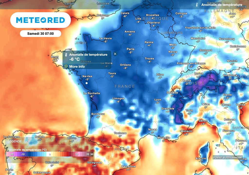
After a rise in temperatures on Wednesday with the arrival of a rainy disturbance in the north-western regions, a further drop in temperatures will occur in the second part of the week, with maximums which will no longer exceed 10 degrees during the day in the north of the country.

However, this drop in temperatures will also be accompanied of a return of high pressures on France. It is therefore dry and rather sunny weather which should prevail, after the possible dissipation of the mists, fogs and low clouds. No further snowfall in the plains is therefore expected this week.


