A 20h17the snowy episode ends, but be careful of the risk of icy formation in the regions affected by snowfall this Thursday.
Risk of ice during the night from Thursday to Friday © The Weather Channel
A 19h50the snowy episode is now over from Normandy to Île-de-France. However, temperatures become negative and the risk of icy conditions is high. However, it continues to snow heavily in Franche Comté and southern Alsace as below in Hésingue (Haut-Rhin).
At 6:50 p.m.snowfall is gradually decreasing in intensity in the departments from Normandy to the Paris basin. On the other hand, it continues to snow more abundantly and continuously in the north of Burgundy and Franche-Comté. We sometimes find up to 25 cm in the Paris region, particularly north of Yvelines.
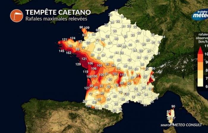
At 5:00 p.m.the storm is still blowing south of the depression with record gusts in the Massif Central, as in Superbesse with 136 km/h. Snow continues to fall at the same time from Normandy to the center-east.
Maximum gusts recorded at 5 p.m. (Caetano storm) © The Weather Channel
A 16h48snow continues to fall heavily in the Paris region at the time we leave the offices. We measure up to more than 15 cm in the suburbs, like at the Weather Channel near Orgeval.
A 15h42The snow front is almost standing still in the middle of the afternoon. The snowfall will soon stop in the English Channel but will continue for a few more hours from the interior of Normandy to Île-de-France then all evening in the Grand-Est and Franche-Comté.
A 15h36Nantes beats its record for wind gusts for the month of November with 121 km/h.
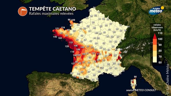
Storm Caetano (maximum gusts) © The Weather Channel
At 2:39 p.m.gusts exceed 150 km/h on the coast, as in Brittany, where a gust of 162 km/h was recorded at 1 p.m. on the island of Groix, which constitutes a monthly record.
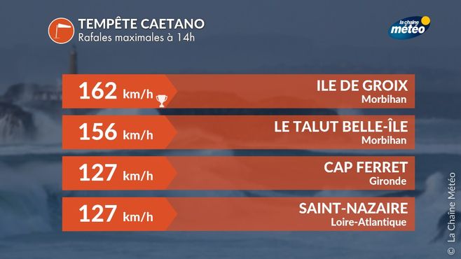
Maximum bursts © The Weather Channel
At 2:00 p.m.the wind is already blowing very strongly on the Atlantic coast with gusts above 120 km/h for example at Cap Ferret. In the video below, the gusts are already reaching 80 to 90 km/h in Saillans near Libourne. The wind will strengthen again very significantly in the coming hours.
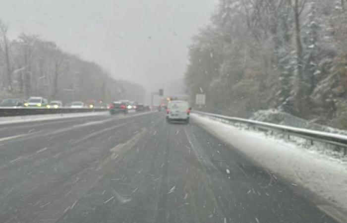
At 1:45 p.m.the snow front extended from Normandy to Franche-Comté, still with high intensities in places. The snow holds well in the Paris region, particularly in the suburbs. Numerous slowdowns are reported on the main roads, in particular the A13. Caution. Another 2 to 3 hours of snow to expect in Île-de-France.
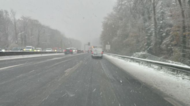
A13 motorway near Saint-Cloud © Cyril Bonnefoy
A 12h, snow fell regularly from Normandy to Île-de-France via the south of Oise and Aisne. The snow band had reached Burgundy (Nièvre) and Franche-Comté (Saône-et-Loire). In the Alps, snow fell from 400 to 600 m before beginning a sudden increase this afternoon. This mild spell should rise to the level of Mâcon and the Jura, but not further north.
Regarding the stormwe noted a gust of 155 km/h at Pointe du Raz, 145 km/h at Penmarch (29) and 138 km/h at Belle-Ile (56). The wind is starting to return inland with already 106 km/h in Niort (79).
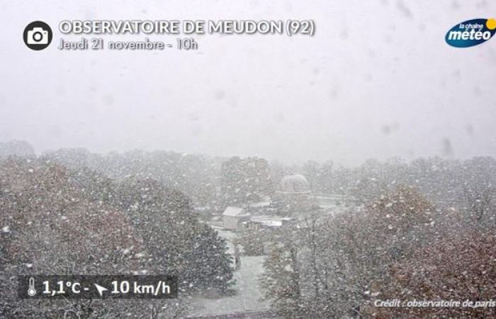
A 10h48 : snow arrived in the west of Île-de-France, falling in large flakes on Yvelines. If the lawns and countryside of the plateaus become dusty, this snow does not last in the Seine valley and wets the roads. Temperatures are between 0 and 2°C, which is just enough for it to snow.
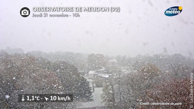
Snow at the Meudon observatory (92) © Paris Observatory
A 09h38the wind gusts were blowing like a storm on the Atlantic coast with 122 km/h at Pointe du Raz (29), 118 km/h at Belle-Ile, 119 km/h at Ile de Ré, and a gust of southeast wind at 124 km/h on the island of Brehat (22), which is not frequent in this direction.
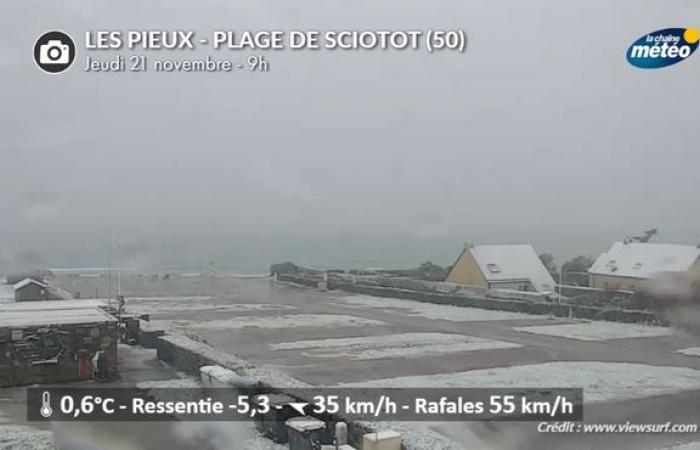
The snow falls in a “blizzard” in northern Cotentin with a strong easterly wind, dusting the landscapes.
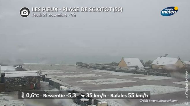
Webcam capture of Sciotot beach (Manche) © Viewsurf
At 9:26 a.m., snow sprinkled the town of Caen (Calvados)
A 09h00 : snowfall invaded all of Lower Normandy, even arriving in the department of Eure (Evreux). The whitewashed landscape, and even the beaches of the Manche department. But the main road network remained dark, wet and salty. In Brittany, the snow was melting and mixed with rain. In the hills of Calvados, we recorded 4 to 5 cm of snow.
A 08h30 : the snow fell in Rennes (35), in Lower Normandy, sticking to the ground.
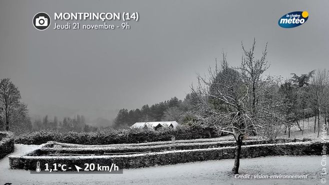
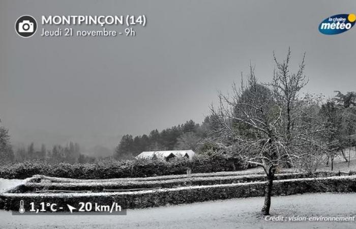
Webcam capture in Montpinçon, in Calvados © Vision -Environment
A 08h : snow fell on the department of Manche (Cotentin) and held to the ground. The temperatures were close to 0°C explaining the hold on the ground. The east wind was rising with a very cold feeling.
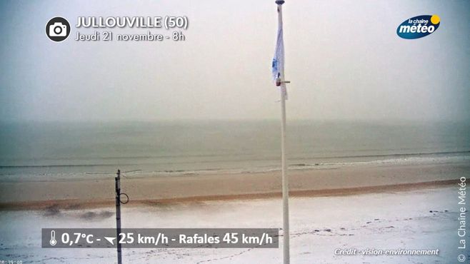
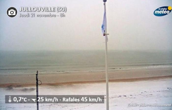
Snowy Jullouville beach (Manche) © Vision-Environnement
The heart of depression CAETANO was located on the island of Ouessant this morning at 08h59 with a pressure of 985 hPa. It caused violent winds (up to 138 km/h on Ouessant) and 90 to 110 km/h on the Breton coast (112 km/h on Belle-Ile).
As for the disturbance, it had already arrived since the end of the night in Brittany with mixed rain and snow, then snow in Côtes-d'Armor. This made the roads slippery and some collisions were reported.


