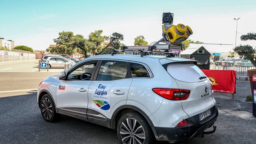
To better manage your network, you must already know it well. And it is by relying on digital modeling that Eau Agglo, the water and sanitation public service delegate, develops the mapping of water networks and public roads with unequaled precision.
The hidden side of underground networks sometimes gives the technical services of municipalities a hard time. The hazard is also well known by all public works stakeholders who operate on public roads. Under the roads. How often does an unfortunate shovel result in “network degradation” ? And this is to no longer see a geyser of water gushing out in the middle of the street, “like recently in Saint-Estève” that the Perpignan Méditerranée Métropole (PMM) urban community is currently equipping itself with a state-of-the-art georeferencing tool. For several days, the RTI group, winner of the call for tenders, has been collecting data in the Vernet sector in Perpignan to produce a detailed map of the environment, and especially of the underground infrastructure.
Avoid breakage and reduce water waste
On the screen installed at the foot of the Brutus stadium where PMM presented this new device, this Tuesday, June 25, the avenue de l’Aérodrome parades in a bare version. “Thanks to the use of cutting-edge sensors and geosensing technologies, we are now able to create a 3D digital twin of all networks. What we see is a virtual representation of unprecedented precision “, as explained by Eric de Saint-Martin, general director of Eau Agglo. Because it is the water and sanitation public service delegate that this innovation will serve, to better understand its network. The modeled images demonstrate both the density of the pipes and the challenges of this technology. “It is another tool to sustainably improve the management of our infrastructures. With detailed mapping of the network, we will now avoid breakages and reduce water waste. This is essential and this is one of the objectives of the delegation”, as pointed out by Robert Vila, president of PMM. In the coming months, the entire perimeter network of the urban community will be scanned by the radar car which compiles the data.
