A polar stall of ordinary intensity will reach France during the week. If our Mediterranean regions will generally remain on the sidelines of the main cold advection, we will still have a few colder days. Moreover, a snowy episode seems to be confirmed for Thursday between the Cévennes, Lozère and Ardèche, sometimes at low altitude.
1) General analysis of the meteorological context: a polar shift which shifts the flow to the North-West
A polar shift is underway over Europe, the depression paroxysm of which is located between Scandinavia and Germany. At the same time, an anticyclonic ridge stretches from the Azores to Greenland. Nature has a “horror of a vacuum”: it is this anticyclone formed in the West in the Atlantic which allows low pressures to collapse over Europe. Predictability is starting to improve with models which are rather in agreement over the coming week (in terms of the general meteorological context).
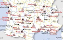
This Wednesday, low pressure reaches the north of France with a shift in the flow to the North-West. The southern regions remain on the margins, with a more curved flow to the West. On Thursday, a dynamic depression will form in the south of Brittany and cross France, passing through the Massif-Central and finishing its course towards the northern Alps. It will be at the origin of a major air mass conflict. To the north of this depression, cold air rushes in freely. To the south, the mild air remains in ambush. We find this depression in the middle of the Massif-Central THURSDAY on the map below:
2) Gentleness this Wednesday before a winter disturbance this Thursday:
This Wednesday, there are expected to be many clouds between Roussillon, Aude and the reliefs from Aveyron to Lozère. Showers are possible in these areas. On the plains of Hérault and Gard, a veil of clouds circulates at times but the impression of good weather persists. It's mild. The highlight of this day is the west wind on the Aude, the Pyrenees reliefs and the high cantons of Hérault. Gusts can reach 100 km/h early in the morning.
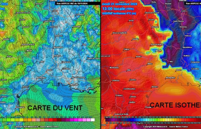
A deterioration is confirmed for Thursday. Clouds are numerous in the morning and colder air arrives from the north. Precipitation is expected to begin early/mid morning by Aude, Hérault, Aveyron and Lozère. By midday and during the afternoon they reach the Gard and Ardèche, while strengthening in the Aveyron/Lozère relief areas. With a 0°C isotherm close to 600/700 m, it snows temporarily to the bottom of the valleys in the East of Aveyron and Lozère, from around 500 m in the Cévennes Gardoises. The situation is nevertheless quite atypical because the persistence of the “cold air range” will depend on whether or not the westerly wind picks up. Explanations below. In areas where the westerly wind will pick up, the P/N limit will quickly increase and rise well beyond the peaks. This implies that on the reliefs of Hérault and Aveyron, as well as West Lozère, the P/N limit explodes quickly and the snow is washed away. We see two parameters on the maps below: the wind (map on the left) and the level of the 0°C isotherm (the altitude where it will be 0°C).
3) More lasting snowfall at lower altitudes between East Lozère, Ardèche and part of the Cévennes Gardoises?
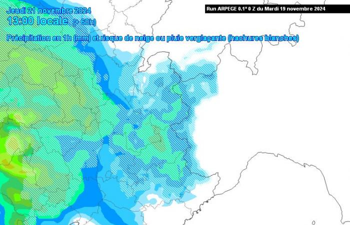
The precipitous episode will continue most of the day on the plains of Aude, Hérault and Gard. It often gives weak and cold rains. In general, remember that the further you go towards the seaside, the lower the precipitation (1 to 3 mm), while the further inland you go, the more regular the precipitation (5 to 10 mm). . We even have up to 20/30 mm in the hinterland of Aude and near the upper cantons of Hérault. Regarding the snow…
As long as the wind does not pick up, this allows snowfall at “low altitude” especially on the Ardèche side (temporarily 300 m altitude) but more generally above 500/600 m. Between the north of Gard, Mont-Lozère and the eastern limits of Margeride, we can also maintain good snowfall from around 500/700 m for several hours, while it rains up to 1700 m in the West Lozère as well as at the top of Aigoual where the mild weather has arrived. This situation is still fragile regarding the reliability and exact location of the pockets of cold resistance. Please note, however, that if snowflakes are likely over almost all of Lozère temporarily, it is really between Mont-Lozère, Margeride, the Ardéchois plateaus and Tanargue that this snow could be the most durable and therefore the most quantitative. (some scenarios see more than 10 cm).
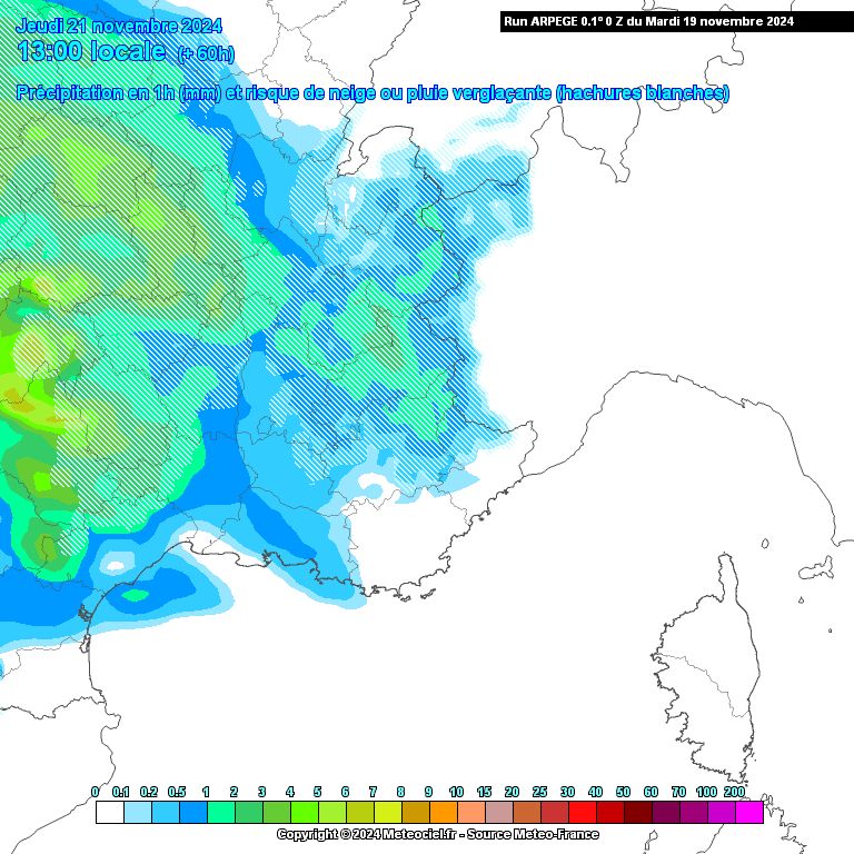
It should be noted that in the event of regular precipitation, we could have a “cold” day on the eastern plains of Languedoc (Gard + Est Hérault) with maximums around 5/6°C in the interior of the Languedoc. lands. This aspect also needs to be confirmed. Friday, return of the sun with great freshness. Frost is forecast for the night from Friday to Saturday, sometimes as far as the coasts on the Gard and Hérault.
Facebook
Twitter
Google+

