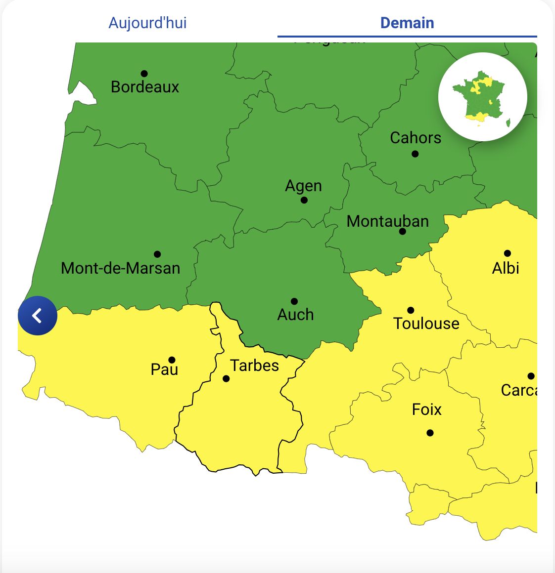
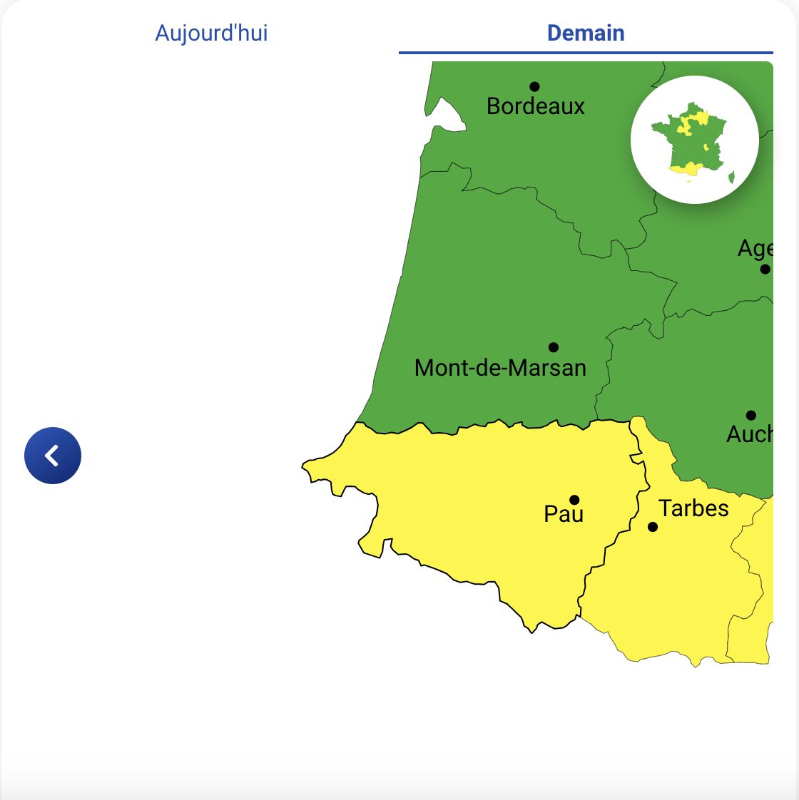
The department of Hautes-Pyrénées is placed on yellow alert for rain-flooding and for violent winds on Tuesday October 15. The departments of Haute-Garonne and Pyrénées-Atlantiques are placed on yellow alert for violent winds.
Météo France has issued an alert for the departments of Hautes-Pyrénées, Pyrénées-Atlantiques and Haute-Garonne, which will be placed on yellow alert on Tuesday October 15. These three departments will have to face violent winds and, for the Hautes-Pyrénées, an increased risk of rain-flooding.
Yellow warning rain, flood and wind in the Hautes-Pyrénées
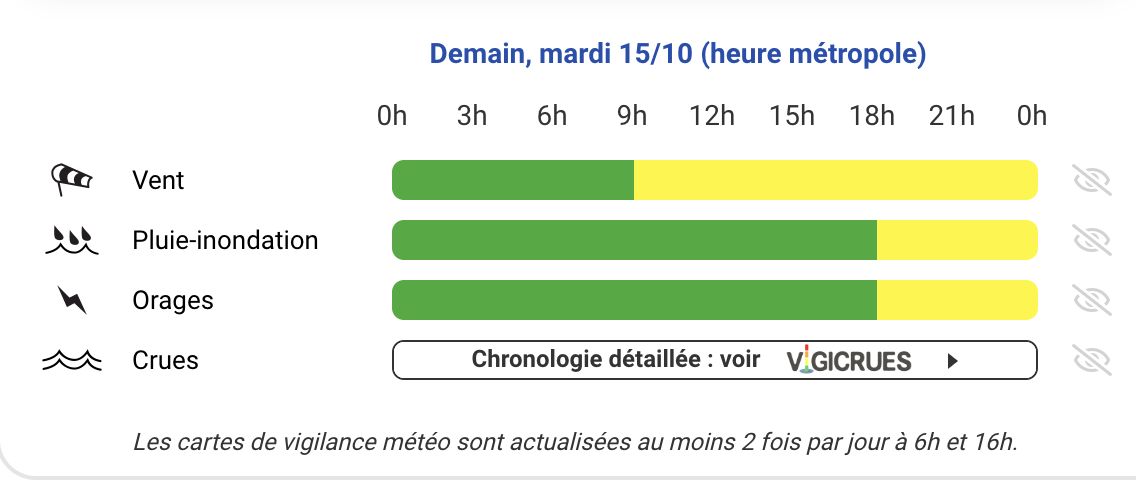
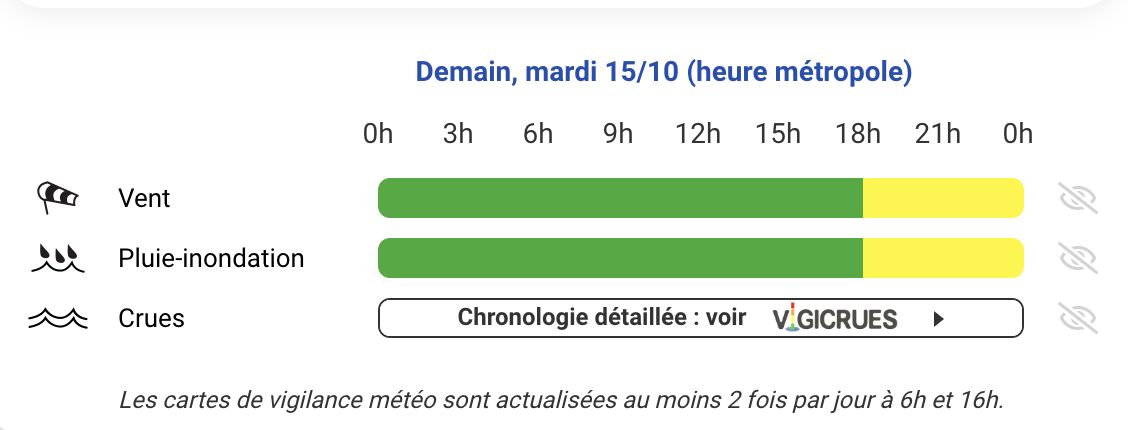
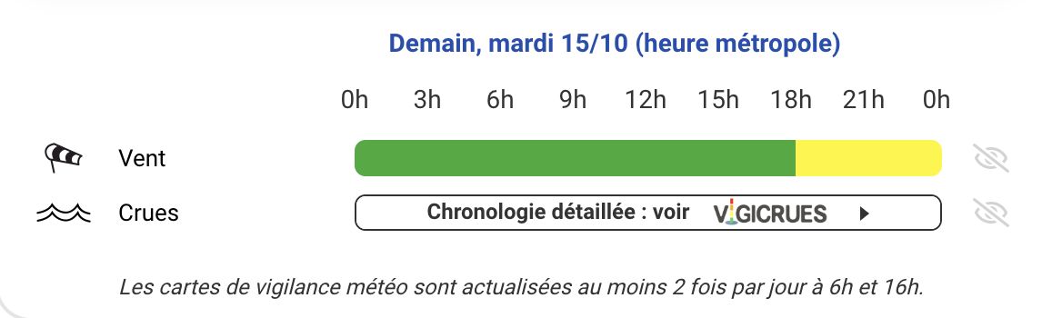
The Hautes-Pyrénées department will be on yellow alert for risks of rain-flooding and violent winds from 6 p.m. and until at least midnight. The wind, from the south, should blow between 70 and 80 km/h over the Pyrenees at the start of the day. This phenomenon will strengthen in the afternoon, with gusts reaching 80 to 100 km/h.
Pyrénées-Atlantiques and Haute-Garonne: violent winds
The Pyrénées-Atlantiques and Haute-Garonne will be placed under yellow alert for violent winds. In the Pyrénées-Atlantiques, the alert will also begin at 6 p.m. and last until midnight.
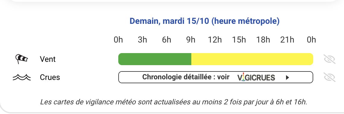
In Haute-Garonne, the start of vigilance is set at 9 a.m., and it will last at least until midnight.
Gradual deterioration of weather conditions
These alerts are a sign of a general deterioration in the weather, which will begin on Tuesday from the Pyrenees to affect several regions in the following days. Persistent gray weather will settle over a large south-eastern quarter of France, going from Var to Bouches-du-Rhône, and will also cover the regions of Languedoc-Roussillon and Midi Toulouse. These areas will be marked by low clouds and occasional drizzle, while high clouds will cover Corsica, the south of the Massif Central, the Midi-Pyrénées region and eastern Aquitaine.
Over the rest of the country, the sky will often be very cloudy. The morning fogs will extend from Brittany to the Paris region and Alsace, while some clearings will try to break through from the Loire" rel="tag">Pays de la Loire region to Burgundy. These clearings may however be interspersed with scattered rain in the west.
In the afternoon, an alternation of clouds and clearings will establish itself to the north of an axis linking the Loire estuary to the Jura Massif, where isolated showers will also be possible.
The Autan wind will blow strongly in its area, with gusts reaching 70 to 90 km/h from the morning and reaching 100 km/h on the Montagne Noire and Lauragais in the afternoon. The Toulouse region will also be affected, with winds of 50 to 70 km/h. On the Var coast, a steady east wind, between 50 and 70 km/h, will be expected.
Minimum temperatures will oscillate between 9 and 12 degrees in the northeast and between 15 and 18 degrees on the Aquitaine and Mediterranean coasts. The maximums, for their part, will be between 17 and 22 degrees in the northern half of the country, and between 22 and 26 degrees further south.
Forecast for the following night
The following night will see an increase in instability, with showers moving up from the Pyrenean ridges towards the Cévennes and the Massif Central. Residents of the affected regions are advised to remain vigilant in the face of unfavorable weather conditions.