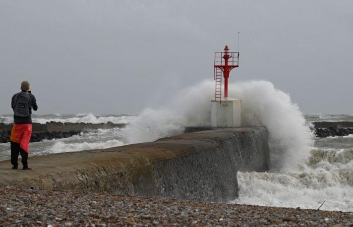
The Kirk depression, resulting from the hurricane of the same name, will touch the west coast of France this Wednesdaycausing “a very strong gale, and heavy rain” indicates Météo-France.
Hurricane Kirk, which is currently located in the heart of the Atlantic, feeds on the heat of the ocean. Currently heading north, it loses this heat and therefore, “without an environment conducive to its development, it will disintegrate, lose its tropical characteristics and become a simple depression“, explains Christelle Robert, forecaster at Météo-France.
According to Météo-France, “the first effects of Kirk are felt this Tuesday evening in Vendée, where heavy rains are expected ahead of the depression.” “Sustained and lasting rains” are then expected on Wednesday “between Vendée and Lorraine, with high intensities”indicates the organization. “The accumulations over the whole day will be very significant, they could reach 40 to 60 mm in the Paris basin and 60 to 80 mm, or locally 90 mm heading towards the Pays de Loire and Vendée. These are quantities that usually fall within a month. This precipitation will occur in a context of already very wet soils and could therefore cause flooding.
Consequently, Météo-France placed 19 departments on orange rain-flood or wind alert for the day of this Wednesday.
Eric Turpin/Meteo France
The Hautes-Pyrénées and the Pyrénées-Atlantiques will be on orange alert in the wind. Seventeen departments will be in orange for rain-flooding: Seine-Saint-Denis, Hauts-de-Seine, Val-de-Marne, Seine-et-Marne, Yvelines, Paris, Val d’Oise, Essonne, Eure-et-Loir, the Loiret, Loir-et-Cherla Sarthe, Indre-et-LoireMaine-et-Loire, Loire-Atlantique, Vendée and Deux-Sèvres.
Gusts of up to 150 km/h on the crests of the Pyrenees, up to 110 km/h on the coast
These heavy precipitations will be accompanied by a “very strong gust of wind”. It will gradually strengthen during the day on Wednesday and the strongest gusts are expected towards the end of the day.
This gust of wind will be felt “on the Atlantic coasts of Aquitaine and Gascony with gusts up to 110 km/h on the coasts, 70 to 90 km/h inland. Stormy winds will also affect the Pyrenees with up to 120 km/h 150 km/h on the ridges. The center-east and the Lyon region will also be exposed to strong winds.
This phenomenon “is not new“, specifies the forecaster, citing precedents with storm Ophelia in 2017who had colored the Breton sky yellowand Grace in 1991.


