Published on October 6, 2024 at 3:45 p.m.
Tuesday looks set to be particularly rainy. Find out if your region is one of the sectors of Quebec that could receive up to 100 mm of rain.
The over-used umbrella
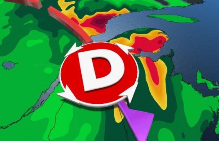
Significant amounts of rain are expected in the east of the province at the start of the week. The system which has entered the province brings precipitation and cooler weather. Monday morning, this frontal system will mainly affect the central areas of the province. Estrie and Beauce may also still need their umbrella. During the day on Monday, this system will continue to progress eastward to reach Gaspésie and the North Shore. And that’s where things will go wrong…
Precipitation will increase in intensity for the day on Tuesday. A coastal reformation will increase the intensity of precipitation. This is what will lead to fairly significant amounts of rain locally from Bas-Saint-Laurent to Gaspésie and on the North Shore, between now and Wednesday.
How wet will the umbrella get?
This episode of sustained rain will mainly be on the program for Tuesday. By Wednesday, the heaviest amounts of precipitation will be a thing of the past. However, between now and the end of this “deluge”, accumulations of 50 to 75 mm of rain are possible on the tip of the Gaspé Peninsula and on Bas-Saint-Laurent. But be careful: it could even potentially exceed 100 mm locally on the North Shore, between Baie-Comeau and Sept-Îles!

When the wind gets involved
Strong winds could also be expected. There is talk of gusts in the east of the province which could exceed 70 km/h locally, particularly in Gaspé and Sept-Îles. Moreover, the night will not be particularly restful for those whose ears are sensitive to noise.

Indeed, during the night from Tuesday to Wednesday, some people’s dreams could have whistling wind as a soundtrack. “Sleepers” in Sept-Îles could be awakened by gusts of up to 75 km/h.
With the collaboration of Kevin Cloutier, meteorologist.
SEE ALSO: Typhoon Krathon: 400mm of rain!
#Canada


