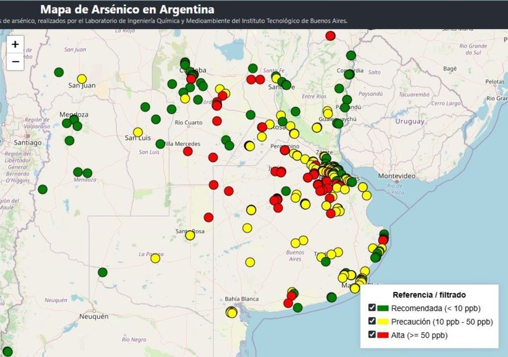
The Technological Institute of Buenos Aires (ITBA) recently presented the update of its arsenic map, an essential tool for monitoring and visualizing the presence of arsenic in water across the country. This project, led by doctors Jorge Stripeikis and Jhon Alejandro Ávila, brings together data from hundreds of water samples and provides a detailed and accessible view of water quality.
Arsenic, although naturally present in the earth’s crust, has become a latent concern in Argentina due to its presence in the water consumed by millions of people. This toxic element can enter water through natural processes such as the dissolution of rocks and minerals, or through human activities such as mining, agriculture and industry.
“Arsenic contamination is mainly of natural origin and results from phenomena that occurred millions of years ago, during the formation of what we know today as the Andes Mountains. In our country, the geographic areas most affected by this phenomenon include 70% of the province of Buenos Aires, particularly the Route 5 corridor, with localities like 9 de Julio, Bragado, Casares and Trenque Lauquen, as well as the surrounding areas of Mar del Plata. They are also found throughout southern Córdoba and Santa Fe, as well as La Pampa and Mendoza. In the north, this particularly concerns Tucumán, Santiago del Estero, Salta, the Chaco and Formosa,” explains Stripeikis.
Consuming water containing high levels of arsenic over long periods of time can lead to serious health problems. Among the most alarming are skin, bladder and lung cancers, cardiovascular diseases and damage to organs such as the kidneys. This problem even has a name: chronic regional endemic hydroarsenicism (HACRE).
The arsenic map: an essential tool
Argentina faces a major geographic challenge, with particularly affected areas such as southern Córdoba and Santa Fe, much of Buenos Aires province, La Pampa, Mendoza and several northern provinces. According to map data, more than four million residents could be exposed to arsenic levels exceeding the limits recommended by the World Health Organization.
The geology of the territory plays a key role: areas with soils rich in arsenic or which have experienced intensive human activity, such as the use of pesticides or industrial practices, have higher levels of this pollutant.
Since its creation, the map has been an indispensable resource for researchers and the general public. With an improved interface, thanks to the work of student Lucía Digón, the tool is now available online to facilitate access to this vital information. One of the particularities of the project is the active participation of citizens, who bring samples of their drinking water so that scientists can carry out the necessary analyses.

The creation of the collaborative map began in 2011, with the support of the NGO Nutrired. The team received water samples submitted by citizens, analyzed arsenic levels and provided personalized feedback, all while incorporating more and more data into the national map. The project now has nearly 1,000 samples.
However, the initiative was interrupted first by the pandemic, then by the laboratory’s move. Today, the team is relaunching the card and renewing the call to the public to collaborate by sending in new samples. Anyone can contribute by sending water samples to the Laboratorio de Ingeniería Química y Medio Ambiente (LIQMA), located in Iguazú 341, Buenos Aires.
Dr. Stripeikis emphasizes: “With this type of project, we aim to provide valuable data to help make proactive decisions on one of the main issues facing the community: access to clean water.
New risk map
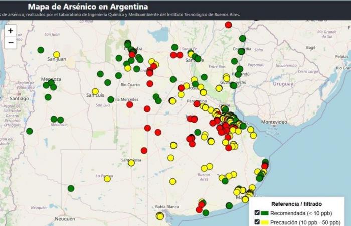
The map uses a color scale to represent different levels of arsenic concentration in water. Areas marked green correspond to samples that do not exceed the limit recommended by the World Health Organization (WHO), which sets a maximum of 10 micrograms of arsenic per liter of water, which is equivalent to ten parts per billion (PPB). Areas in yellow indicate concentrations between 10 and 50 PPB, while regions in red exceed 50 PPB.
This map published at https://mapa-de-arsenico.web.app/ allows not only to identify the most affected areas, but also to make informed decisions and develop strategies aimed at to mitigate the impact of arsenic on public health.
Among the areas identified in red are municipalities in provinces such as Salta, Santiago del Estero, Córdoba, Santa Fe and Buenos Aires, including localities such as Junín, Lobos, Francisco Álvarez, Balcarce and Suipacha. On the other hand, certain provinces, such as Formosa, Mendoza, La Pampa and Santa Cruz, present areas of concentration suitable for human consumption. Full results can be viewed on the map’s website, which is currently being updated with new samples.
The main objective of monitoring is to raise public awareness of the risks associated with the consumption of contaminated water and to promote prevention strategies. It also aims to provide essential information to national, provincial and municipal authorities so that they can implement water purification measures in affected areas.
Article references:
https://www.itba.edu.ar/blog/itba-relanza-mapa-arsenico-y-llama-a-comunidad-a-contribuir/
https://mapa-de-arsenico.web.app/


