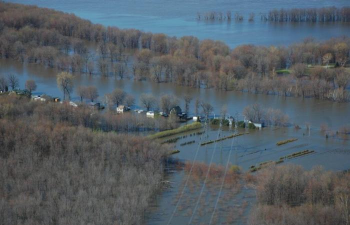
While the government of Quebec is working to develop new maps of flood zones in the province, the MRC of Argenteuil has decided to release the unofficial preliminary version of that of the Ottawa River. Through this gesture, the MRC is asking for more transparency from the government in this matter and to be more flexible when the time comes to apply the new regulatory framework.
The MRC of Argenteuil is not alone in its requests: the MRC of Vaudreuil-Soulanges and Deux-Montagnes also revealed the unofficial preliminary map of the new flood zones of the Ottawa River at the same time as Argenteuil last November 20. The Metropolitan Community of Montreal (CMM) did the same earlier this fall for certain waterways in its own territory.
Why distribute maps that are not yet official and that could change by the time they are adopted by Quebec in a few months, perhaps by next spring? The objective of the various municipal authorities concerned is the same: to put pressure on the provincial government so that it is more transparent with the public in this matter but also to display greater flexibility in the application of future regulations. .
“The maps are not yet official or in force. They are being developed but they are very advanced, warns Éric Pelletier, director general of the MRC d’Argenteuil. The public knows it’s coming and asks a lot of questions. »
“Currently, the government relies on the MRCs and municipalities to make the maps public and explain them to the population. It shouldn’t be like this: it should be the government which presents the file to citizens, denounces the prefect of the MRC d’Argenteuil, Scott Pearce. We want the government to explain what will change [avec les nouvelles cartes]. We also want the new regulatory framework to be flexible in its application. »
Moreover, the council of mayors of Argenteuil adopted a resolution last October, taking up the requests made by the prefect to the local media. In particular, we want the new construction regulations in flood-prone areas to facilitate projects that will integrate notions of resilience to floods.
Note that flood zone maps are currently being developed for other waterways in Argenteuil, including the Rouge and Nord rivers. These have not yet been disclosed.
From frequency to intensity
Previously, flood zones were determined according to the frequency of floods, i.e. 0-20 years and 20-100 years. The catastrophic floods of 2017, then 2019, pushed the provincial government to review this model.
In future maps, we will instead talk about the intensity of flooding: we will then base ourselves on the height that the water level can reach on flooded land, coupled with the frequency that this can occur. For example, if water can reach more than 30 centimeters in height on land that has a 70% chance of being flooded at least once every 25 years, we will speak of a very high flood intensity. Conversely, on land which only has between 7 and 20% of the chance of being flooded once in 25 years and where the water will not rise higher than 30 centimeters, we will then speak of a low flood intensity. In between, we find high and moderate intensities.
“The more we are submerged, the more we are at risk and therefore, the more restrictions are imposed in terms of construction,” illustrates Stéphanie Morin, coordinator of the environmental service at the MRC d’Argenteuil. We go from a two-color card to one with four colors. »
Indeed, with this new categorization of flood zones, the restrictions on the construction or expansion of buildings vary depending on the intensity class. Obviously, the restrictions are greater for very high intensity sectors compared to low intensity sectors.
However, the changes to building regulations in flood zones should not be too significant when compared to the restrictions already in place. In 2019, the government established the Special Intervention Zone (ZIS) for sectors in flood zones before replacing it with a transitional regime in 2022. The future new regulations should be an improved version of these previous regulatory regimes.
“We are essentially taking over the provisions of the transitional framework in which we have made adjustments. There are around thirty regulations that have been modified and three that have been added,” indicates Éric Morency, director of the land planning service at the MRC d’Argenteuil.
“It is a relatively complex regime that the government is preparing to put forward,” he warns, however. We are asking for more flexibility because there is a mechanism that has been integrated into it, the Flood Risk Management Plan. This can pose a problem when trying to have an integrated vision of a development sector. The flexibility that we are asking for would be that these Management Plans have a broader scope and that we trust the municipal sector to be capable of developing certain portions of flood-prone areas in a resilient manner. »
Mr. Morency emphasizes that, even if it will be up to the MRCs and municipalities to apply the regulations concerning construction in flood zones, these rules and these new maps are developed by Quebec. He therefore recalls that Argenteuil took the liberty of revealing these unofficial preliminary maps for the Ottawa River on his own initiative so that citizens can find out from the provincial government what changes this will have on their land.
Some changes
In the maps that have been revealed, the flood zones along the Ottawa River affect three of the four municipalities of Argenteuil bordering this watercourse. Only Brownsburg-Chatham has no flood zones along this river.
According to Mr. Morency, the sectors of very high and high intensity were essentially already recognized on the old maps, in the 0-20 year zones. “The territories which will be [nouvellement inclus dans la zone inondable]these are the so-called low intensity sectors, he says. However, there are also sectors that we had already identified previously. There won’t be that much area added to the flood zones. »
According to the MRC, less than a hundred residences will see changes to the flood zone of the Ottawa River.
“The mapping aspect, we leave that to the scientists. It is not up to citizens to determine what the risk is for them, says Éric Pelletier. On the other hand, it is on the regulatory framework that citizens should have their say and they must raise their hands to say what they have to say. »
As for knowing the financial impact that these mapping changes could have on the value of the residences concerned, the MRC is cautious.
“It’s hard to say. In terms of land values, we have to see how the market will behave, indicates Frédérick Jones, director of the MRC’s evaluation service. If people continue to be interested in these residences and buy them at attractive values, theoretically, based on the valuation, there is no reason for it to decrease. The valuation will follow market trends. Will people start to be more reluctant to settle in these areas? It is a possibility but for the moment, in terms of building value, it is too early to say. »
You can consult the map of the flood zones of the Ottawa River on the website of the MRC d’Argenteuil (argenteuil.qc.ca), in the section “Unofficial preliminary mapping of the flood zones of the Ottawa River” under the “Services” tab. There are also various links on different aspects that this new cartography will provide.


